Best 10 Wildflower Hikes in the Columbia Gorge (that aren’t Dog Mountain)
While Dog Mountain is great, there’s no denying that it gets crowded. Avoid the seasonal permit and massive crush of humanity by trying out one of the other excellent wildflowers hikes in the Columbia Gorge. There are enough great options that I’m updating this post to add a couple more hikes that I regretted missing on this list last year.
When to go: Look for early bloomers like grass widows as early as February and holdouts like bachelor buttons and California poppies into mid-summer. The best displays, including the showstopping clusters of balsamroot and lupines, will be from around April until early June. To help with your timing, check out this cool wildflower bloom tracker.
1. Tom McCall Trail
Length: 3.4 miles out and back
Elevation gain: 1000 feet
Difficulty: Moderate
Pass/permit: None. There is free but limited parking at the trailhead.
Drive time from Portland: 75 minutes
Know before you go:
There are no restrooms at the trailhead. Look for the rest area off I-84 East before exiting the highway for the hike.
The hike is good for kids. There are some steep areas at times and a fair amount of uphill walking that may be challenging for younger children.
Be careful to stay on the trail, both to protect fragile wildflowers and because of poison oak nearby.
Dogs are not allowed on this trail.
The trail is closed from November 1st until March 1st to prevent erosion.
Trip highlights:
Start at the iconic Rowena Crest Viewpoint for panoramic views of the Columbia Gorge.
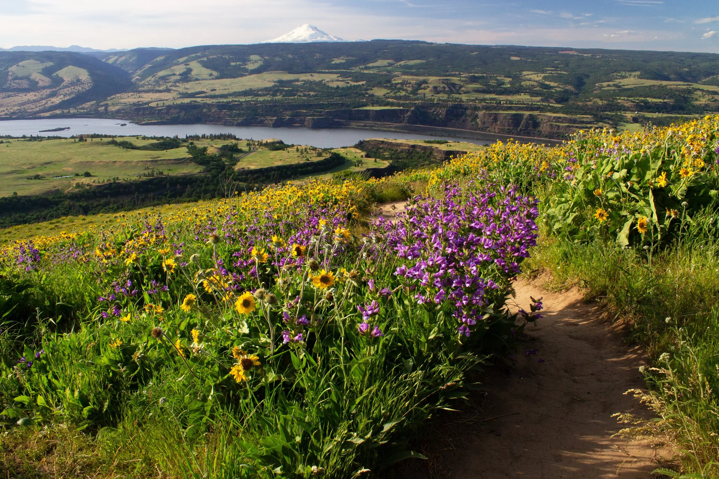
Wildflowers from start to finish! The hike begins in a field of lupines and balsamroot. You’ll head briefly into the trees where the flowers continue, decorating the grasses beneath oak and ponderosa pine. When the trees thin, you’re rewarded for your uphill walking with a slope covered in yellow balsamroot and a glimpse of Mount Hood in the distance. The trail ends on a plateau covered in flowers and views of two mountain peaks on a clear day: Mount Hood and Mount Adams.
This trail has tons of flower species. Look for balsamroot, lupine, paintbrush, prairie star, bachelor button, desert parsley, larkspur, fiddleneck, cluster lily, and ballhead waterleaf among others. In particular, the trifecta of balsamroot, lupine, and paintbrush at the top of the hill makes for a specular finale to the climb to McCall Point.
After the hike, you can cross the road and check out the Rowena Plateau Trail.
2. Rowena Plateau Trail
Length: 2.2-mile lollipop loop
Elevation gain: 240 feet
Difficulty: Easy
Pass/permit: None. There is free but limited parking at the trailhead.
Drive time from Portland: 75 minutes
Know before you go:
There are no restrooms at the trailhead. You can stop at the rest area off I-84 before exiting the highway.
The hike is good for kids. There are some steep areas nearby, although they are easy to avoid. The trail is pretty flat throughout.
Dogs are not allowed on this trail.
There are spots where it will be tempting to leave the trail for the perfect picture. Please stay on the trail to protect the flowers. Photo ops will still be plentiful.
Trip highlights:
Take a moment to admire the views from Rowena Crest Viewpoint before setting out.
The Rowena Plateau Trail has many of the same wildflower varieties as the Tom McCall Trail, only with less hiking distance and elevation gain. Lupine and balsamroot are the stars here.
Basalt plateaus make an interesting backdrop for delicate wildflowers.
Small vernal pools form in the spring along the trail. Look for a carpet of delicate yellow and white flowers that form from the runoff of the pools.
The trail ends with an overlook of the Columbia River.
You can combine this trail with the Tom McCall Trail for a longer hike and more wildflowers.
3. Mosier Plateau Trail
Length: 3 miles out and back
Elevation gain: 700 feet
Difficulty: Easy/moderate
Pass/permit: None
Drive time from Portland: 60 minutes
Know before you go:
There’s a free public parking lot in the town of Mosier. You don’t need a pass.
There are restrooms (port-a-potties) by the parking lot.
The hike is good for kids, although there are some steep areas.
Leashed dogs are allowed on the trail.
Watch out for poison oak near the trail.
Trip highlights:
You’ll see historic Mosier Cemetery at the beginning of the hike, which has headstones of long-ago town residents.
Look for the viewpoint for Mosier Creek Falls shortly after the cemetery.
After climbing a steep hill, you will reach the Mosier Viewpoint, which overlooks the Columbia River, the town of Mosier, and the distinctive columnar basalt of Coyote Wall across the river.
Balsamroot galore! These bright yellow wildflowers create a specular foreground on the plateau overlooking the Columbia Gorge. You might also see desert parsley, cluster lilies, cow vetch, and bachelor buttons in the grassy fields.
Consider stopping at the Mosier Twin Tunnels before heading out of town.
Find more details and pictures in my article about the Mosier Plateau Trail.
4. Memloose Hills Trail
Length: 3-mile lollipop loop
Elevation gain: 600 feet
Difficulty: Moderate
Pass/permit: None
Drive time from Portland: 65 minutes
Know before you go:
Trailhead parking is off Highway 30 at the Memloose Overlook. No pass is required, although parking is limited and fills up quickly. My friends and I got a spot late in the morning on a beautiful Sunday, so it’s worth a try, but have a backup hike in mind. Parking for hikers is no longer allowed at the rest area off I-84. That being said, you may want to make a pit stop there before heading to the overlook parking as there are no restrooms at the trailhead.
This hike is good for kids.
Watch out for poison oak and potentially rattlesnakes.
Dogs are allowed on the trail.
The public trail is surrounded by private property. Watch for signs. The boundaries are clearly marked.
Directions on the trail: From the overlook, cross Highway 30 to reach the trail. There is a trail junction about halfway into the hike. Veering right will take you up Chatfield Hill. It’s a steep but short climb to the top of the hill, which has great views of the Columbia River and, on a clear day, Mount Hood and Mount Adams. Continue down the hill and follow the trail to Marsh Hill, where you’ll find a wildflower vista that looks too beautiful to be real.
For a shorter and easier version, you can skip Chatfield Hill and just do an out-and-back hike to Marsh Hill. Continuing straight at the trail junction (rather than turning right) will lead to a gentler climb up Marsh Hill into a field of wildflowers. Look for balsamroot, lupines, and cow vetch here. There are views of Mount Hood and Mount Defiance on a clear day.
Visit both hills on the loop if you have the time and energy. The hike is not very long or strenuous, and both are worth seeing.
Trip highlights:
The Memloose Overlook at the trailhead has a great view of the Columbia Gorge and Memloose Island.
The beginning of the trail offers good shade, with clumps of lupine and balsamroot growing beneath stands of oak and ponderosa pine. There are flowers consistently throughout the entire hike.
Fields of wildflowers offer a colorful foreground to the hills of pine forests and vineyards in the distance on both Marsh Hill and Chatfield Hill.
Enjoy the mountain views on clear days.
Find more details and pictures in my article about the Memaloose Hills Trail.
5. Dalles Mountain Ranch
Length: 6.9 miles of trails in a figure 8 shape
Elevation gain: 1300 feet
Difficulty: Moderate
Pass/permit: Discover Pass required
Drive time from Portland: 90 minutes
Photo credit: Irina Kvashilava
Know before you go:
Restrooms are available, as is a picnic area.
The hike is good for kids.
Leashed dogs are welcome on the trails.
Watch out for poison oak, ticks, and rattlesnakes. Ticks can be particularly abundant on this hike.
Horseback riders and mountain bikers use the trail as well as hikers.
Trip highlights:
Excellent views of Mount Hood on clear days.
A bonanza of balsamroot and lupines in April and May.
Pass Eightmile Creek Falls and check out the viewpoint.
Walk along Eightmile Creek.
See the remains of the Brune Homestead, built by the Brune family in the 1890s.
See the Crawford Ranch, the former home of the Crawford family, and its collection of buildings, old farm equipment, and cemetery. Construction of the property began in the 1870s and the Crawfords lived on the property for several decades.
Photo credit: Irina Kvashilava
6. Lyle Cherry Orchard Trail
Length: 6.5 miles in two connected loops
Elevation gain: 1,500 feet
Difficulty: Moderate
Pass/permit: None
Drive time from Portland: 90 minutes (or save about 10 minutes and pay the $3.50 Hood River bridge toll)
Know before you go:
This hike is good for older children and has some steep areas.
Watch out for rattlesnakes. I almost stepped on one here once hidden in rock scree on the trail.
Leashed dogs are welcome on the trail.
Parking is free and you don’t need a pass.
There are no restrooms at the trailhead, so consider stopping at the rest area of Highway 14 a few miles west of the trail. As a bonus, this rest area is surprisingly beautiful with lupine blooms of its own.
Trip highlights:
Although there are good wildflowers on this hike, it’s the views that make it incredible. Don’t worry if you miss wildflower season for this one, it will still be a great stop. Check out the overlooks of the Columbia Gorge from dramatic basalt outcroppings.
Lupines, desert parsley, cluster lilies, and death camas line the lower trail. Desert parsley in particular has a knack for growing in craggy basalt.
Walk through a field of balsamroot on the steep climb up the Cherry Orchard Trail.
Buttercups and lupines line the trail at the top once you reach the oak forest.
Find more details and pictures in my article about the Lyle Cherry Orchard Trail.
7. Cape Horn
Distance: 5.2 miles out and back
Difficulty: Moderate
Elevation gain: 1200 feet
Pass/permit: None
Drive time from Portland: 40 minutes
Know before you go:
Parking is free, but the parking lot fills up quickly on summer weekends.
There is a restroom in the parking lot.
This trail is good for kids.
Dogs are allowed on the trail.
This hike can be done as a 7.4-mile loop from Jul 16th - Jan 31st. The rest of the year (including wildflower season), you can do a 5.2-mile out-and-back hike. The out-and-back version of the hike avoids an area that gets closed seasonally to protect nesting peregrine falcons.
Trip highlights:
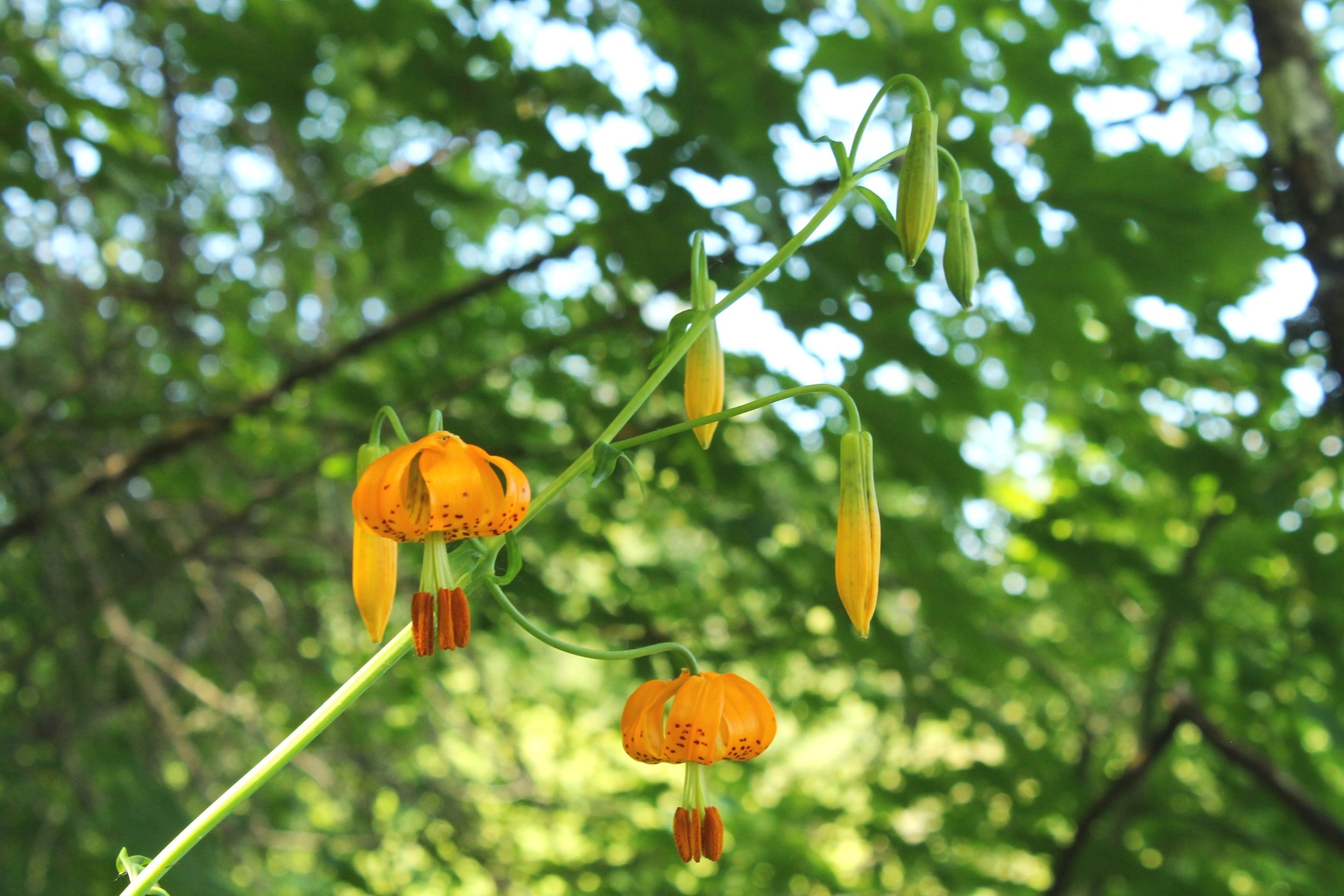
There are tons of wildflowers on the Cape Horn Overlook Trail, both in terms of numbers and species. Expect to see different varieties lining this forested trail than those on the grassy hills farther east. Look for wildflowers like columbine, larkspur, foxglove, tiger lilies, buttercups, and iris.
There are two good viewpoints on this trail. The first is about 1.5 miles into the hike, a pull-off from the main trail that leads to an unpaved ledge with great views of the Columbia Gorge to the east. Look for wildflowers here. The second is a formal stone viewpoint at the top.
Toward the end of the hike, shortly before you reach the second overlook, you’ll walk through a field of wildflowers. Look in all directions to see the lupines, daisies, and hawksbeard.
Learn more in my guide to the Cape Horn Trail.
8. Catherine Creek Universal Access Trail
Length: 1.2-mile loop
Elevation gain: Minimal
Difficulty: Easy
Pass/permit: None
Drive time from Portland: 90 minutes (or save 20 minutes by paying the $3.50 Hood River Bridge toll)
Know before you go:
Look for a narrow gravel parking lot at the trailhead. Parking is free and no pass is required. Cross the road to reach the Universal Access Trail. Alternatively, head up the hill to one of the other hiking trails that begin at the Catherine Creek Trailhead.
There are restrooms available by the parking lot (port-a-potties).
The Universal Access Trail is paved throughout.
Hikes here are good for kids.
Leashed dogs are welcome on the trail.
Watch for poison oak and possibly rattlesnakes. I did see a snake on the trail when I visited, although it was not a rattlesnake.
Trail options:
Many hiking options start at this trailhead. The Universal Access Trail is the shortest and easiest. It also gets closest to the Columbia River.
The Catherine Creek Arch Loop (a 3.5-mile easy loop hike) has good lupines on the trail as well as a chance to see the stone arch in a wall of basalt.
There are several additional loop hike options, the longest connecting to the Coyote Wall trail at 11 miles in distance.
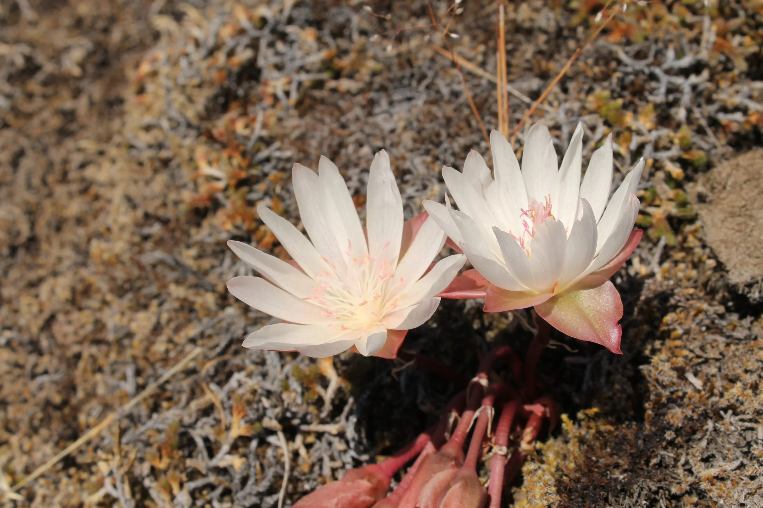
Bitterroot blossoms grow on a rock
Trip highlights:
Plentiful bachelor buttons, cluster lilies, and lupines, as well as elegant bitterroot blossoms.
Excellent views of the Columbia River throughout most of the hike.
Generous offering of benches perfect for having a snack while taking in the scenery of the Gorge.
Viewpoint for dainty Catherine Creek Falls.
9. Labyrinth Trail to Coyote Wall Loop
Length: 6.5-mile loop
Elevation gain: 1,500 feet
Difficulty: Moderate
Pass/permit: None
Drive time from Portland: 90 minutes (or save 20 minutes by paying the $3.50 Hood River Bridge toll)
Know before you go:
There is a decent-sized parking lot at Coyote Wall, although it is popular so consider arriving early. Parking is free and no pass is required.
There are restrooms by the parking lot.
This hike is good for kids. The Coyote Wall Trail is near some drop-offs, which are easy to avoid. Consider an early turnaround point with younger kids.
Dogs are allowed on the trail. They must be on a leash from December through the end of June.
Watch out for poison oak.
The trail is popular with mountain bikers as well as hikers.
Trip highlights:
Walk along the basalt palisade that is Coyote Wall. Desert parsley grows in its nooks and crannies in the spring.
A small cave towards the beginning of the hike is followed closely by Lower Labyrinth Falls.
Look for Accordion Rock, an imposing formation of columnar basalt. There may be climbers attempting to reach the top.
Admire the unobstructed views of the Columbia River Gorge towards the top of the hike. Don’t worry if you miss wildflower season when you visit, it will still be a great hike.
Find details and more photos on my guide to the Labyrinth - Coyote Wall Loop.
10. Angel’s Rest
Distance: 4.8 miles out and back
Difficulty: Moderate
Elevation gain: 1500 feet
Pass/permit: None
Drive time from Portland: 35 minutes
Know before you go:
Parking is free but limited. Arrive early on summer weekends.
There are no restrooms at the trailhead. The closest restrooms are by the parking lot for Bridal Veil Falls, about a mile west on the Historic Columbia River Highway.
This hike is good for kids, but be cautious at the top where you’ll see some steep drop-offs.
Dogs are allowed on the trail.
Trip highlights:
Although it’s not known as a wildflower hike, I was surprised by how many flowers I saw along the Angel’s Rest Trail last spring. Expect to see different varieties here than you do in the fields. Iris and columbine blooms lining the trail were a particular highlight.
Look for Upper Coopey Falls about a mile into the hike.
Take in the panoramic views of the Columbia Gorge to both the east and west when you reach the summit.
A plateau of andesite at the top of Angel’s Rest provides a change from the typical flood basalts of the Columbia Gorge.
Best wildflower hikes in the Columbia Gorge (that aren’t Dog Mountain), the summary:
Tom McCall Trail
Rowena Plateau Trail
Mosier Plateau Trail
Memloose Hills
Dalles Mountain Ranch
Lyle Cherry Orchard Trail
Cape Horn
Catherine Creek
Labyrinth Trail to Coyote Wall
Angel’s Rest
Enjoy the wildflowers of the Columbia Gorge!
With love,
Emma
Explore nearby
Find the best wildflower hikes in Portland.
Elowah Falls, one of the 10 great hikes near Multnomah Falls.


