

Hike to Carter Falls and Madcap Falls in Mt Rainier National Park


A thick curtain of fog on my last trip to Mt Rainier National Park gave me a new appreciation for its alpine waterfalls. When the mountain is invisible, the falls are still stunning. The trek to Carter Falls and Madcap Falls is a short and approachable segment of the intense 93-mile Wonderland Trail that circles Mt Rainier (or Tahoma, more meaningfully). On the hike, you’ll journey across the Nisqually River and then through an old-growth forest alongside the Paradise River to reach two lovely mountain waterfalls. On a clear day, you’ll get a fantastic view of Rainier’s summit as a bonus. Here is everything you need to know about the hike to Carter and Madcap Falls, plus a few highlights nearby.

The Wonderland Trail to Carter Falls
Know before you go
You must have an entrance pass to visit Mt Rainier National Park. A 7-day entrance pass costs $30/passenger vehicle. You can buy one with a credit card at any park entrance during daylight hours or online ahead of time. You can also use the America the Beautiful Pass ($80) or an annual park-specific pass ($55) to enter the park.
Mt Rainier National Park has four entrances. The hike to Carter Falls is closest to the Nisqually entrance, a 15-minute drive from the park entrance to the trailhead.
Dogs are not allowed on the trail.
Look for the nearest restrooms at the Cougar Rock picnic area.
There are a few parking spots along the road and a larger parking lot near the Cougar Rock picnic area. Parking is limited and may fill up during popular times. Parking in the Cougar Rock campground is not allowed unless you are camping.
Hike this trail from May - October. The trail to the falls begins by crossing a log bridge over the Nisqually River, which often gets washed out during winter.
The trail to Carter Falls and Madcap Falls is well-maintained but does have uneven surfaces, tree roots, and some rocks to negotiate along the way. It’s doable in sneakers but better in hiking boots.
Please stay on the trail. Alpine natural areas are fragile, especially where wildflowers grow. If they are damaged, they might not grow back.

After you cross the Nisqually River, the trail heads through the forest
On the Wonderland Trail to Carter Falls and Madcap Falls
Distance: 2.8 miles out and back
Elevation gain: 600 feet
Difficulty: Moderate
Pass required: Mt Rainier National Park entrance pass or America the Beautiful Pass
Dog friendly: No, dogs are not allowed on the trail.
ADA access: No
Season: May - October

A vine maple provides color along the trail
The details:
Don’t be fooled by the sign along the side of the road pointing to Carter Falls, which makes it look like a quick roadside overlook. It takes some hiking to reach the waterfalls of the Paradise River. After you park, look for the Wonderland Trailhead next to Paradise Rd. A small sign at a trailhead will point you toward the nearby highlights, including Carter Falls. Madcap Falls isn’t listed on the sign but it’s in the same direction, just past Carter Falls. Follow the arrow and take the trail to the left toward the Nisqually River.

The trailhead
The dirt trail winds a short distance, about 0.1 miles, through a rocky clearing before reaching a log bridge crossing the Nisqually River. This river begins high on Mt Rainier at the Nisqually Glacier and flows out to the Puget Sound. It fills with rainwater and snowmelt in spring and becomes more sedate by late summer. It may be impassable on this trail when the water level is high. As you cross the river, you might notice a slight opacity to the water caused by glacial flour, the tiny fragments of mountain rocks ground down by glaciers and carried by meltwater.

Nisqually River
The smooth rocks and boulders on the riverbanks of the Nisqually are worth some attention. Among the grays of Mt Rainier’s andesite and dacite, you’ll see white rocks flecked with black. These eye-catching rocks are much older granodiorite, part of a volcanic intrusion in the bedrock that underlies much of the present-day mountain.

Footbridge over the Nisqually River
As you make your way to the log bridge, look north for an excellent view of Mt Rainier’s snowcapped summit on a clear day. Or, if you get a day like mine, enjoy the fog. The log bridge is sturdy and easy to cross. Many people choose to turn around at the bridge rather than continue to the waterfalls and I don’t think everyone realizes that the trail goes farther than the river. The short stretch of the trail on the other side of the bridge is the only potentially confusing part of the hike, but if you head up the riverbank and veer toward the left, you’ll see a wide, well-maintained, and unmistakable trail.

The Wonderland Trail passes through old-growth forest
From here, a canopy of old-growth western red cedars, hemlock, and Doug firs will surround the trail and provide good shade. Look for early-blooming wildflowers like trillium in the spring, more wildflowers and edible huckleberries in late summer, and dazzling fall colors in October. Throughout the hike, you’ll hear the rushing waters of the Paradise River running parallel to the trail, although the forest shields it from view most of the way. The beginning of the hike is fairly flat but soon starts heading uphill.
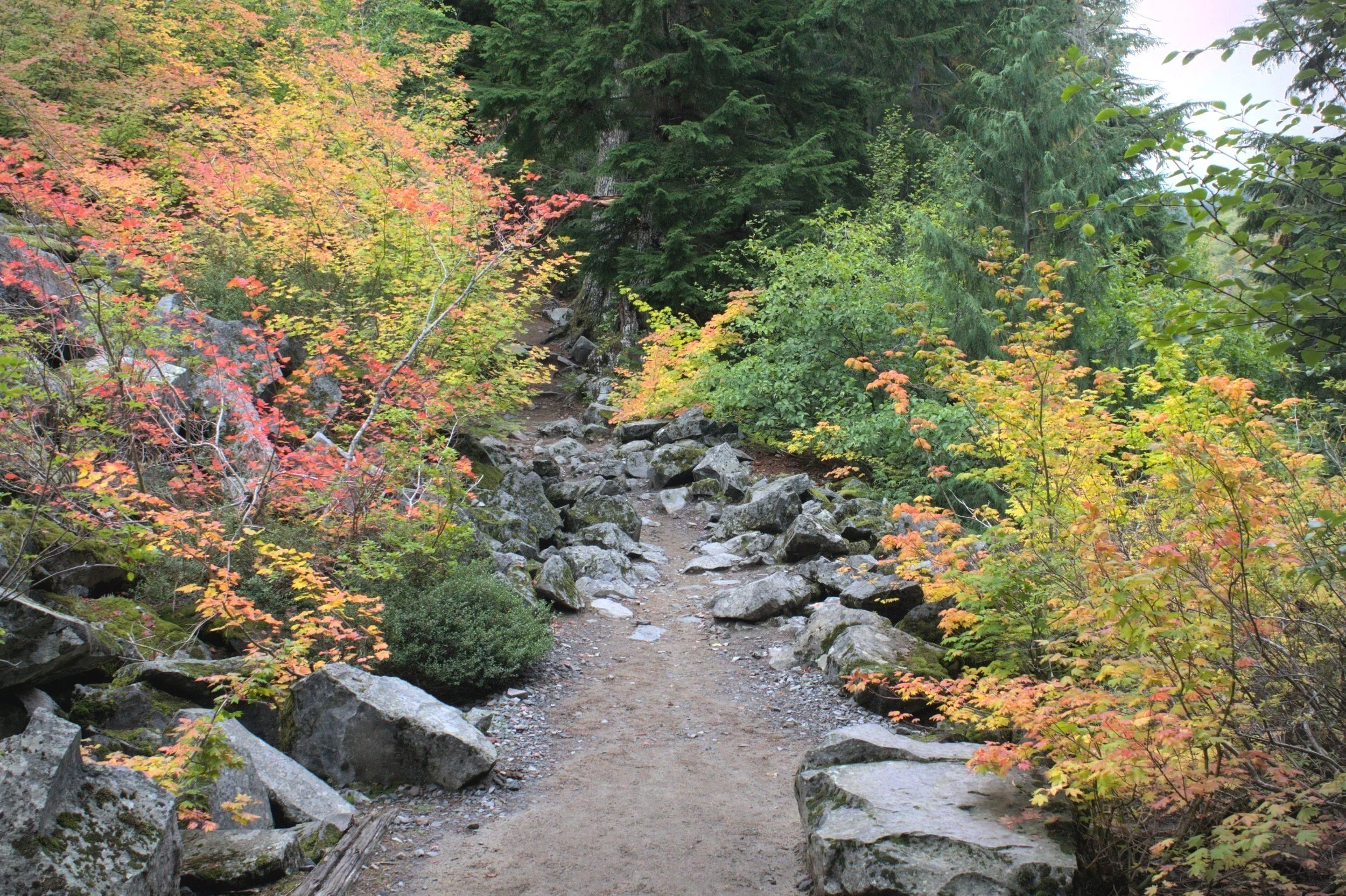
Fall colors are best in October
The best river view is about halfway through the hike, where sparser tree cover allows you to see the cascading water of the Paradise River pass through a canyon flanked by talus slopes. In the middle of the river, you’ll see a large and memorable glacial erratic. Glacial ice transported this huge boulder to its current unlikely position.

Glacial erratic in the Paradise River
The second half of the hike is a steady uphill climb. After about 1.3 miles, you’ll reach the viewpoint overlooking 53-foot Carter Falls, which is marked with a sign. You will get a sense of the falls from the viewpoint, but it is somewhat disappointing because of the tree branches blocking the view. Please stay on the trail. There is not a good way to get down to the river and clear views of the falls.

Carter Falls
If you continue another 0.1 miles through the forest, you’ll reach the cascading, sidewinding 34-foot Madcap Falls. Its viewpoint is more satisfying since it is unobstructed by tree cover.

Madcap Falls
When you are done admiring the waterfalls, turn around and head back the way you came to return to the parking lot. The way back is mostly downhill and goes by faster than the way out.
Other destinations on the Wonderland Trail

Approaching Narada Falls
The Wonderland Trail in Mt Rainier National Park is a 93-mile strenuous trail that encircles the mountain and includes thousands of feet of elevation changes along its course. Fortunately for day hikers like me, it has shorter segments that lead to beautiful places. Here are some hikes on the Wonderland Trail that include Carter Falls and Madcap Falls as destinations.
If you continue past Madcap Falls on the Wonderland Trail, you can hike to Narada Falls for a total of 5.7 miles out and back, gaining about 1,400 feet in elevation. This hike continues through the woods along the Paradise River and gets a bit steeper after Madcap Falls. Know that you can also drive to Narada Falls and reach it via an easy, 0.2-mile hike if you have time or energy constraints.
For a longer hike, 8.5 miles out and back will bring you out to Reflection Lake via the Wonderland Trail. Here you can enjoy the pleasing symmetry of Mt Rainier’s summit and its mirror image reflecting from the lake on a clear day. Like Narada Falls, you can also reach Reflection Lake by driving.
Instead of starting at Cougar Rock, you can begin your hike to Carter Falls and Madcap Falls at Longmire for a 6-mile hike that gains about 1,000 feet of elevation.
Easy waterfall stops near Carter Falls
Given the wealth of waterfalls in Mt Rainier National Park, I’ll mention a few that are close to the Carter Falls hike and easy to reach by car. Here are some of the highlights nearby.

Christine Falls
Christine Falls is one of the prettiest and easiest-to-reach waterfalls in Mt Rainier National Park. Starting from Cougar Rock, a 5-minute drive on Paradise Rd E will get you there. Park at the roadside pull-off next to Christine Bridge and follow the trail about 100 feet to reach a viewpoint for the falls framed by the stone bridge passing overhead.

Narada Falls
Driving 6.4 miles (about 15 minutes) on Paradise Rd E will bring you to the parking area for Narada Falls. A 0.2-mile hike leads to the viewpoint overlooking the falls.

Myrtle Falls
If you visit the Jackson Visitor Center at Paradise, an easy, 0.7-mile hike will bring you to lovely Myrtle Falls backed by views of Mt Rainier’s summit on a clear day.

Upper Sunbeam Falls
Upper Sunbeam Falls is a tranquil cascading waterfall visible from the road just past Reflection Lake. A small parking area makes it easy to stop for a picture. Drive 9 miles east (about 20 minutes) to reach it from Cougar Rock.

Picture Frame Falls
Picture Frame Falls is just as easy to see from the road as Upper Sunbeam Falls but can be easy to miss if you aren’t looking for it. Small but picturesque, greenery makes the perfect frame for this waterfall. Look for it next to Stevens Creek on Stevens Canyon Rd. It’s about 12 miles (25 minutes) from Cougar Rock.
Getting there
To reach the parking area at Cougar Rock, it’s easiest to use Mt Rainier National Park’s Nisqually entrance.
From Tacoma:
Follow WA-7 S until the town of Elbe, then head left onto WA-706. Follow WA-706 through Ashford to the Nisqually entrance. The drive from Tacoma to the trailhead takes about 1 hour and 40 minutes. From Seattle, it’s about 2 hours and 15 minutes.
From Portland:
Take I-5 N until exit 68 for US-12 E. Follow US-12 E for 31 miles, then turn left onto WA-7 N. Continue on WA-7 N until you reach Elbe, then turn right onto WA-706 and follow it until you reach the Nisqually entrance. The drive from Portland to the trailhead takes about 3 hours.
The Wonderland Trailhead will be 8.5 miles (about 15 minutes) east of the park entrance. Look for a few parking spots on the sides of the road near the trailhead or a larger parking area next to the Cougar Rock picnic area.
Enjoy your trip to Mt Rainier National Park!
With love,
Emma
Explore nearby


Find tips for visiting Mt Rainier National Park in October.

For another stunning Cascade Mountain escape, check out the area around Mt Adams.

Find more about Oregon’s national park, Crater Lake.

Find more things to do in the Cascade Mountains.