

Clatsop Loop Trail


The Clatsop Loop Trail is one of the Oregon Coast’s most popular hikes. The scenery is incredible, and a few historical oddities keep you guessing about what’s up ahead. The trail begins in a mossy Sitka spruce forest and ends at a viewpoint overlooking the Pacific Ocean from 600 feet. Along the way, you’ll pass an old WWII radar station, see an infamous offshore lighthouse, and retrace the steps of Lewis and Clark on a quest for whale blubber. After your hike, you can explore the rest of the wild and beautiful Ecola State Park, starting with Indian Beach at the trailhead. I live in Portland and have been hiking all over the Oregon Coast. This one’s a gem. Here’s everything you need to know about hiking the Clatsop Loop Trail.

The Clatsop Loop Trail passes some huge Sitka spruce trees
Know before you go
The Clatsop Loop Trail is in Ecola State Park. Start at Indian Beach. To park, you need the Oregon State Park Pass, $10/day or $30/year. You can pay with a credit card at the machine by the Indian Beach parking lot.
Leashed dogs are welcome on the Clatsop Loop Trail.
Picnic tables are by the parking lot. They overlook Indian Beach.
Look for vault toilets by the trailhead.
The Clatsop Loop Trail is family-friendly. The west side of the loop is near some steep hills that are easily avoided.
The trail gets muddy. I’d suggest hiking boots rather than sneakers.
Indian Beach
The Clatsop Loop Trail starts from the Indian Beach Viewpoint. It’s worth taking a moment to admire the beach before starting the hike. The cliffs of Tillamook Head rise steeply on the north end. To the south, the chain of small sea stacks off Ecola Point makes Indian Beach memorable. The one with the arch is Sea Lion Rock.

Indian Beach
To get down to the beach, take the stairs and follow the short trail through the dense thicket of trees. You’ll pass another picnic table in the tangle of branches that looks like a secret hideout.

Stairs to the beach
Indian Beach has decent rockhounding potential, especially when the tide is receding and after winter storms. You might find some agates or sea glass. At low tide, look for tidepool critters at either end of the beach. Standing at the south end, look north to see Tillamook Rock Lighthouse in the distance.

Indian Beach
Indian Beach is a popular surfing spot, enjoying some protection from the cliffs. You may recognize it from the end of the 1991 surfing movie Point Break, where, strangely enough, it stood in for Australia. After seeing Indian Beach, head back up the stairs to start the Clatsop Loop Trail.

Australia. Just kidding, it’s still Indian Beach.
On the Clatsop Loop Trail
Distance: 3-mile loop
Elevation gain: 800 feet
Difficulty: Moderate
Pass required: Oregon State Park Pass ($10/day)
Dog friendly: Yes, leashed dogs are welcome on the trail.
ADA access: No, not past the viewpoint for Indian Beach.
Season: All year
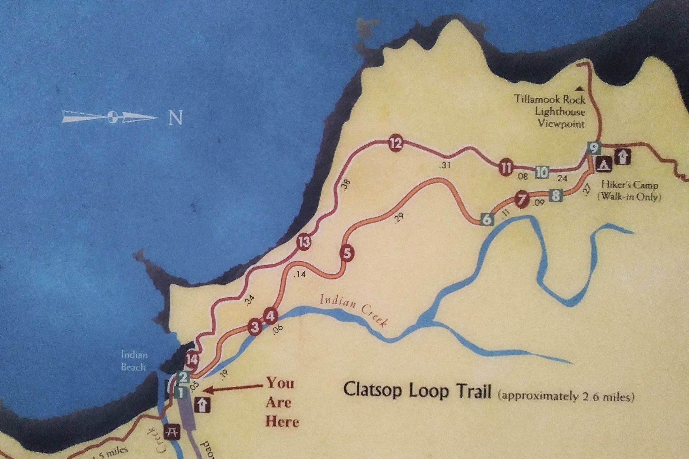
The sign by the trailhead has a map
The details
The trail splits into two just past the trailhead, the start and the end of the Clatsop Loop. I’d suggest taking the trail to the right. This side of the loop is inland, so you’ll get the “boring part” out of the way first and end with ocean views. The hike begins next to Canyon Creek in a dense coastal forest.

Canyon Creek
Signs along the Clatsop Loop Trail provide information about Tillamook Head. Members of the Lewis and Clark expedition, including William Clark and Sacajawea, followed this route from Seaside in search of a beached whale. Their goal was to collect oil and blubber. Other signs talk about the area’s ecology. The trees have had a hard time of it. Evidence suggests that an earthquake impacted the forest around 300 years ago. Then, logging cleared most of the trees around 150 years ago. Seeing the giant Sitka spruce along the trail, it seems like some must have survived these calamities. The forest is mature, and some trees are clearly old.

Moss makes the trees along the Clatsop Loop Trail look otherworldly
The trail heads steadily uphill on a wide path through the forest. Moss covers most of the rocks, trunks, and branches along the trail. Sword ferns fill the undergrowth. You’ll see many young trees growing from nurse logs.

Clatsop Loop Trail
The Clatsop Loop Trail gives you regular encouragement. Trail markers numbered 1-14 keep track of your progress. I found them helpful for morale on the uphill part of the hike.

Numbered posts track your progress around the loop
In a little over a mile, you’ll reach the far end of the loop and, finally, the end of the uphill walking. When you reach the junction, follow the sign toward the hiker camp and viewpoint, keeping right. This spur trail leads 1/8 of a mile to the overlook for Tillamook Rock Lighthouse.

Follow the sign toward the viewpoint
Just after the sign, you’ll pass the hiker camp, which hosts hikers on the Oregon Coast Trail. Moss is slowly consuming the cabins and picnic shelter.

Hiker camp
Beside one of the cabins is the trail across Tillamook Head that ends in Seaside. From here, it would be about an extra 10 miles roundtrip. We’ll continue past it.

This trail goes to Seaside
Past the hiker camp is the remains of an old WWII radar station. After decades of sitting unused in the forest, moss and maidenhair ferns cover the concrete shells.

Old WWII radar station
Continue past the radar station over a plank bridge. The viewpoint is just ahead.

Bridge over the mud
The spur trail ends at a viewpoint hundreds of feet above the Pacific. You’ll see Tillamook Rock Lighthouse on top of a tiny basalt island. This lighthouse is notorious. Better known as Terrible Tilly, it stands just over a mile offshore. Construction cost a fortune and nearly killed the work crew. After the lighthouse began operating in 1881, the keepers needed to rotate frequently due to the challenging conditions. It’s since been decommissioned and has changed hands many times, mostly recently serving as a resting place for ashes. While human visitors are few, Tillamook Rock is a favorite of sea lions. If you have a good pair of binoculars, look for them on the rocks beneath the lighthouse. The viewpoint is also a place to watch for whales, especially during the winter and spring migrations.

Terrible Tilly
After seeing the lighthouse, head back down the spur. At the trail junction, keep right to continue the Clatsop Loop Trail.

Head back down the spur
The second half of the hike has the double appeal of being downhill and having regular ocean views. Unlike the uphill journey, the trail is narrow and has plenty of tree roots on it. You’re now on the Oregon Coast Trail.

Look for some cool trees next to the trail
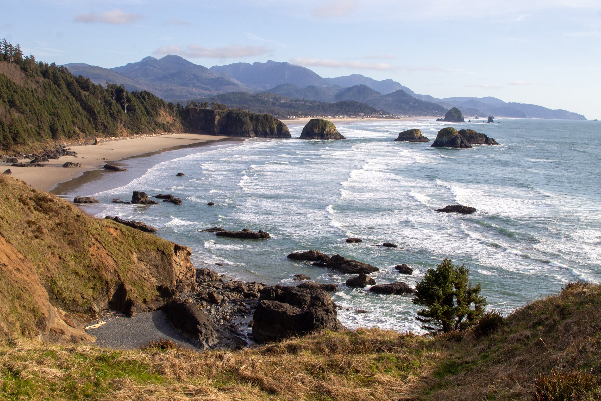
From here, you’ll make your way downhill through the forest. A few spots open up to views of the water and a stretch of the coastline to the south.

Sitka spruce forest along the Clatsop Loop Trail
The trail ends with some of the best views on the hike. You’ll get a final sighting of Tillamook Rock Lighthouse, looking lonely out in the ocean.

The hike ends with ocean views
You’ll get a great overhead view at Indian Beach before returning to your starting point.

King tides at Indian Beach
Enjoy your hike on the Clatsop Loop Trail!
With love,
Emma
Getting there
Take Highway 101 to the exit for Cannon Beach City Ctr/Ecola State Park. Turn right onto Ecola State Park Road. A sign for the park entrance marks the turn. In 1.5 miles, keep right to head toward Indian Beach. Continue another 1.5 miles until Indian Beach. The drive from Portland takes about 90 minutes.
Explore nearby
Learn more about visiting Ecola State Park.

Check out another great short hike in Ecola State Park, the Crescent Beach Trail.

Find the best things to do in Cannon Beach.