

How to Find Cove Beach, a Secret Beach near Manzanita, OR

Secret beaches are my summer fascination. As tourist season brings vast flocks of humanity to Cannon Beach and Lincoln City, hidden corners of the Oregon Coast remain quiet and empty. Cove Beach (also called Magic Rocks Beach) is one such gem. It’s a place you won’t find unless you go looking for it. The rewards are great if you do. Low tide reveals a broad sandy shore, while high tide sends waves over stacked cobbles, making them roll and clatter. To the south, Cape Falcon’s cliffs loom. Here is how to find Cove Beach, the secret beach between Cannon Beach and Manzanita.

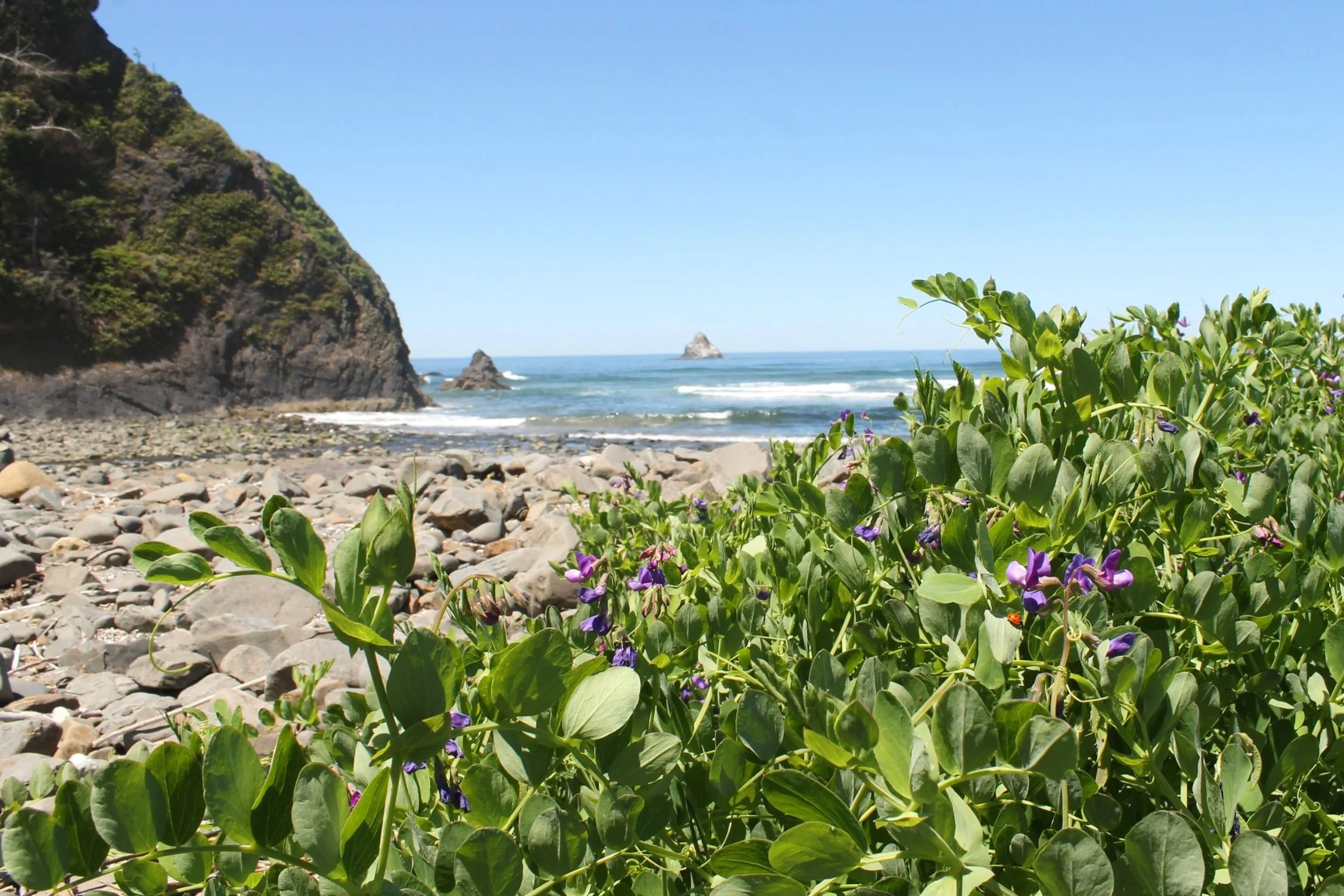
Cove Beach and Cape Falcon
Know before you go
It is free to visit Cove Beach. You don’t need a pass or permit to park.
Some of the roads on the way to Cove Beach are gravel. They’re in good condition and driving is no problem with a low-clearance vehicle.
Dogs are welcome on Cove Beach.
Two public access trails in a residential neighborhood lead to Cove Beach. There are no restrooms or other amenities for visitors, just beach access. Look for the closest restrooms at the Oswald West State Park lot, about 3 miles to the south.
Private property surrounds the beach access trails and I got the sense that there have been issues in the past. You’ll see a lot of no-trespassing signs, fences, and security cameras. You can use the access trails and the beach, but stick to public areas and pack out your trash to be a respectful visitor.
Making it to Cove Beach requires navigating uneven terrain and stairs.
Cove Beach access #1 - recommended

Head to Tide Rd to find the beach access
Parking
Drive to the corner of Richmond St and Tide Rd. The beach access trail starts from this intersection. At the end of Richmond St, look for a shoulder with room for several cars. Around the corner on Cove Beach Rd, there’s room for one more.

Take this trail to Cove Beach
The trail
Once you’re at the corner of Richmond St and Tide Rd, the beach access trail will be obvious. You’ll see a sign with beach regulations next to the trailhead. The narrow dirt access trail is only about 0.1 miles long. You’ll walk a short distance downhill and then take a wooden staircase the rest of the way to the shore. The staircase has a railing and is mostly in good condition. Watch out for a loose stair about halfway down. One of its boards is broken and the ones that remain don’t inspire confidence.

Staircase to Cove Beach
Cove Beach access #2 - harder

The trail starts next to the road sign
Parking
Drive to the corner of Columbia St and Tide Rd. A small shoulder on the west side of Tide Rd accommodates about two cars. Beach access #2 is only a block from beach access #1, so you could park and walk to the easier access point if the parking spots there are full.

Cape Falcon from the beach access trail
The trail
Leave it to me to find the hard way first and seek out an easier route only after my companions refuse to follow me. Fortunately, their good judgment pushed me to find a better way so I didn’t drag them, and then you, down an unnecessary scramble. Beach access #1 is easier and safer. I mention this other access trail because I’ve seen it as the recommended route in other guides, which is why I headed there first. It will get you to Cove Beach, just with more crab-walking required.
You’ll see the trailhead just to the right of parking spots on Tide Rd. It’s the trail next to the “Danger: cliff edge ahead” sign. Yep, just as promising as it sounds. Like beach access #1, it’s short and sweet. The tricky part here is that instead of a staircase, the end of the trail is a steep crumbling hill. It’s doable but awkward, both coming down and going back up.

The crab-walking part
Cove Beach

Cove Beach, where the crowds are not
Cove Beach, or Magic Rocks Beach, is directly north of Cape Falcon. The dramatic cliffs of the cape frame the southern end of the beach, which extends to Arch Cape, a small conical headland. Beyond Arch Cape, you’ll see the much larger Tillamook Head extending out into the ocean to the north. Offshore, several sea stacks are stained white thanks to visiting seabirds. Appropriately, the sea stacks are called Gull Rocks. Bring a good set of binoculars to look for them perched there.

Looking north to Arch Cape
When the tide is out, Cove Beach has a sandy shore dotted with fragments of jellyfish and sand dollars. Along the edge of the sand is a border of rocks worn smooth by the waves. At high tide, the waves hit these cobbles, which clack and tumble to the rhythm of the ocean. Hence, Magic Rocks Beach. Looking closely, you can see the imprints of ancient sea life on some of them. At a very high tide, the sand disappears. You can still walk on the cobbles, although it will be a clumsy journey.

Cape Falcon
My favorite part of Cove Beach is the base of Cape Falcon, where piles of boulders have fallen from the cliffs, now encrusted with barnacles. Flies land on patches of seaweed, and you, while shore crabs skitter over the rocks. When the tide is not too high, you can walk (well, clamber really) a short distance beneath Cape Falcon. Proceed with caution and keep an eye on the waves.

Rocks for clambering
At the north end of Cove Beach is Arch Cape, which is traversable at a very low tide. My timing has never been right to try it, but a cool-looking 5.5-mile loop hike connects Cove Beach, Arch Cape, and the Oregon Coast Trail, directions courtesy of Oregon Hikers. When the tide isn’t cooperating, you can also drive to Arch Cape and its beach. More on that below.
Beaches near Cove Beach
Arch Cape
Arch Cape Beach
Pass required: None
Dog-friendly: Yes
Hike in: None
Amenities: None
Arch Cape is a bit of a secret beach in its own right. I’ve stopped there on summer weekends when the better-known spots like Arcadia Beach and Short Sand Beach are circuses. Parking is limited to the neighborhood streets but tends to work out. Almost everyone drives by Arch Cape without realizing it’s there. The most obvious access point is on Highway 101 driving south from Hug Point. Look for a non-descript right turn just before crossing the bridge in front of the tunnel. This turn leads to a short road with beach access at the end of it. There’s room for about ten or so cars. Arch Cape Beach is a stunning rocky beach with the little headland of Arch Cape at its southern end. At a very low tide, you can walk around it to find the namesake arch and Cove Beach.
Short Sand Beach

Short Sand Beach
Pass required: None
Dog-friendly: Yes
Hike in: 1.2 miles out and back (easy)
Amenities: Restrooms at the parking lot and the beach. Picnic area near the beach.
Unlike Cove Beach or Arch Cape, Short Sand Beach is well-known and often crowded. It has multiple parking lots that usually, but not always, keep up with demand. An easy, 0.6-mile hiking trail leads from the parking area down to Short Sand Beach by way of a beautiful old-growth Sitka spruce forest. The beach borders Smuggler’s Cove, an unusual notch at the end of Cape Falcon. Pine-covered cliffs surround the cove, protecting it from strong winds off the ocean. Short Sand Beach is one of the calmest and warmest places on the Oregon Coast, making it popular among surfers and beachgoers. At the north end of the beach, look for Blumenthal Falls tumbling down the side of a cliff into the ocean. At low tide, you can find crabs, anemones, and sea stars around the waterfall.
Hug Point

The road circling Hug Point is passable at a very low tide
Pass required: None
Dog-friendly: Yes
Hike in: None
Amenities: Restrooms and a couple of picnic tables.
Despite its low-profile entrance, Hug Point State Recreation Site is one of the most popular stops near Cannon Beach. Often the biggest giveaway that you’re approaching is the row of cars parked (illegally) along Highway 101 after the parking lot fills up. Hug Point is beautiful in any conditions but has a unique draw at low tide when you can walk around the small headland at the north end of the beach. On the other side, you’ll reach a secluded cove with colorful sandstone cliffs, sea caves, and a waterfall. At a very low tide, you can go farther still. At the base of Hug Point, a broad ledge extends to form a road. Carriages and early automobiles used this road in the early 20th century before the construction of Highway 101. Today, you can walk around Hug Point on this ledge to reach the south end of Arcadia Beach. Look for clusters of giant green anemones on the way. Just make sure to return before the tide comes in.
Find details in my guide to Hug Point.

Hug Point Falls
Getting there
Cove Beach is between Arch Cape and Oswald West State Park. Coming from the north, take Highway 101 S until Cove Beach Rd, then make a slight right. The turn will be just after you pass through the tunnel. Follow Cove Beach Rd 0.7 miles until Richmond St. Look for parking and beach access at the end of Richmond St.
Coming from the south, take Highway 101 N until Falcon Cove Rd, then make a left. Take Falcon Cove Rd for 0.4 miles. Make a slight right onto Columbia St and then make a left onto Tide Rd. Follow Tide Rd until the intersection with Richmond St, where you’ll find parking and beach access.
Cove Beach is 15 minutes south of Cannon Beach and 15 minutes north of Manzanita. The drive from Portland to Cove Beach takes about 1 hour 45 minutes.
Explore nearby


Try out the best short hikes on the north Oregon Coast.

Find more secret beaches on the Oregon Coast.