

Portland’s 4T Trail, Step by Step


Part urban hike, part public transit scavenger hunt, the 4T Trail is one of Portland’s most unique adventures. If you’re visiting or new to town, it’s a great way to get to know the city. If you’ve lived here for years like me, it’s fun to feel like a tourist for a day. Stretch your legs on hiking trails through the forest, see some mountain views, take a ride on the aerial tram, and then grab something to eat at a restaurant downtown. Here is everything you need to know about hiking Portland’s 4T Trail.

Camellia blooms in Marquam Nature Park
What is the 4T Trail?
Portland’s 4T Trail combines hiking and public transportation to make a roughly 10-mile loop around the city. The 4 T’s are Trail, Tram, Trolley (streetcar), and Train (MAX light-rail). You’ll hike 4.4 miles and use public transit for the rest of the loop. It takes about 4 hours.
You can start from anywhere on the loop and do it either clockwise or counterclockwise. My directions here start at Pioneer Square downtown and go counterclockwise, which is my favorite way to do it. You’ll get the uphill walking done early on and finish downtown, where the drinks and snacks are.
How much does it cost?
It costs $14.10 to do Portland’s 4T Trail as of the fall of 2024.
Detailed receipt: a Trimet day pass costs $5.60. OHSU’s aerial tram costs $8.50 roundtrip (one-way fares are not offered). You may see older resources say that it’s free to ride the tram downhill, which is no longer true.
You can save $2.80 if you finish the transit portion within the 2.5-hour limit for a Trimet one-way fare. If you do the MAX and streetcar segments back to back, you’ll finish within this time frame.

You’ll walk through both the city and the woods on the 4T Trail
Parking info
If you’re starting downtown, you’re good to go. Just head to Pioneer Square.
If you’re driving to the 4T Trail, most parking areas have fees. Marquam Nature Park has free (limited) parking, but there’s a two-hour limit for most spaces, which isn’t enough time to finish the trail. Council Crest has free parking if you don’t mind finishing the loop with an uphill walk. Parking downtown costs about $12/day on weekdays or $6/day on weekends. It costs $8/day to park at the Oregon Zoo, which has a large lot.
I took public transit to Pioneer Square since it’s in the spirit of the day and I was meeting friends for drinks downtown afterward. Depending on where you’re starting, this option might not be practical.

Oregon grape blooms along the 4T Trail in spring
Bathrooms
Not a comprehensive list, but these are clean and you don’t need to buy anything to use them:
World Forestry Center lobby (near the Washington Park MAX station)
OSHU (tram)
Downtown Public Library (near the Pioneer Square MAX station)
When to do the 4T Trail
Go Monday - Saturday. The aerial tram doesn’t run on Sundays, which is probably the coolest part of the 4T Trail. The tram runs on weekdays from 5:30 AM to 9:30 PM and Saturdays from 9 AM to 5 PM.
If you do the 4T Trail on a weekday, try to avoid taking the aerial tram at rush hour times (7 - 9 AM and 4 - 6 PM). OHSU employees and students commute using the tram.
Go during daylight hours. The forested hiking trails aren’t lit.
Go on a clear day if possible to see the mountain peaks.

Expect great views on the 4T Trail
Other tips
Wear comfortable shoes that can get a little dirty. The hiking trails are not paved and can be muddy.
Bring water.
The 4T Trail is family-friendly. If you have small children, there are some places where you’ll need to watch out for passing cars.
Basic directions
Start at Pioneer Square in downtown Portland. Take the MAX Red or Blue line westbound. Get off at the Washington Park stop.
Follow the signs for the 4T Trail. You’ll hike up to the top of Council Crest, then down to Marquam Nature Park and OSHU.
Take OHSU’s aerial tram.
Take the streetcar from the stop next to the tram back to Pioneer Square.
Because I can get lost leaving a room, I like very specific directions. After working out the kinks by getting lost wherever humanly possible, here are the step-by-step directions for the 4T Trail.
Train

Pioneer Square
Start from Pioneer Square in downtown Portland. There are food carts if you want a snack before starting the trail. Starbucks is also here, but I’d walk a few blocks to Case Study Coffee, Good Coffee, or Stumptown instead. It’s Portland, we have great coffee here. Look for the westbound MAX stop on the north side of Pioneer Square.

MAX stop at Pioneer Square
Buy a ticket before getting on the MAX. If you have a tap-and-pay credit card, you can use it at the little green boxes at the stop. You won’t get charged more than the cost of a day pass even if you use your card multiple times. You can also buy a ticket from the pay station. Tickets are good for both the MAX and the streetcar.

Elevator up at the MAX station
Take the MAX until the Washington Park stop, the deepest underground transit station in North America. Then, take the elevator 260 feet up to street level.

World Forestry Center
At the top of the elevator, you’ll be in Washington Park. Head away from the World Forestry Center and towards the zoo. You’ll see the first signs for the 4T Trail pointing the way.

Follow the signs
If you don’t have a map downloaded, take a moment to get a picture of the map in front of the zoo. Portions of the 4T Trail don’t have cell phone reception.

4T Trail map in front of the zoo
Trail

Follow signs for the Marquam Trail
The hiking portion of the 4T Trail has a lot of helpful signs. There aren’t too many confusing spots and, trust me, I’d know. Following the signs, head past the zoo and cross the bridge over Highway 26.

Cross here
On the other side of the bridge is the least pleasant part of the 4T Trail, a walk along the highway on-ramp. It will look strange and like you’ve gone the wrong way. You haven’t. Don’t worry, it doesn’t last long.

Yup, afraid so
After about 0.1 miles, you’ll see a trail to the right leading away from the highway.

Go this way
From here things start to get a lot prettier. You’ll be moving away from the road noise into the woods.

The trail is heading toward the viewpoint at the top of Council Crest. With a steady climb, you’ll get most of the uphill walking done early. In spring, look for wildflowers in the undergrowth.

Trillium along the trail
When you reach a road, head uphill to the Chevron station.

Head up to the gas station at the top of the hill
At the intersection with the gas station, take a left onto SW Talbot Terrace.

Cross the road, then go left
Continue on SW Talbot Terrace through a cute residential neighborhood until you see the hiking trail to your right.

Follow this trail to Council Crest Park
At the top of the hill, you’ll be at Council Crest Park, one of the highest points in Portland. Look for views of downtown, Mount Hood, and Mount St Helens on a clear day. The benches at Council Crest are great places to stop for a snack.
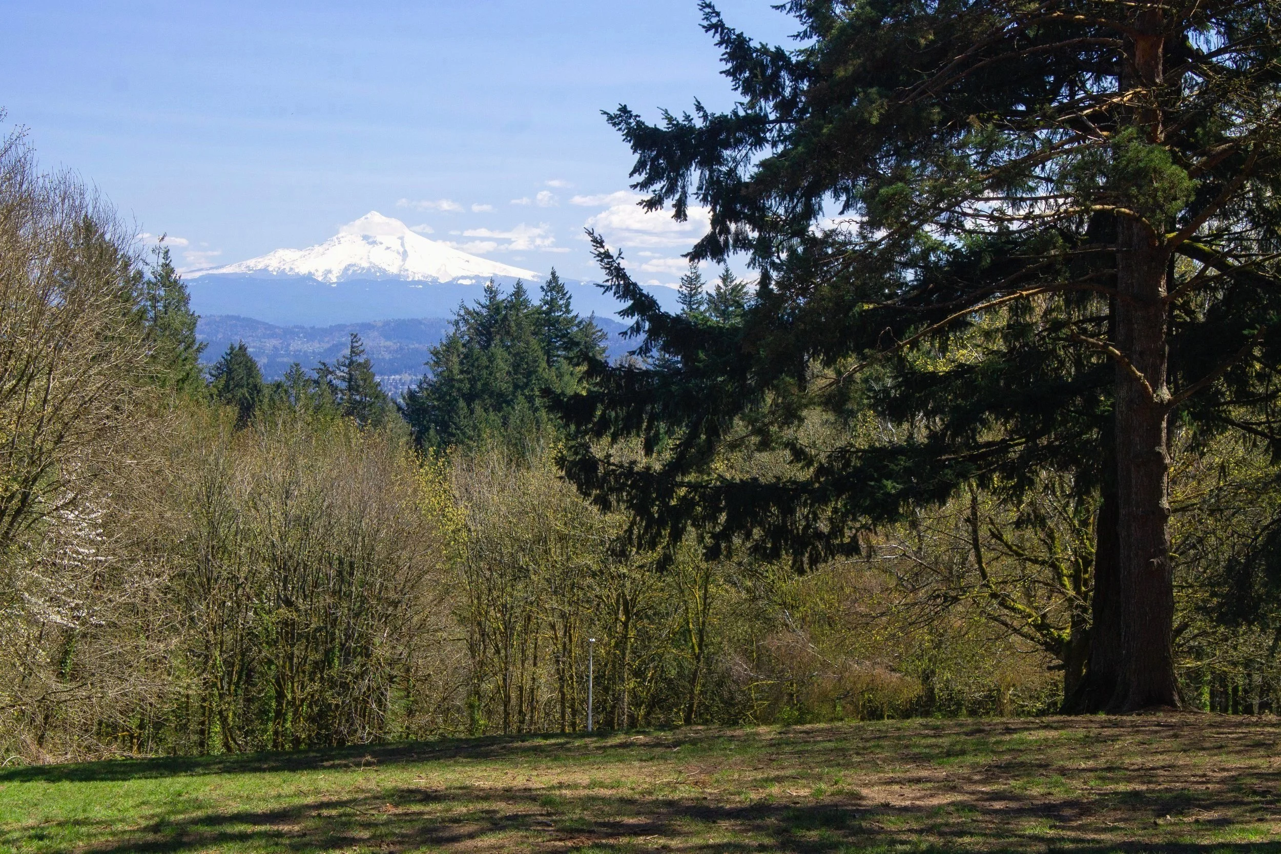
Mt Hood behind the off-leash dog park at Council Crest
On the other side of the Council Crest Viewpoint, the 4T Trail continues, finally downhill. Look for the Marquam Trail alongside the off-leash dog area. As before, signs help point the way.

Oregon grape blooms at Council Crest Park
As you head down the hill toward Marquam Nature Park, you’ll cross a couple of roads and pass a few trail junctions. Keep following the signs for the 4T Trail. After about a mile from the top of Council Crest, you’ll take the Shadyside Trail.

The trail continues after crossing this road
After 0.3 miles on the Shadyside Trail, you’ll reach the Marquam Nature Park shelter. There are a few picnic tables and a cool tile mosaic here.

Marquam Mosaic
From the shelter, take the Basalt Trail for about 0.1 miles. Then, look for the Connor Trail to your left.

Basalt trail
A sign at the trail junction points to the next leg of the 4T Trail, the OHSU aerial tram.

Connor Trail
Take the Connor Trail uphill for 0.5 miles until you reach the staircase that will bring you to OHSU. Once you’re at the stairs, you’ve finished the hiking part of the 4T Trail.

Staircase to OHSU
Tram

OHSU
At the top of the stairs is a parking lot. Cross it and follow the road to OHSU’s campus. You might see a helicopter landing while you’re here. This part of the journey is a bit confusing because of the size of OHSU’s campus. Head toward the hospital building to find the tram.

Follow signs for the aerial tram
After feeling disoriented among the OHSU’s many buildings, it was a relief to see a great big sign pointing to the tram. Head inside and follow the signs. You’ll pass a nice restroom and a water bottle filling station on the way.
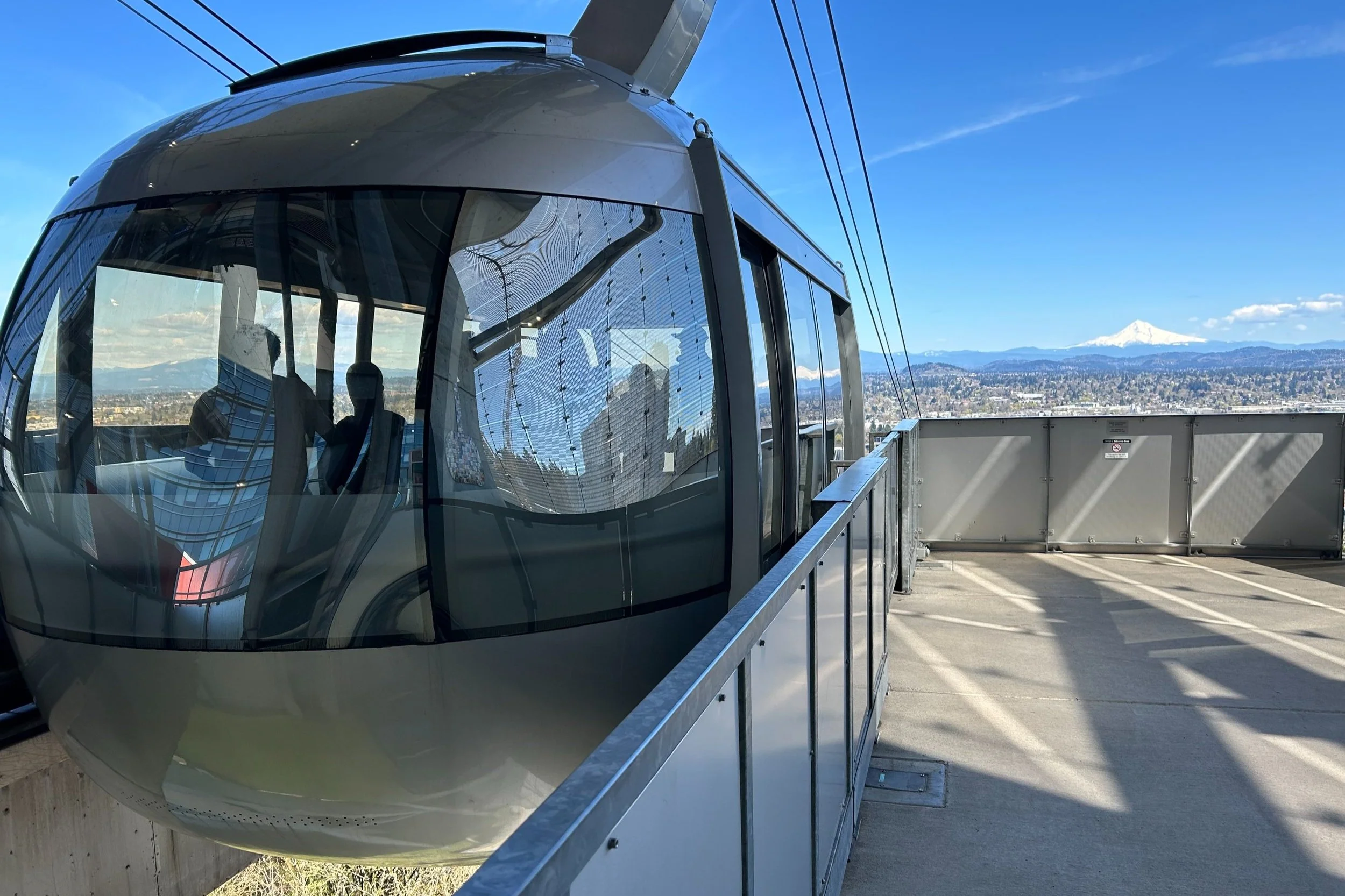
Aerial tram waiting area
Once you reach the tram, it’s worth taking a moment to appreciate the amazing views of Portland from OHSU’s observation deck. On a clear day, look for Mount Hood and Mount St Helens. When you’re ready to continue, use a credit card at the pay stations to buy a tram ticket. Then, scan the ticket at the gates in front of the tram to enter the waiting area.

Views from the tram
When the tram car arrives, try to get a spot by the window. If you’re at the back of a crowd, you might want to hang back until the next car comes for a better view. The tram will head descend to Portland’s southwest waterfront. Look for Mt Hood straight ahead and Mount St Helens to the left on a clear day.
Trolley

Use this streetcar stop
Now the easy part. Once you leave the aerial tram, the streetcar stop will be a few steps away. Google Maps gets confused here sometimes, so ignore it. Just wait at the stop you see immediately after stepping off the tram. The NS streetcar will take you back to Pioneer Square.
If you go one additional streetcar stop past Pioneer Square, you’ll be at Powell’s Books if that’s on your Portland itinerary.
Enjoy your day on the 4T Trail!
With love,
Emma
Explore nearby

Check out the best parks for hiking in Portland.

Find the best solo activities in Portland.

See the blooms at the International Rose Test Garden.

Rainy day? Check out Portland’s best indoor activities.

Have post-hike drinks at one of Portland’s best wine bars.