

Hike the Shellburg Falls Trail [Reopened 2024]


After an extended closure following the 2020 Labor Day wildfire, the hike to Shellburg Falls reopened in the spring of 2024. Both the forest and trails look different now. Charred trunks remain while living trees are scarce. The undergrowth has regrown, thick and lush, with many wildflowers in spring. It is everything haunting and hopeful about a forest in recovery. Two out-and-back trails lead to the 100-foot waterfall in the secluded Santiam State Forest. One also brings you to Lower Shellburg Falls downstream of the main event. Here is everything you need to know about the reopened hike to Shellburg Falls.

Shellburg Creek
Know before you go
Shellburg Falls is free to visit. You don’t need a pass or permit.
Leashed dogs are welcome on the Shellburg Falls Trails.
The road to Shellburg Falls is unpaved but in good condition. It’s no problem with a low-clearance vehicle.
Look for restrooms and a picnic area near the parking lot.
Two separate out-and-back hikes start from the same place, both leading to Shellburg Falls. Unlike before the 2020 closure, you cannot walk behind the falls. Both trails are family-friendly and in good condition.
Stay on the trails. Much of the land around Shellburg Falls is private property.

Irises bloom along the trails in May
The trails
Two out-and-back trails approach Shellburg Falls from different sides of Shellburg Creek. Neither is very long or hard, so you might want to tackle both while you’re there.
Upper Shellburg Falls Trail (1.4 miles out and back). This trail is the shortest way to reach Shellburg Falls. I thought it was the prettier of the two trails, although it doesn’t include Lower Shellburg Falls.
Lower Shellburg Falls Trail (3.4 miles out and back). This longer, if not quite as scenic, trail leads to the base of Shellburg Falls and Lower Shellburg Falls.
Distance: 4.8 miles (both trails)
Elevation gain: 400 feet
Difficulty: Easy
Passes required: None
Dog friendly: Yes, leashed dogs are welcome on the trails.
ADA access: No
Season: Potentially all year, most popular spring to fall. The waterfalls are best in spring.
Upper Shellburg Falls Trail

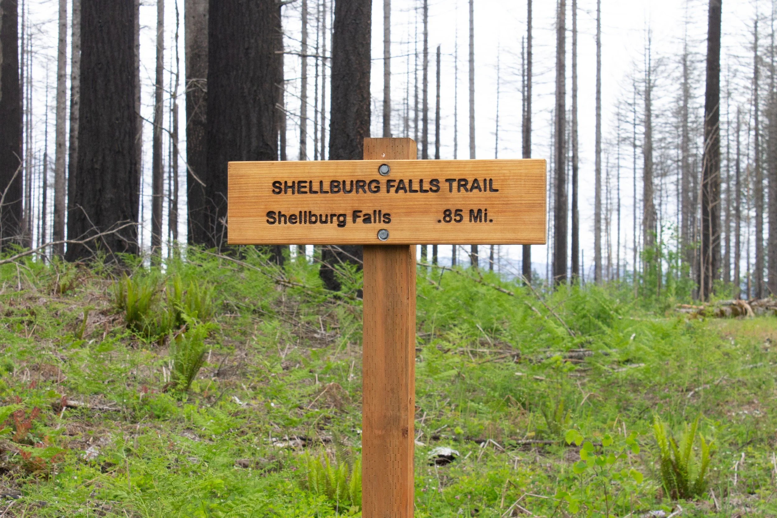
Shellburg Falls Trailhead
The easiest way to see Shellburg Falls is to take the short and sweet Upper Shellburg Falls Trail. You’ll see the sign for the trailhead next to the parking lot.

Pacific bleeding hearts bloom along the trail in spring
Wildflowers are one of the highlights of a spring hike to Shellburg Falls. When I visited in late May, the last white blossoms lingered on the dogwood tree next to the trailhead. Bleeding hearts, violets, false Solomon’s seal, irises, and monkey flowers were blooming in the undergrowth.

Walk around this gate
After about 0.1 miles, you’ll reach a gated road. Walk around the gate to head towards the Upper Shellburg Falls Trail. The other direction goes to the picnic area and the Lower Shellburg Falls Trail.

Take a right at the sign
Just past the gate is a dirt path to the right. A reassuring sign confirms that it’s the trail to Shellburg Falls.

Scotch broom blooms along the trail
The trail begins as a flat and easy stroll through an area heavily impacted by wildfires. The aftermath of the 2020 Labor Day fire is unmistakable here with acres of blackened trunks all around.

A new bridge crosses Shellburg Creek
About a quarter mile from the trailhead, you’ll cross a footbridge over Shellburg Creek. Soon after, you’ll see the first glimpse of Shellburg Falls from above. Keep going for a better view at the end of the trail.

My parents have a look at Shellburg Falls
After a flat and gentle beginning, the trail begins to descend. It’s easy to see that a lot of work went into restoration. Despite the difficult terrain around it, the hike is smooth sailing throughout.

Switchbacks head toward the falls viewpoint
The second half of the hike explores a canyon with Shellburg Creek at its base. You’ll see basalt outcroppings above you and some impressive boulders below.

Approaching the canyon
Through the burnt trunks, the hillside across the canyon is bright yellow in spring. Scotch broom covers its slopes.

You’ll see views of the surrounding hills through the tree trunks
At the end of the hike, a viewpoint overlooks 100-foot Shellburg Falls. Much like the waterfalls of Silver Falls State Park, it tumbles over a deeply recessed cliff. The top of the falls is basalt from ancient lava. Underneath is an eroded sedimentary layer that creates a cavern behind the falls. Shellburg Falls is not the tallest or most powerful waterfall in the area. It looks most impressive in spring or after heavy rains. Since rainwater feeds it, the waterfall slows to a trickle in late summer.

False Solomon’s seal blooms in front of Shellburg Falls
A sign at the viewpoint makes it clear you’ve reached the end of the road. Take a moment to admire the falls, then return the way you came. At this point, you can call it a day or check out the Lower Shellburg Falls Trail.

The area behind Shellburg Falls is closed
Lower Shellburg Falls Trail

Covered picnic area
Back at the parking lot, head away from the trailhead sign up the hill. You’ll pass the bathrooms and then the picnic shelter.

Shellburg Creek Trail
Just past the picnic shelter, you’ll be on the Shellburg Creek Trail. You’ll see two narrow paths split off to either side. Both are the Vine Maple Loop. Go ahead and take any of the three trails. They all meet up in about 0.3 miles.

Bridge over Shellburg Creek
When the trails meet back up, you’ll cross the footbridge over the creek. You’re now on the August Mountain Trail but don’t worry too much about the trail names. You’re still heading to Shellburg Falls.

August Mountain Trail
Unlike the extensively restored Upper Shellburg Falls Trail, the August Mountain Trail seems kind of like someone took a lawnmower through the undergrowth. It’s in good shape, just feels more informal. This trail also didn’t have quite as many wildflowers, but the irises were still a treat.

Irises bloom next the trail
You’ll soon reach a trail junction with an unmarked road. Keep going straight. It’s a bit hard to distinguish the trail from the grass, but a sign helps out.
Follow this sign at the trail junction
From here, you’ll head downhill, then cross a gravel road. The viewpoint for the falls is just ahead.

Shellburg Falls Viewpoint
Where the trail ends in a T, you’ll see Shellburg Falls. Head right to approach the waterfall. As before, the trail behind it is closed. I thought this viewpoint was better than the one on the Upper Shellburg Falls Trail. You get closer to the waterfall and have a better sense of its height.

This trail leads to Lower Shellburg Falls
Back at the junction, a sign points toward the Lower Shellburg Falls Viewpoint.

Lower Shellburg Falls
In 0.1 miles, you’ll be at the top of Lower Shellburg Falls. This waterfall is most interesting in person since it’s hard to capture both the 40-foot waterfall and the cascades below it in a single shot. The best angle is in front of the picnic table at the viewpoint. It’s also a good place to have a snack before returning the way you came.

Lower Shellburg Falls
Getting there
From Salem, take OR-22 for 21 miles. Turn left onto Teeters Rd, then make a slight right onto Wagner Rd and continue for 2.4 miles. Continue onto Ayers Creek Rd. Drive for 2.2 miles then turn left onto Shellburg Rd. Look for the parking area on your right.
The road leading to the Shellburg Falls Trailhead is unpaved for several miles. It is in good condition and okay for any type of vehicle. It will seem like it goes on forever. There are regular signs along the way pointing you in the right direction.
The drive from Portland to Shellburg Falls takes about 90 minutes. From Salem, about 50 minutes.
Enjoy your hike to Shellburg Falls!
With love,
Emma
Explore nearby

See incredible waterfalls on the trails of Silver Falls State Park.

Try the easy and rewarding waterfall hike at McDowell Creek Falls County Park.

Find the trail to beautiful Abiqua Falls.

Find more hidden gem hikes near Portland.