Catherine Creek Hiking Guide
Catherine Creek has some of the most stunning wildflower meadows in the Columbia Gorge. It isn’t a single hike, but a trail network. The options are many, and the signage is poor. After multiple visits, I still haven’t done all the potential routes. Rather than an exhaustive list, I wrote this article to answer the question of where to start, with options ranging from easy and relaxing to long and ambitious. Here’s everything you need to know about visiting Catherine Creek.
Mid-March to May is the best time for wildflowers at Catherine Creek
Hike options
Here are what I’d call the main hikes at Catherine Creek:
Catherine Creek Universal Access Loop (1.2 miles, easy, paved)
Catherine Creek Arch Loop (2 miles, moderate, unpaved)
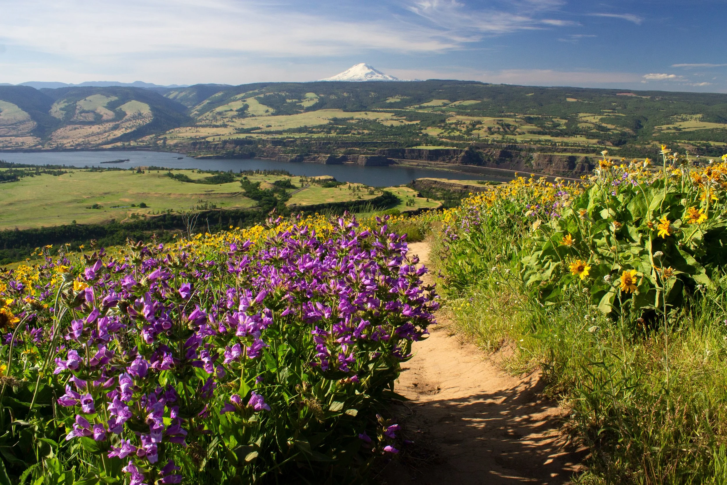
Catherine Creek to Coyote Wall (10 miles, hard, unpaved)
Hike #1 starts at the Lower Trailhead, across the road from the parking lot. The other two start from the Upper Trailhead, on the same side of the road as the parking lot.
If it’s your first time visiting, I’d recommend doing the Universal Access Loop, then the Arch Loop. It’s about 3 miles total, feels like a workout without being exhausting, and gives you a good feel for Catherine Creek.
Know before you go
Cost: Parking at the Catherine Creek Trailhead is free. You don’t need a pass.
Crowds: Catherine Creek gets crowded during wildflower season. Arrive early on weekends in the spring. Other times, parking usually isn’t a problem.
Amenities: A porta-potty is across the street from the parking lot.
Dogs: Leashed dogs are welcome on the trail.
Leave no trace: Please stay on the trail. Don’t pick or step on the wildflowers.
Navigation: Besides the Universal Access Trail, I find the trails at Catherine Creek confusing. There are many junctions, and most don’t have signs. Have an offline map with you.
What to bring: Layers, water, and sunscreen. Catherine Creek has little shade and can be very windy.
Hazards: Watch for rattlesnakes and poison oak.
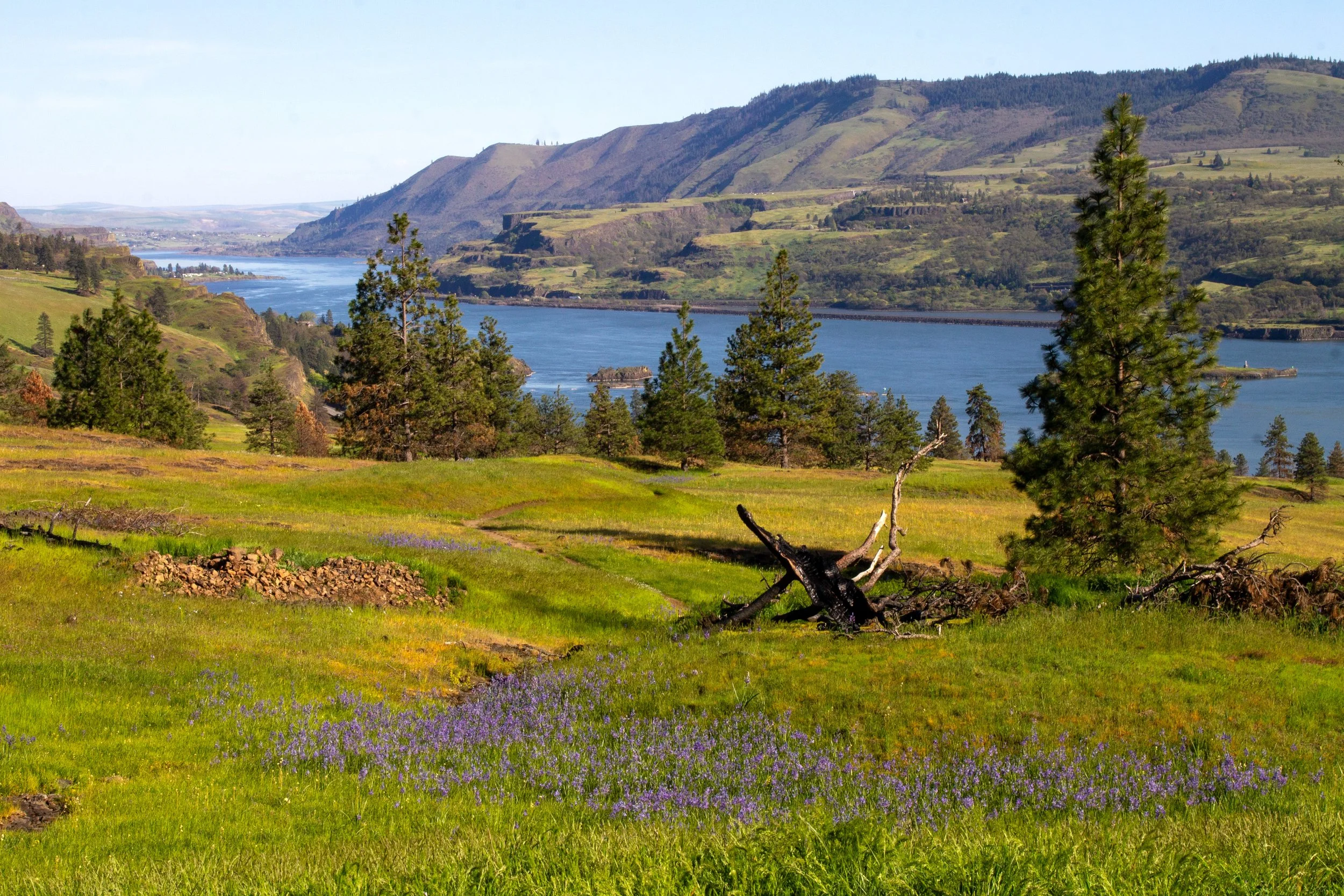
Wildflowers at Catherine Creek
Camas at Catherine Creek in April
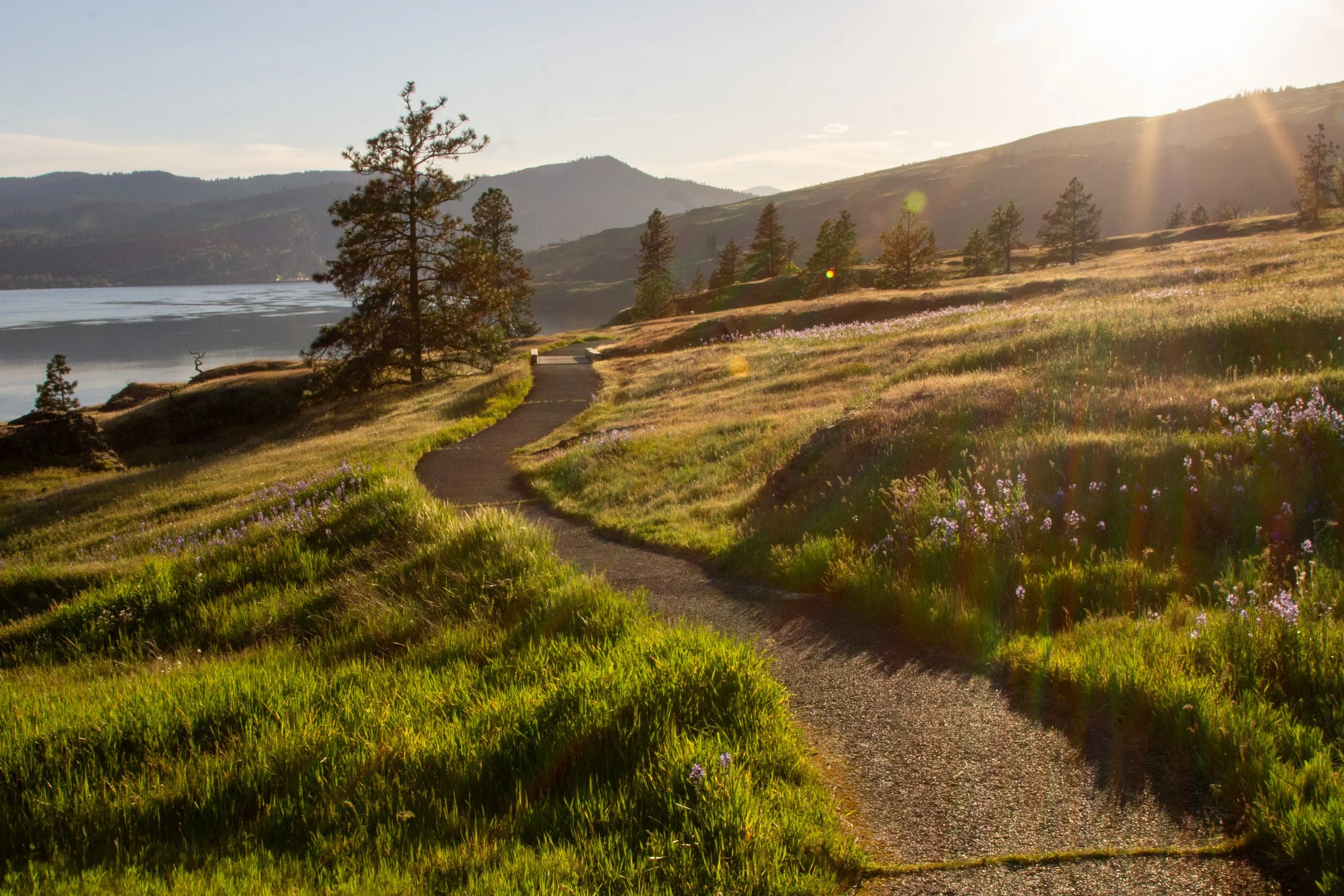
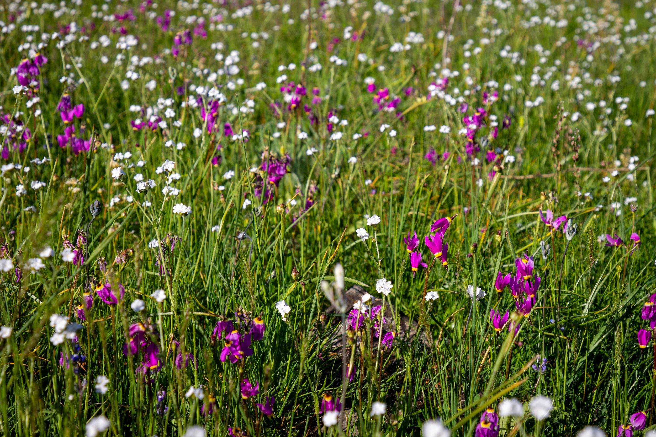
Wildflowers bloom at Catherine Creek from around mid-March to late May. You might see some early blooms, like grass widows, as early as February. Don’t expect big balsamroot and lupine displays covering the hillsides. It’s more about variety here. Around 90 species of wildflowers grow at Catherine Creek. Great camas and poet’s shooting star are highlights in April. Bachelor buttons and poppies look great later in the season. One of my favorite wildflowers, bitterroot, grows here and not many other places in the Columbia Gorge.
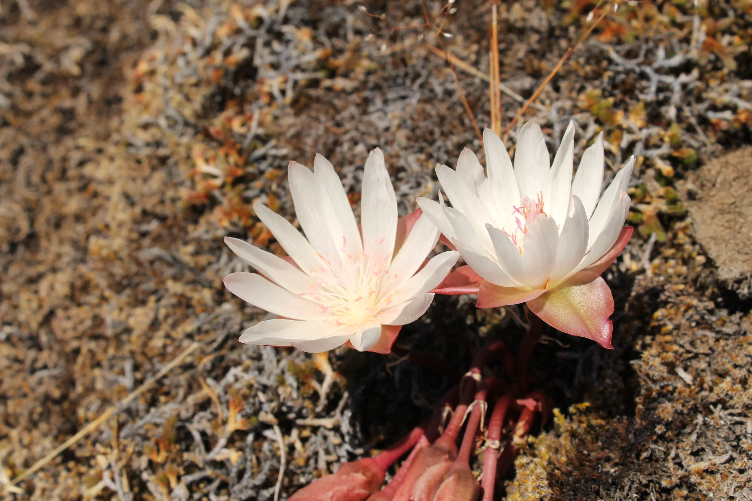
Bitterroot blooms in May
Hikes
1. Catherine Creek Universal Access Loop
Distance: 1.2 miles
Elevation gain: 100 feet
Difficulty: Easy
ADA access: The trail is paved and doesn’t have barriers like steps. It has some cracks, but nothing that would be a major obstacle. The narrowest parts are about 4 feet wide. It does get steep (up to about 12% grade), which, along with the gravel parking lot, would be the biggest challenge in a wheelchair. The trail has benches.
Trailhead: Lower
Highlights: Columbia River views, Mount Hood (on clear days), wildflowers, Catherine Creek Falls, great for families, easy on the knees
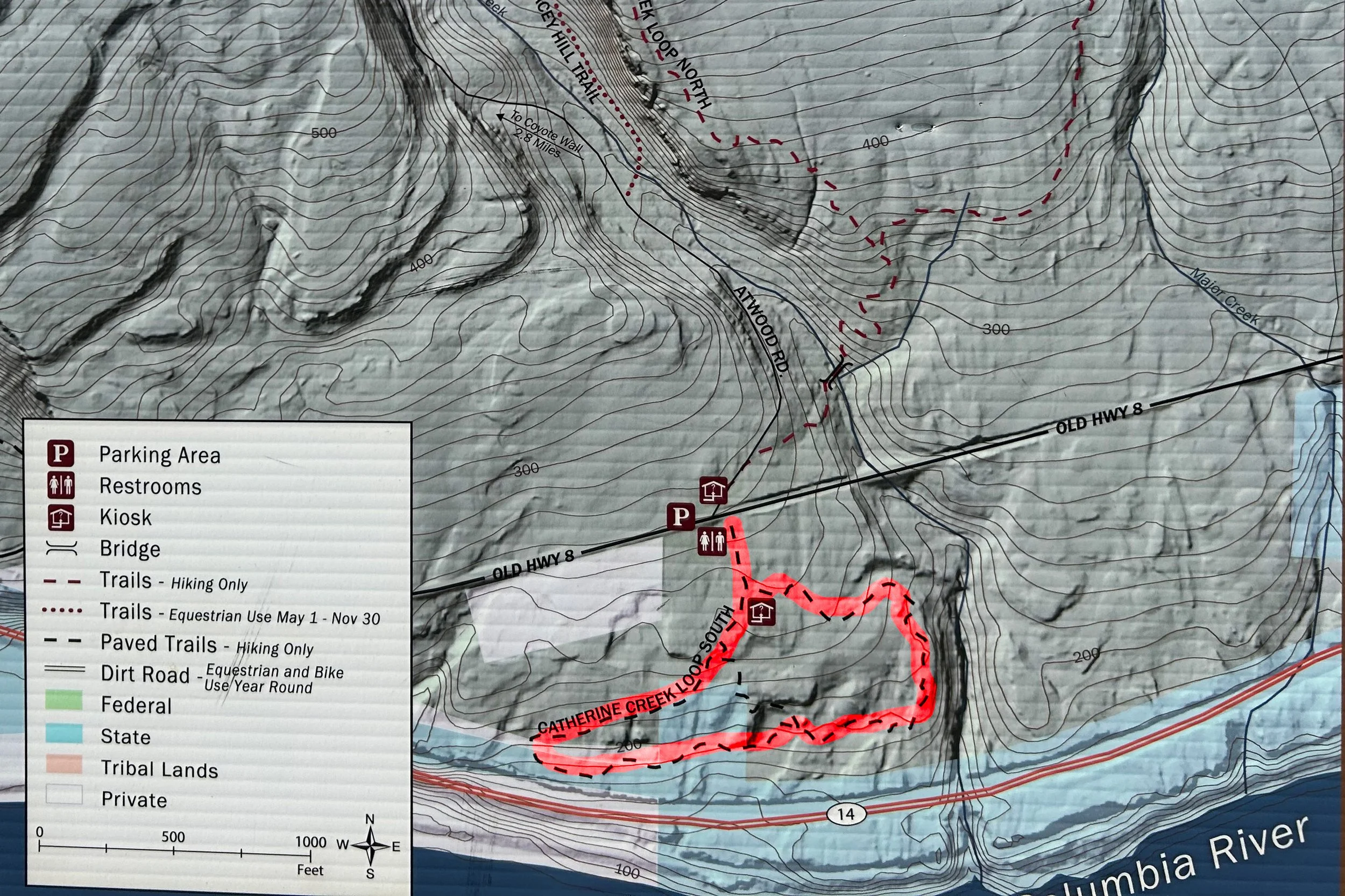
Catherine Creek trailhead map; I marked the Universal Access Loop in red
The Catherine Creek Universal Access Loop is the only hike on the south side of Old Hwy 8. The paved trail makes a gentle loop out toward the Columbia River, with interpretive information and benches along the way. To begin, head to the Lower Trailhead, which starts at the porta-potty.
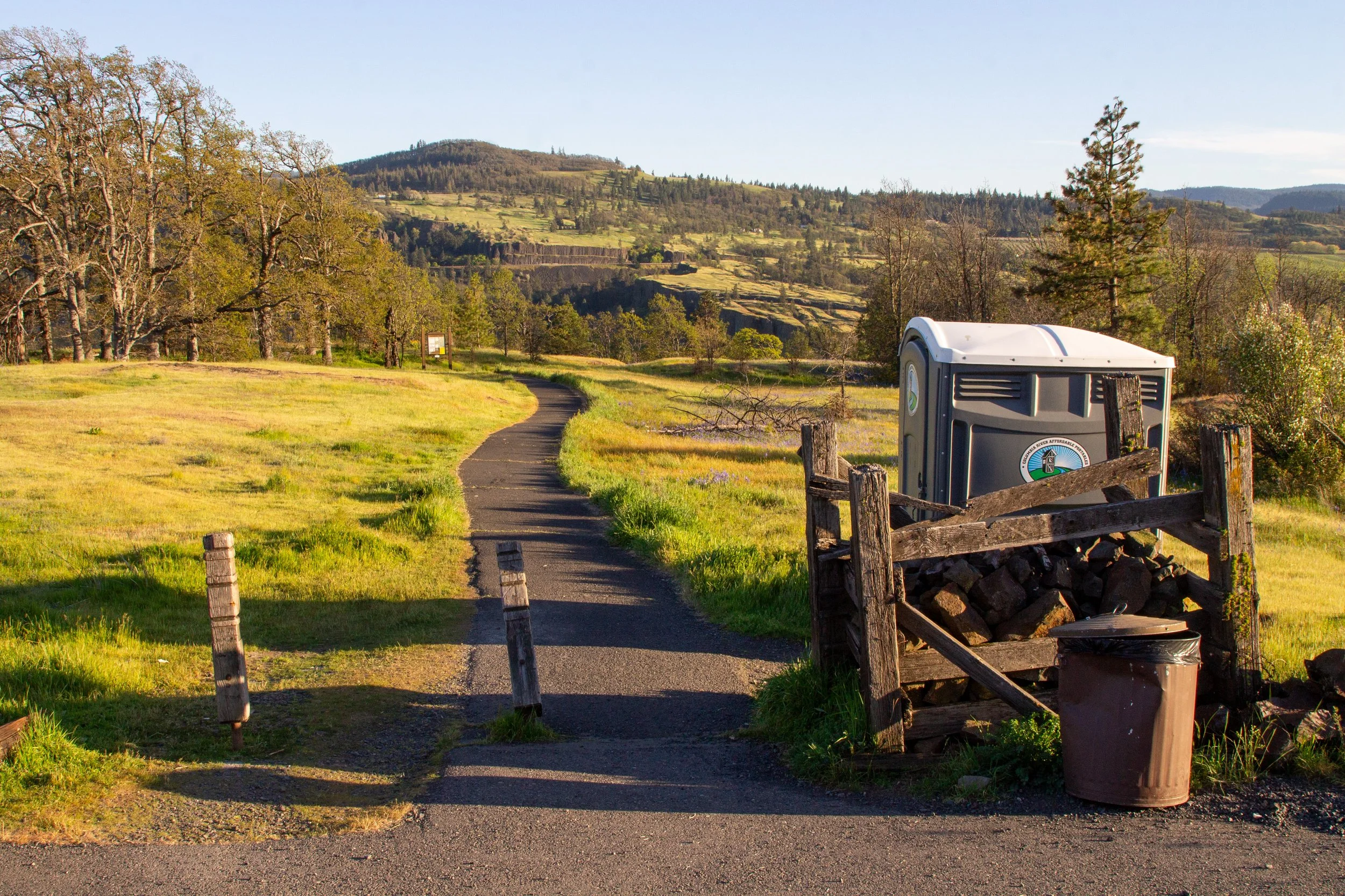
Lower Trailhead
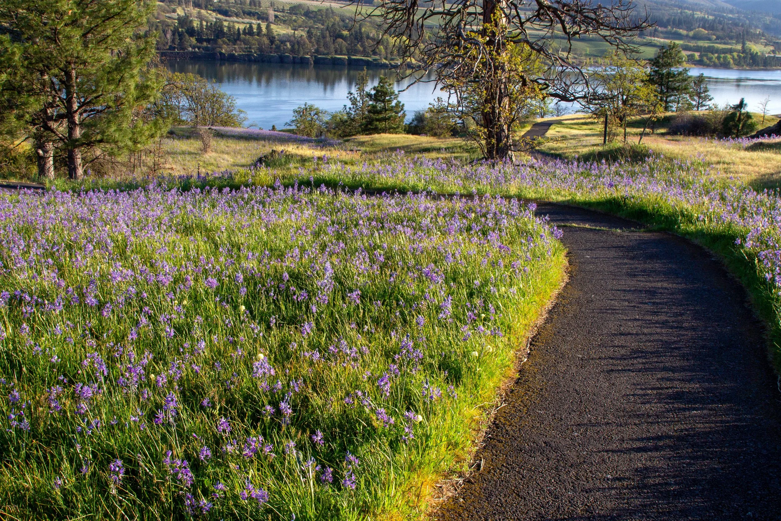
After about 0.1 miles, the trail splits at the sign with the trail map. You can go either direction. It’s the start and end of the loop hike. We’ll head to the right. In spring, purple-blue camas flowers blanket the grassy plateau surrounding the trail. Looking closer, you can spot others: shooting stars, death camas, cluster lilies.
Camas on the Universal Access Loop
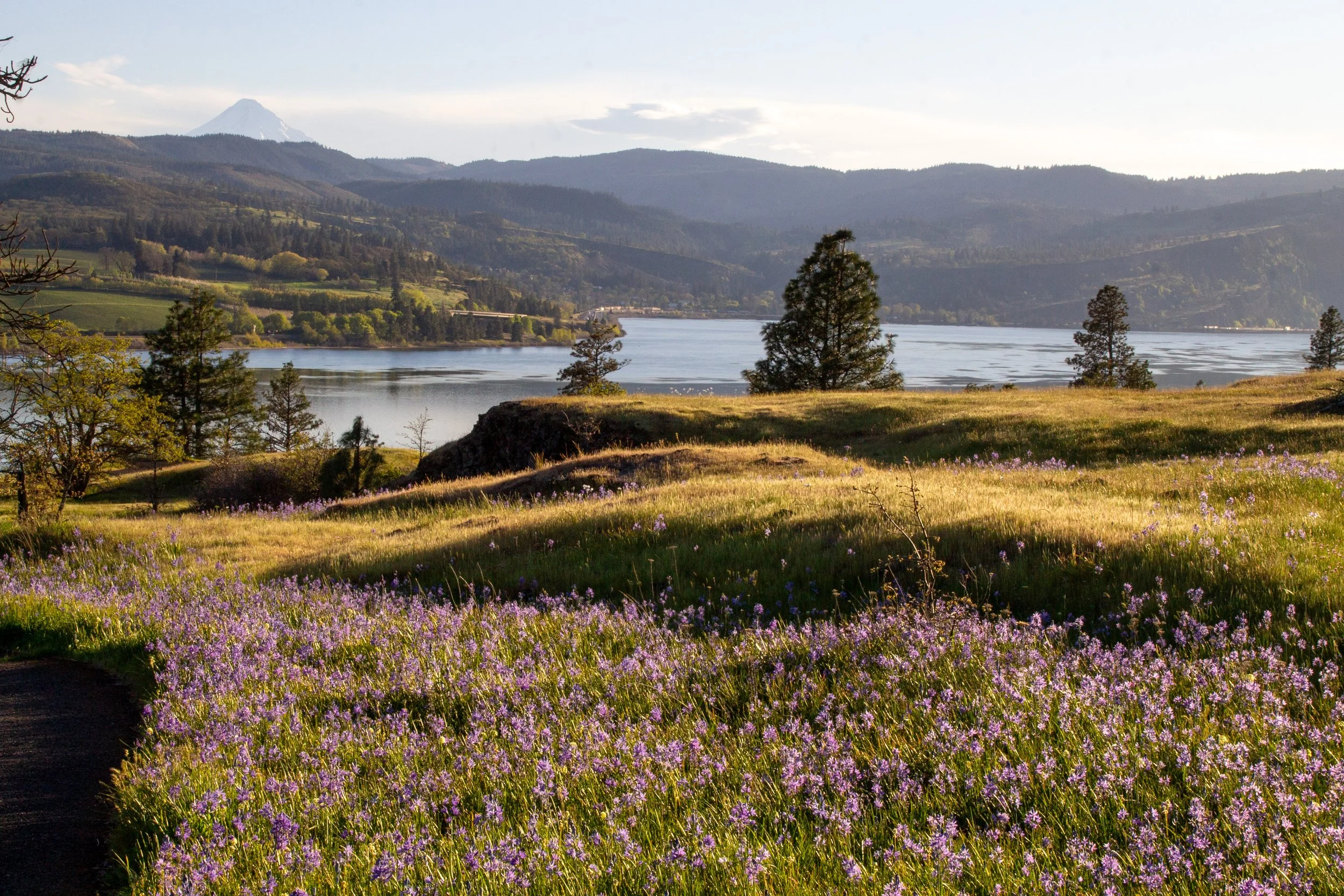
You’ll pass a connector trail that bisects the loop. Keep right unless you want a shorter distance. You’ll soon reach the first of several benches overlooking the Columbia Gorge. After the bench, the trail winds back toward the east, parallel to the Columbia River. On clear days, you can see Mount Hood’s summit popping up above Oregon’s slanted basalt cliffs.
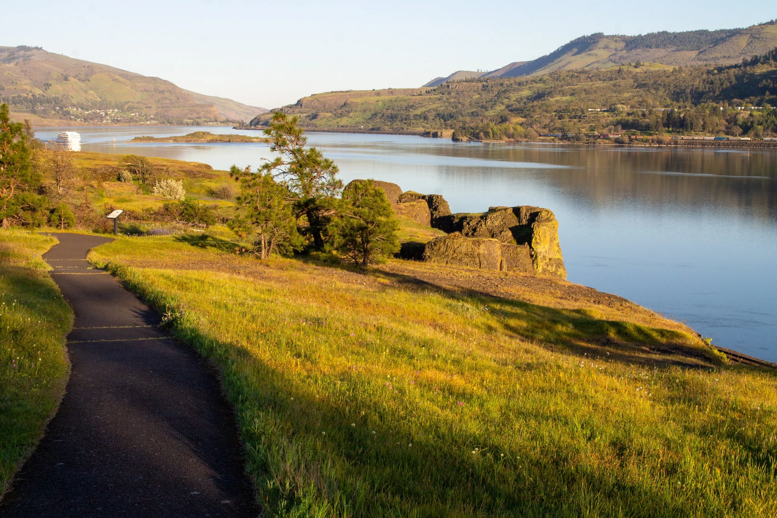
Columbia River views on the Universal Access Loop
You’ll pass clumps of desert parsley and serviceberry bushes before entering a thicket of Oregon white oak and ponderosa pines. Watch for poison oak here.
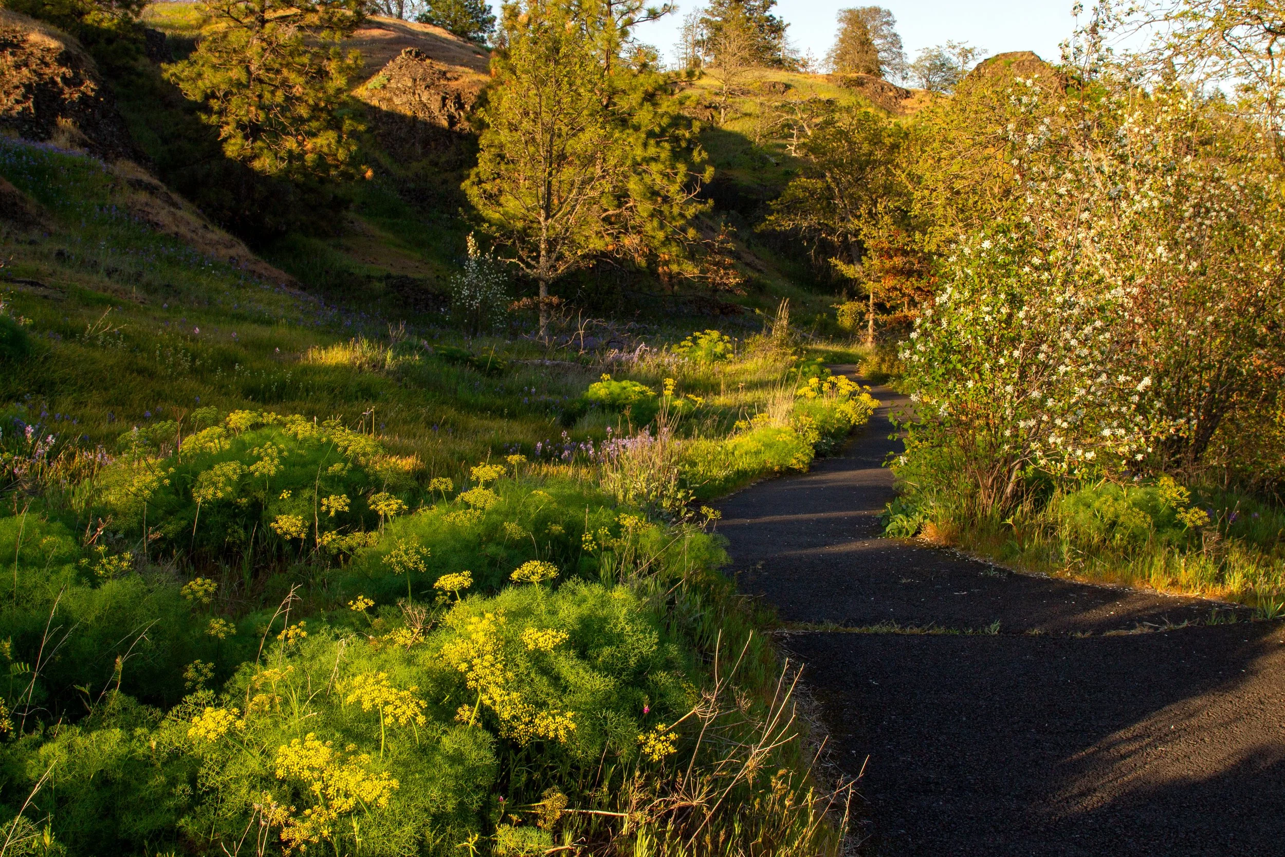
Desert parsley on the Universal Access Loop
Then, you’ll cross a little boardwalk through a patch of camas and rosy plectritis.
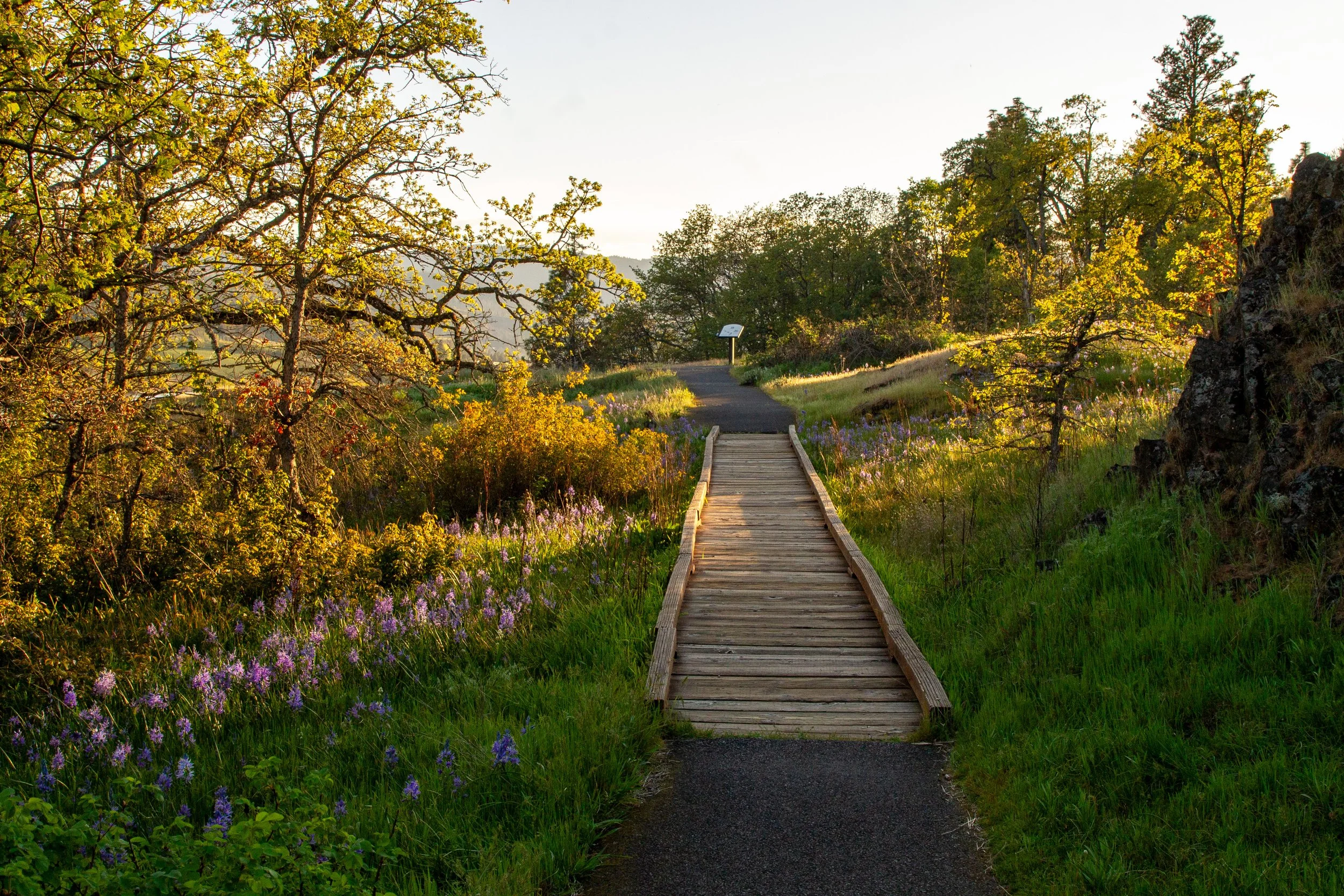
Boardwalk on the Universal Access Loop
The other side of the loop takes you past Catherine Creek, flowing through a wildflower meadow, and the lovely, 15-foot Catherine Creek Falls before returning to your starting point.
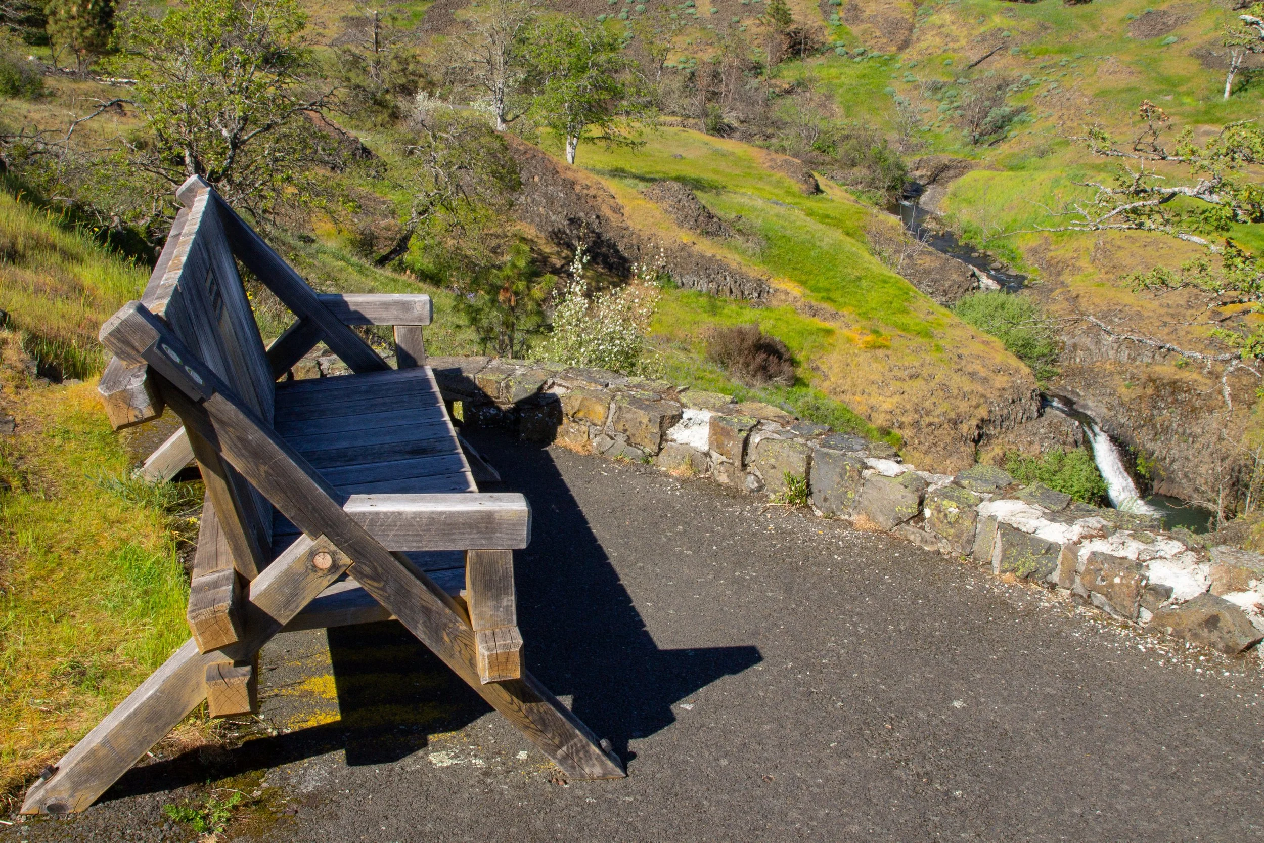
Bench overlooks Catherine Creek Falls
2. Arch Loop
Distance: 2 miles
Elevation gain: 400 feet
Difficulty: Moderate
ADA access: No
Trailhead: Upper
Highlights: Columbia River views, Mount Hood (on clear days), wildflowers, Catherine Creek Arch rock formation
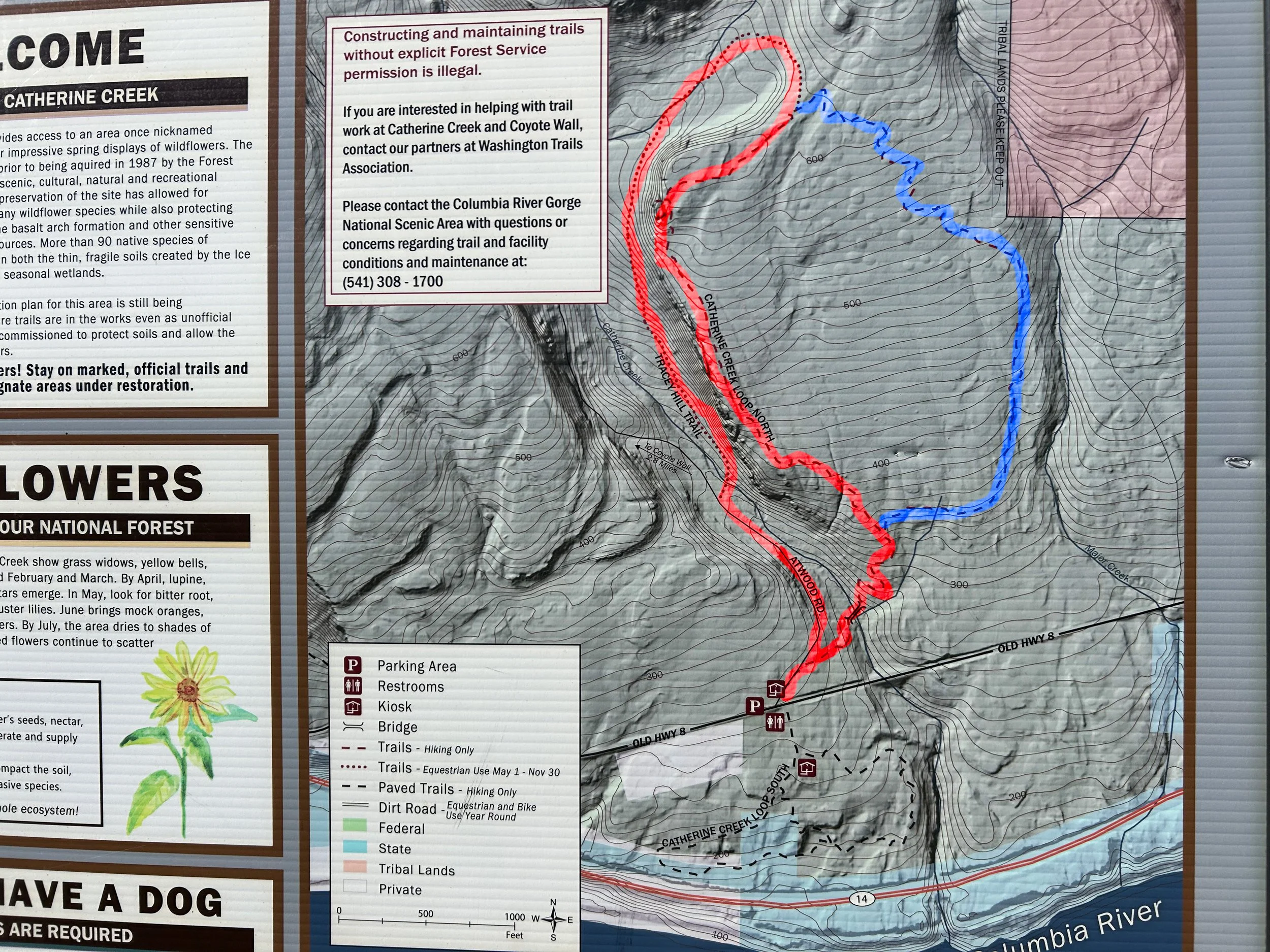
Catherine Creek trailhead map; I marked the Arch Loop version 1 in red, version 2 in blue
The Catherine Creek Arch Loop is the most approachable hike on the north side of Old Hwy 8. Unlike the Universal Access Loop, it’s sometimes steep and often rocky. To begin, walk past the gate at the Upper Trailhead.
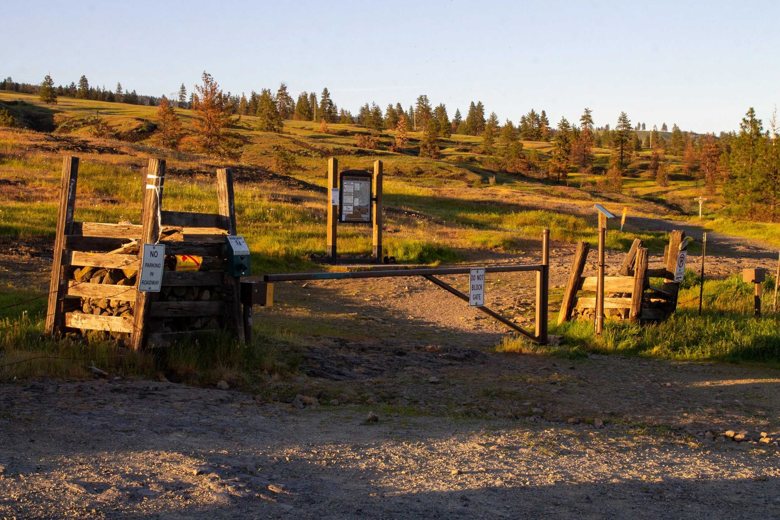
Upper Trailhead
A sign at the trailhead has a map and a boot brush. Head right from the trailhead sign, then take an immediate left onto Atwood Road where the trail splits. It’s the one without a sign.
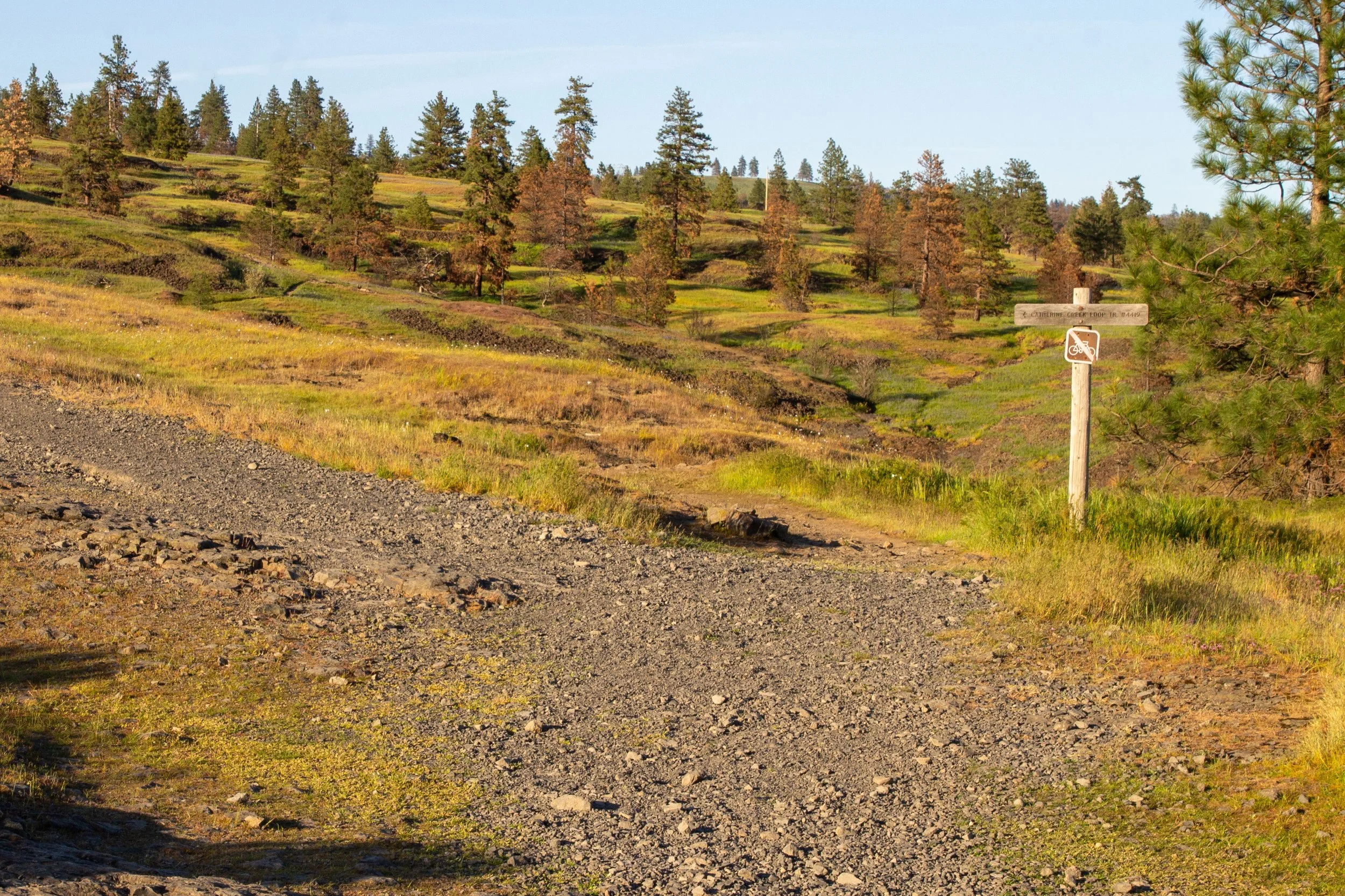
Take the unmarked gravel road to the left to start the Arch Loop
In about 0.2 miles, the trail splits again. Keep right onto the Tracy Hill Trail (unlabeled). Next is the hike’s only major obstacle, a makeshift log bridge over Catherine Creek. This hot mess is standing in for the real bridge that used to be here. Do your best. It’s not very hard to cross, just awkward and unstable.
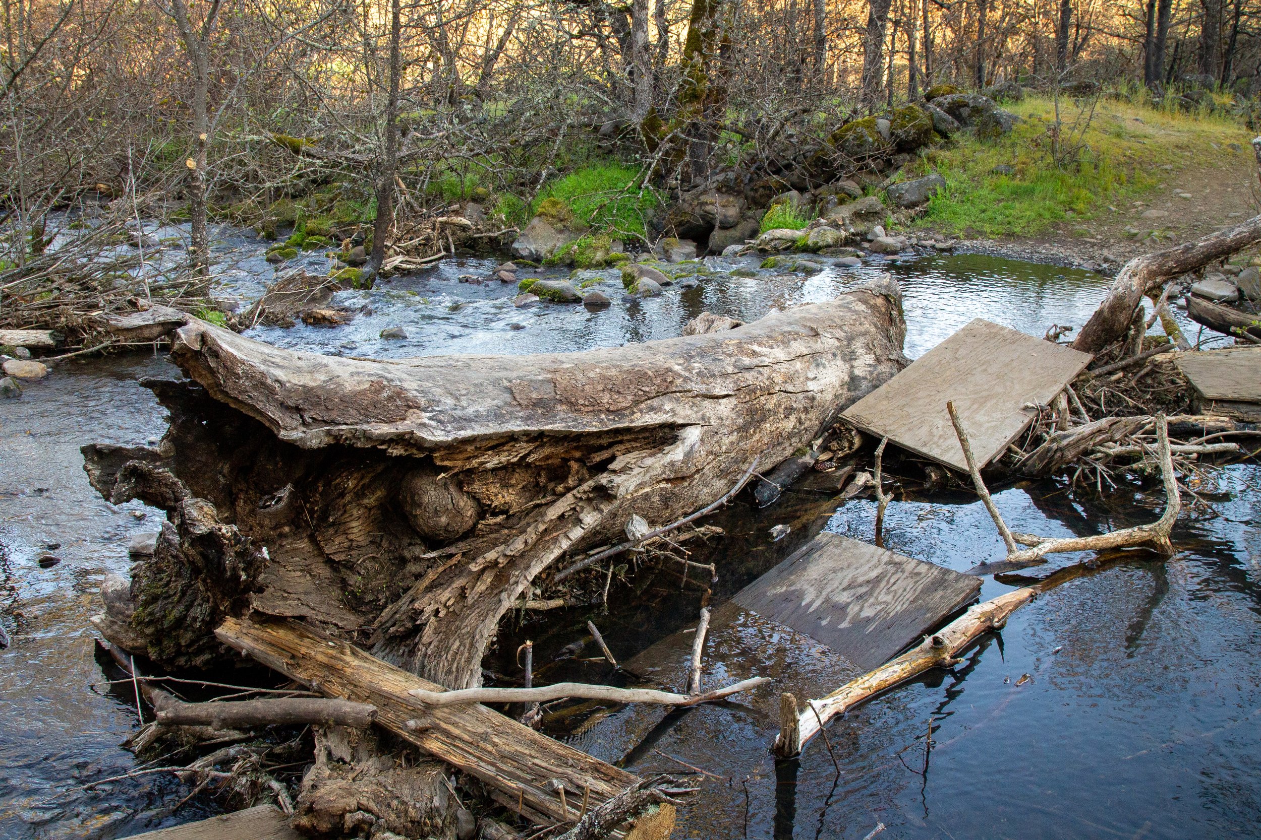
The log bridge
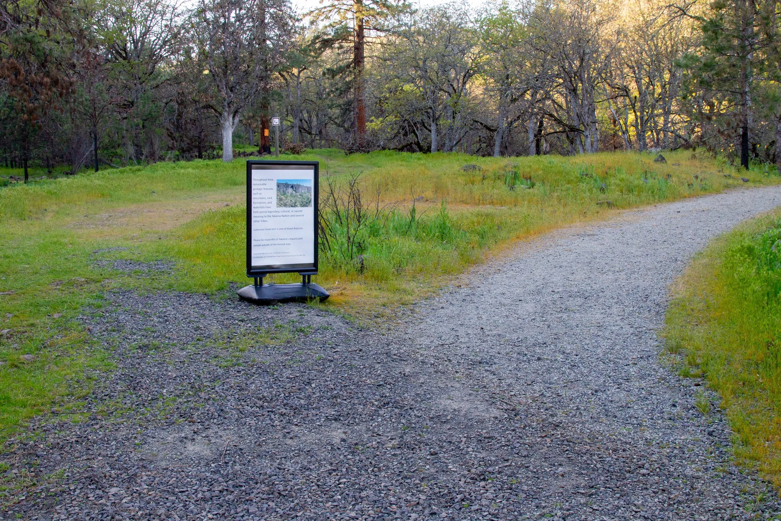
Just past the log bridge is the Catherine Creek Arch, an impressive recess in a lichen-covered basalt cliff. A sign explains its spiritual significance to the Yakima tribe. Please respect the fenced boundary next to the trail. Past the Arch, you’ll head uphill through oak trees. Lupines bloom in the undergrowth later in the spring.
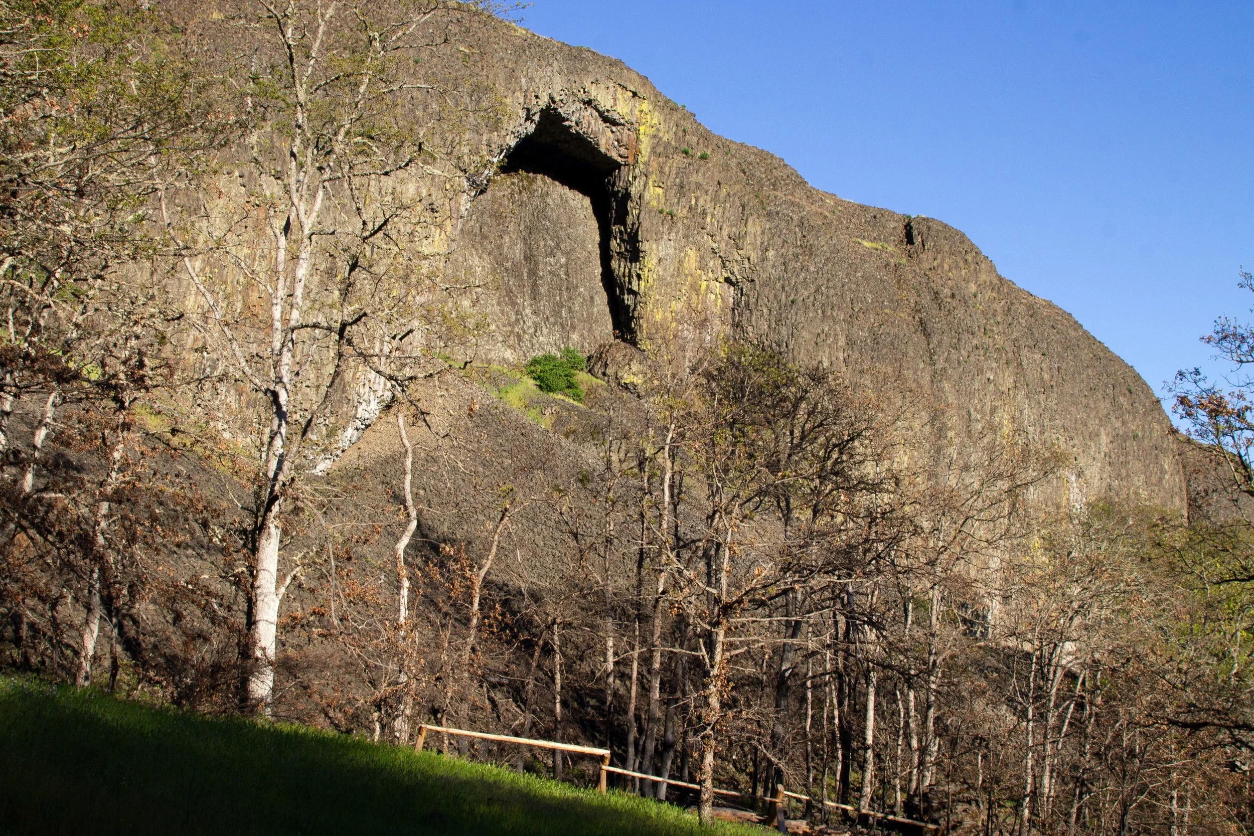
Catherine Creek Arch
When you reach the next trail junction, follow the sign onto the Catherine Creek Arch Trail. Next, keep right past a couple of unmarked trails heading uphill. They lead to an upper trail network. I haven’t tangled too much with it. It’s not on the sign at the trailhead, which has some language about closing upper trails for restoration. The sense I get is that it’s not closed but also perhaps not encouraged.
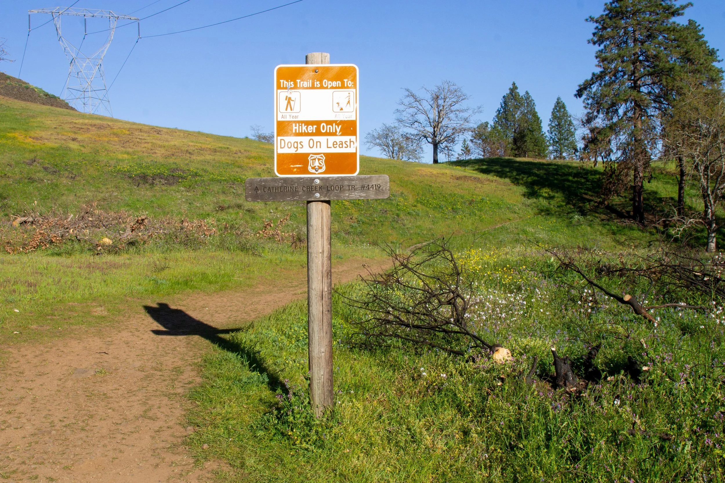
Keep right onto the Catherine Creek Loop Trail
The next unmarked trail junction is a decision point. You can go either direction to return down the hill.
Junction for the two versions of the descent
Version 1
The trail to the right is a more direct descent along the top of a ridge above Catherine Creek. You’ll pass the top of the Catherine Creek Arch, although you can’t see much of it from this angle.
Top of the Catherine Creek Arch
Version 2
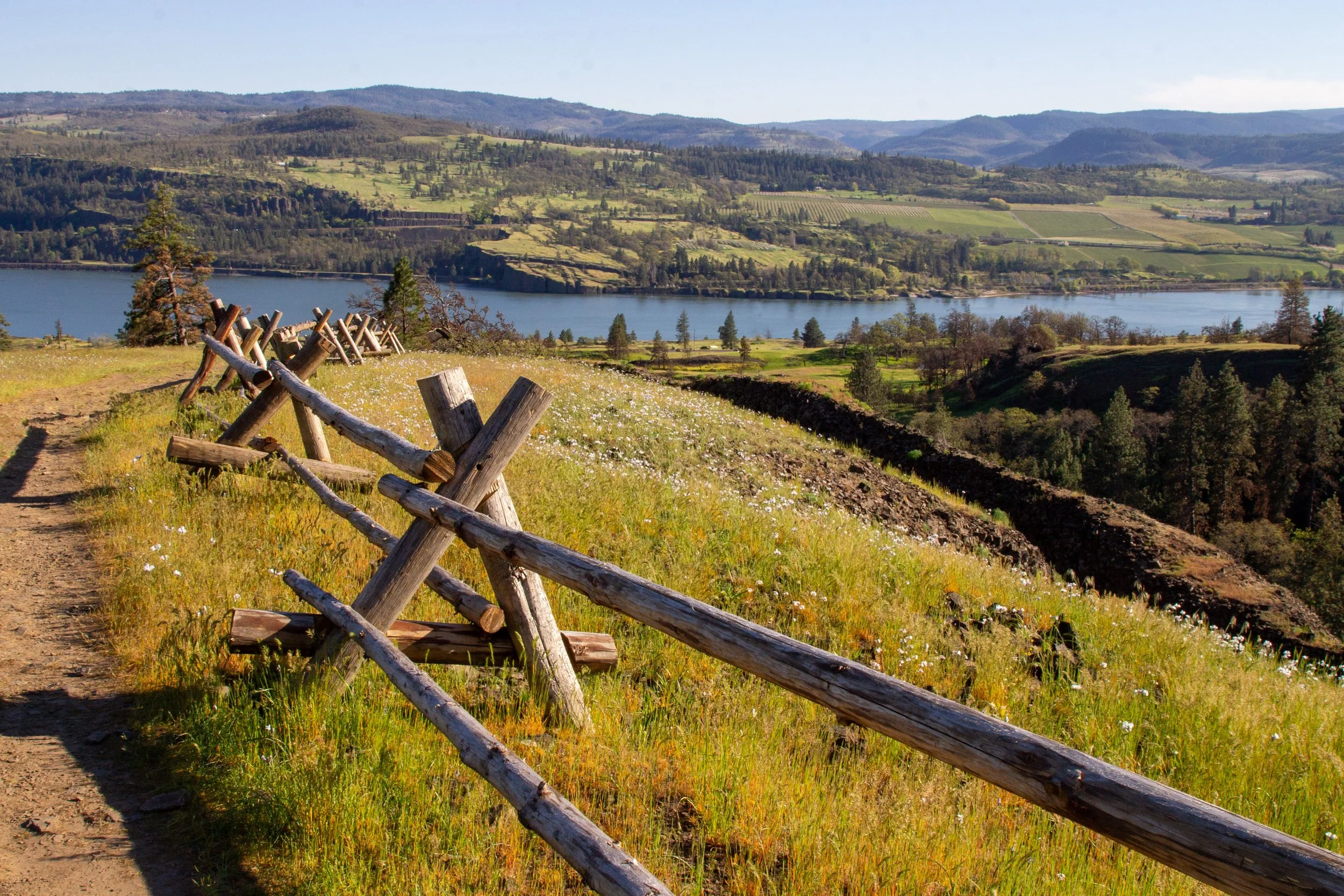
The trail to the left is slightly longer. It takes you east with better views of the Gorge looking towards The Dalles.
Columbia Gorge views on the Catherine Creek Loop
Both versions have excellent views of the Columbia Gorge, Mount Hood, and wildflowers galore. Watch for birds like meadowlarks, scrub jays, turkey vultures, and raptors. The trails meet back up in about a half mile.
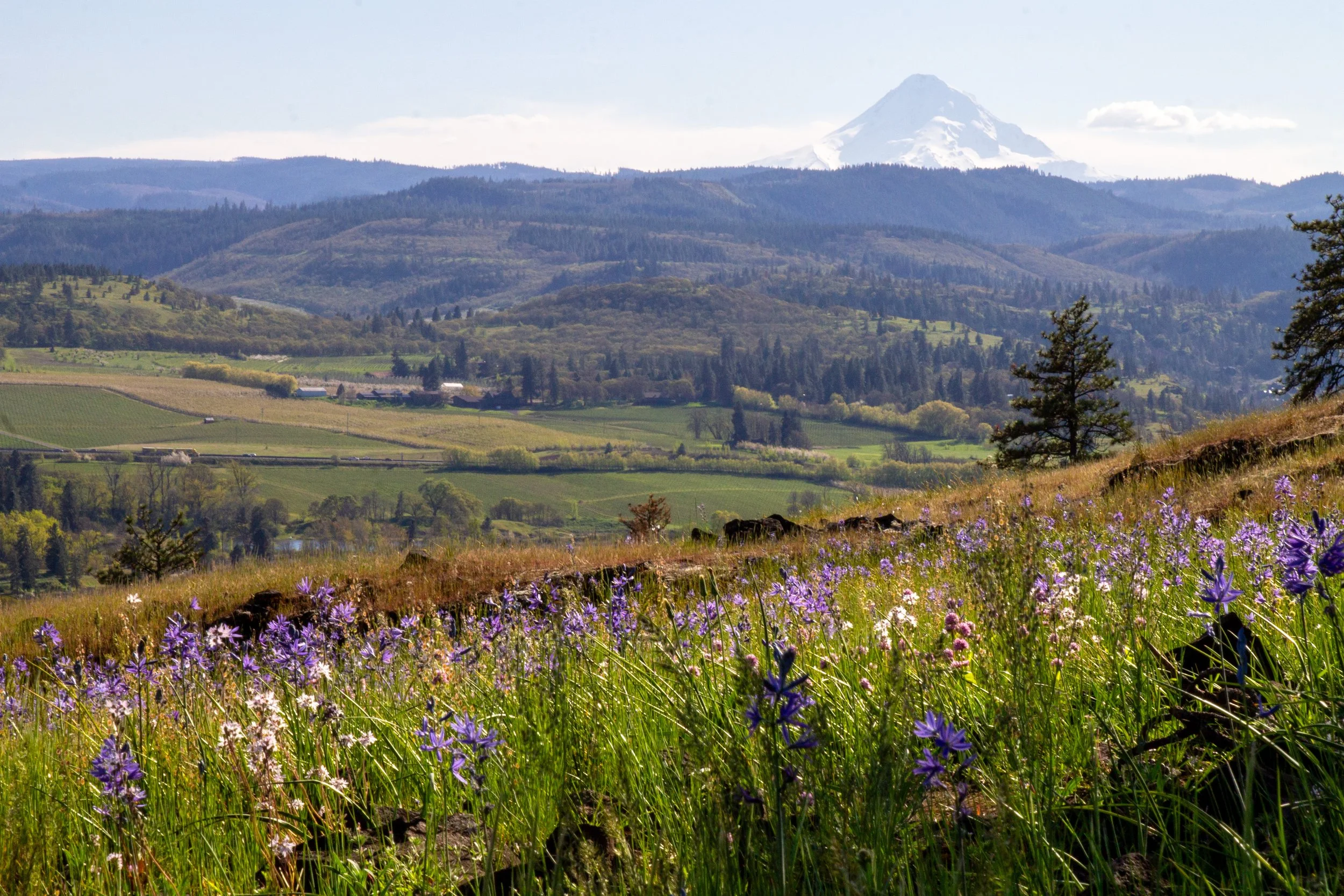
Mount Hood from version 2
After the trails merge, you’ll cross a wooden footbridge over Catherine Creek and return to the parking lot.
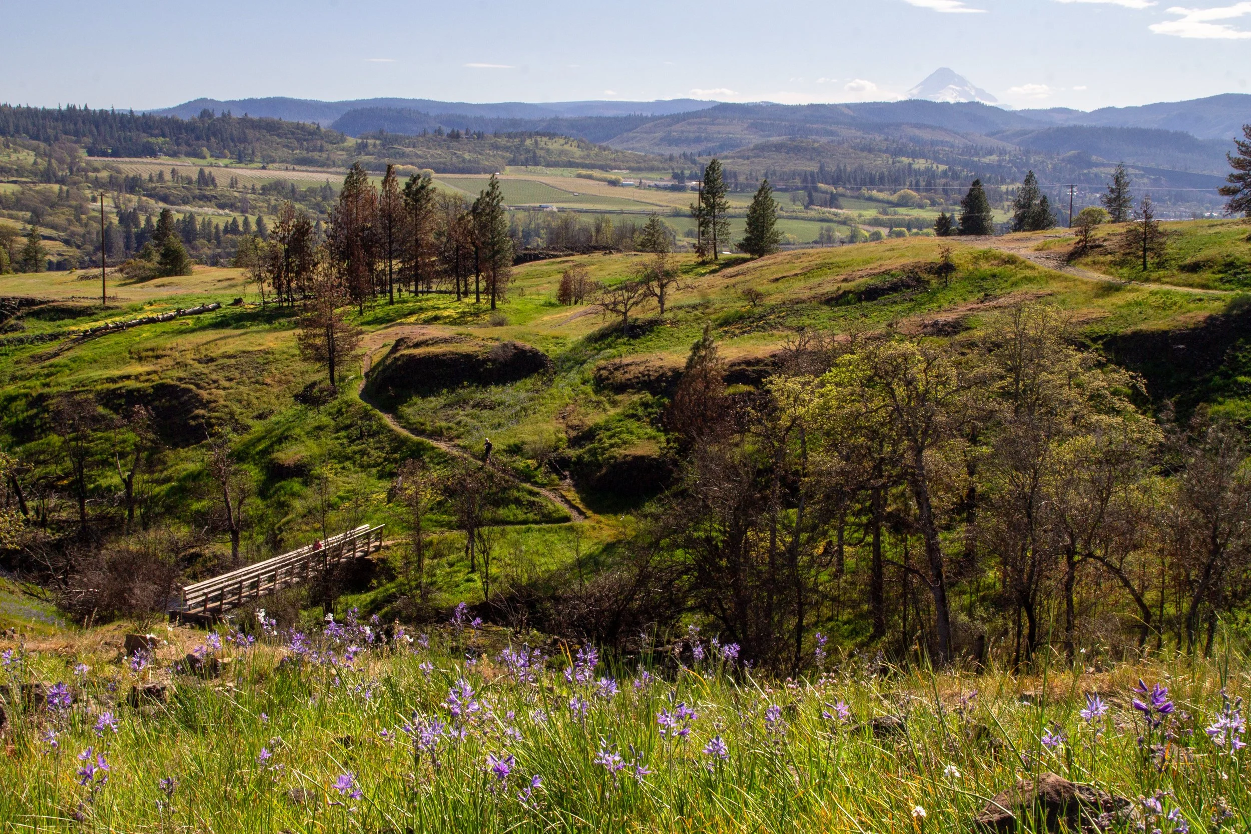
Take the footbridge to return
3. Catherine Creek to Coyote Wall
Distance: 10 miles
Elevation gain: 2,600 feet
Difficulty: Hard
ADA access: No
Trailhead: Upper
Highlights: Columbia River views, Mount Hood (on clear days), wildflowers, Coyote Wall cliff
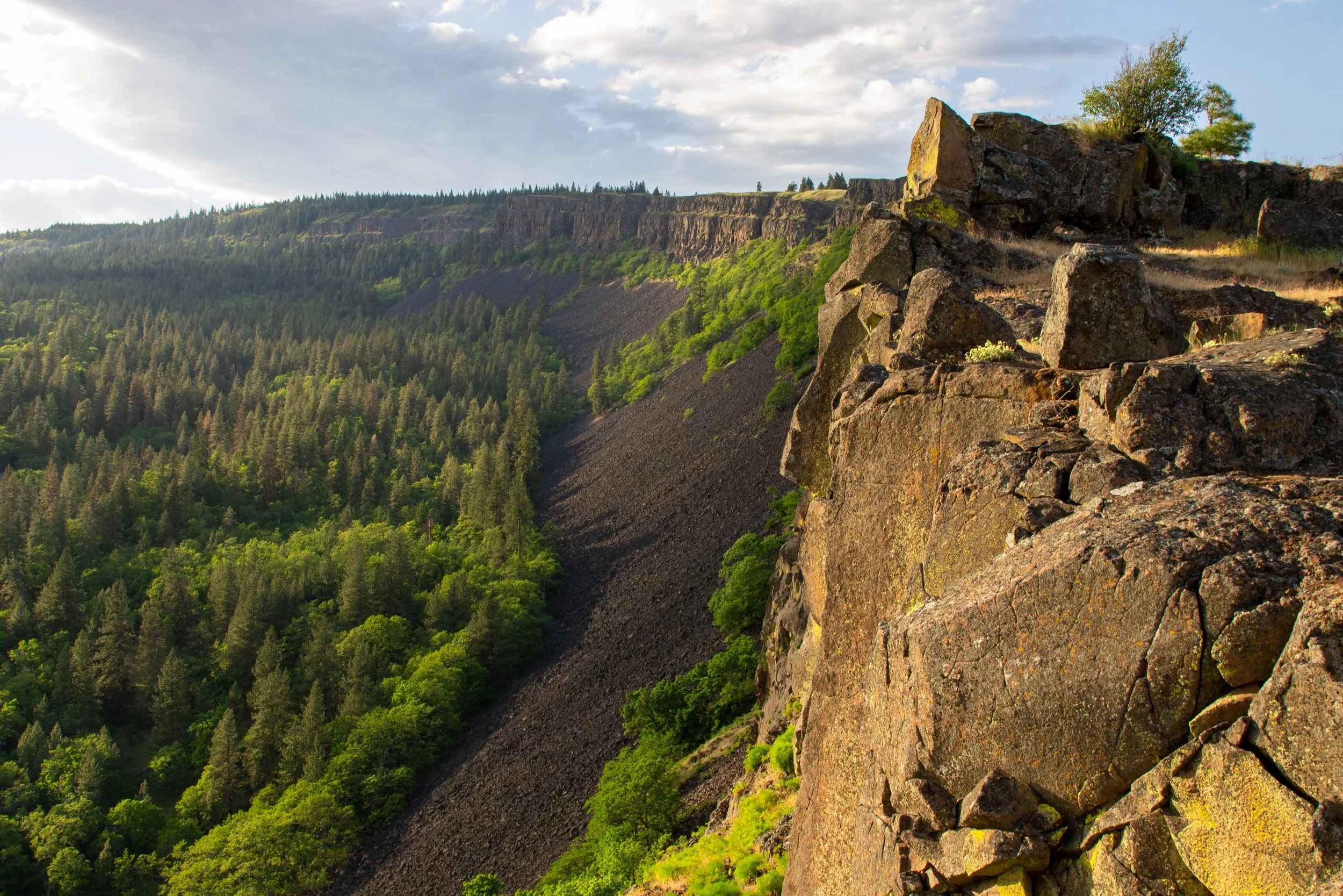
Coyote Wall
Hikes #1 and #2 explore the eastern side of Catherine Creek. The trails to the west connect to a larger network. Hike #3 is an ambitious 10-mile loop that starts in Catherine Creek, extends to Coyote Wall, and returns via the Labyrinth Trail. I’ve done most of it, although not at once from start to finish. The whole route is farther than I could coax my bum leg to walk. The parts I’ve done are extraordinary. The land and wildflower profile are similar to the east side of Catherine Creek, but this hike takes you to higher elevations where Mount Hood is more visible. The trail along the top of the Coyote Wall cliffs is exhilarating. Towards the top is a section of thick balsamroot and lupines with the classic look of Columbia Gorge wildflower fields.
Keep left to stay on Atwood Road and head toward Coyote Wall
As with the Catherine Creek Arch Loop, you start at the Upper Trailhead and take Atwood Road. Just before the log bridge, Atwood Road continues by splitting off to the left. This trail heads west towards the Coyote Wall trail network. For detailed directions, check out the excellent write-up on Oregon Hikers.
I also have a guide for the Labyrinth to Coyote Wall hike with many photos. If you do it on its own without starting from Catherine Creek, it’s about 6.5 miles.
Enjoy your day at Catherine Creek!
With love,
Emma
Getting there
To reach Catherine Creek, navigate to the Catherine Creek Day Use Area/Trailhead in Google Maps.
From Portland, you can:
Take I-84 E to Hood River, then cross at the Hood River Bridge ($3.50 each way). After crossing, take WA-14 E for 5.8 miles. Then, take a left onto Old Hwy 8. The gravel parking lot for the trailhead will be on your left in 1.5 miles. The drive from Portland takes about 80 minutes.
Take WA-14 E from Vancouver, WA. This way doesn’t have a bridge toll, but adds about 15 minutes of drive time.