

Hardy Falls, Rodney Falls, and Pool of the Winds Hike (and beyond!)


The Hamilton Mountain Trail has some of the most extraordinary scenery in the Columbia Gorge. Packed with highlights, you can tackle anything from a short and rewarding waterfall hike to the heart-pumping climb up Hamilton Mountain. The trail begins along Hardy Creek, bringing you to a massive waterfall complex with so many tiers and cascades that it’s named as three different falls: Hardy Falls, Rodney Falls, and Pool of the Winds. Turn around here or continue on a harder hike to reach incredible vistas on top of Hamilton Mountain. Since it’s so close to Portland, I’ve been several times and have tried out the hike’s easier and harder versions. Here’s everything you need to know about hiking to Hardy Falls, Rodney Falls, Pool of the Winds — and beyond!
Hamilton Mountain
Know before you go
Cost: You need the Washington Discover Pass to park at the Hamilton Mountain Trailhead. It’s $10/day or $45/year. The parking lot has a pay station that accepts credit cards.
Parking: The Hamilton Mountain Trail is popular. Parking is limited, especially on weekends. Arriving by 9 AM should be early enough to find a spot.
Dogs: Leashed dogs are welcome on the trails.
Amenities: Restrooms, picnic tables, a covered picnic shelter, and a playground are next to the parking lot.
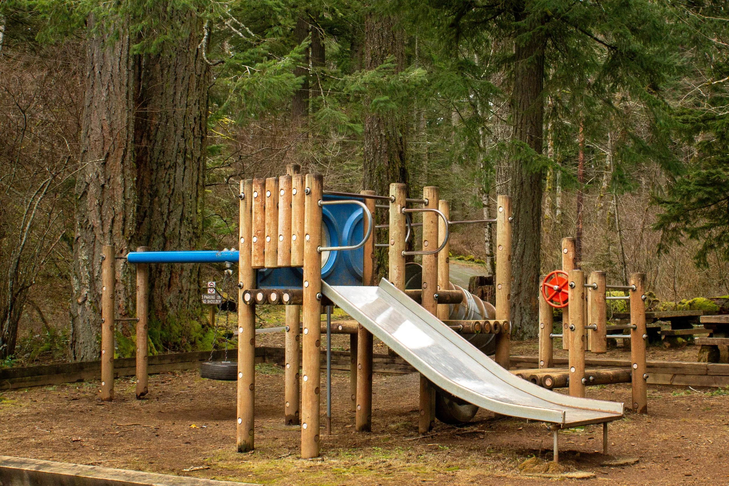
Playground at the trailhead
Hike options
Starting from the Hamilton Mountain Trailhead:
An easy, family-friendly 2.5-mile hike on the Hamilton Mountain Trail leads to Hardy Falls, Rodney Falls, and Pool of the Winds.
If you continue past the waterfalls, the trail leads to the summit of Hamilton Mountain. It’s harder, steeper, and has unfenced drop-offs. I’d skip it with kids younger than 7. The hike is 5.4 miles out-and-back or a 7.2-mile loop.
Little Beacon Rock is a short and kid-friendly side quest that turns the end of the hike into a small loop. It adds about 0.5 miles of distance.

Hardy Creek
Hardy Falls, Rodney Falls, and Pool of the Winds
Distance: 2.5 miles out and back
Elevation gain: 600 feet
Difficulty: Easy
ADA access: No
Season: All year
Start here
The details
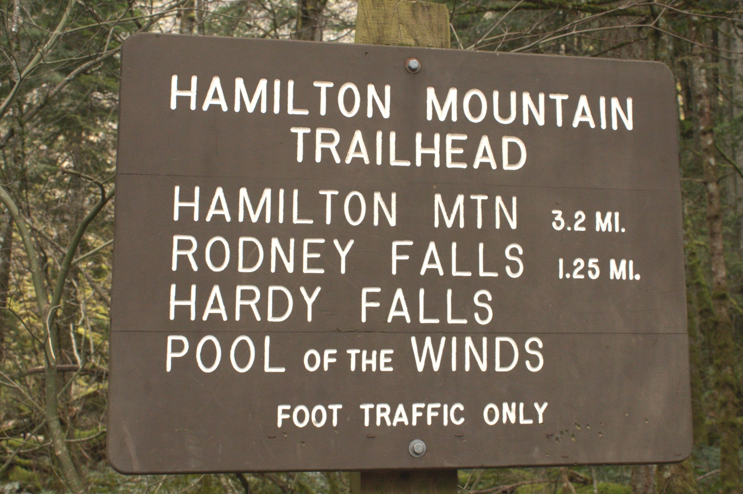
The hike to Hardy Falls, Rodney Falls, and Pool of the Winds starts at the Hamilton Mountain Trailhead, one of the most welcoming in the Columbia Gorge. Tall Doug firs surround a playground and a rustic picnic shelter. Look for the Hamilton Mountain Trail next to the large sign that lists the hiking distances to the waterfalls and the summit of Hamilton Mountain. From the trailhead, you’ll begin a steady uphill climb that never lets up but also never gets steep. Big-leaf maples and vine maples add yellow to the forest in late October and early November.
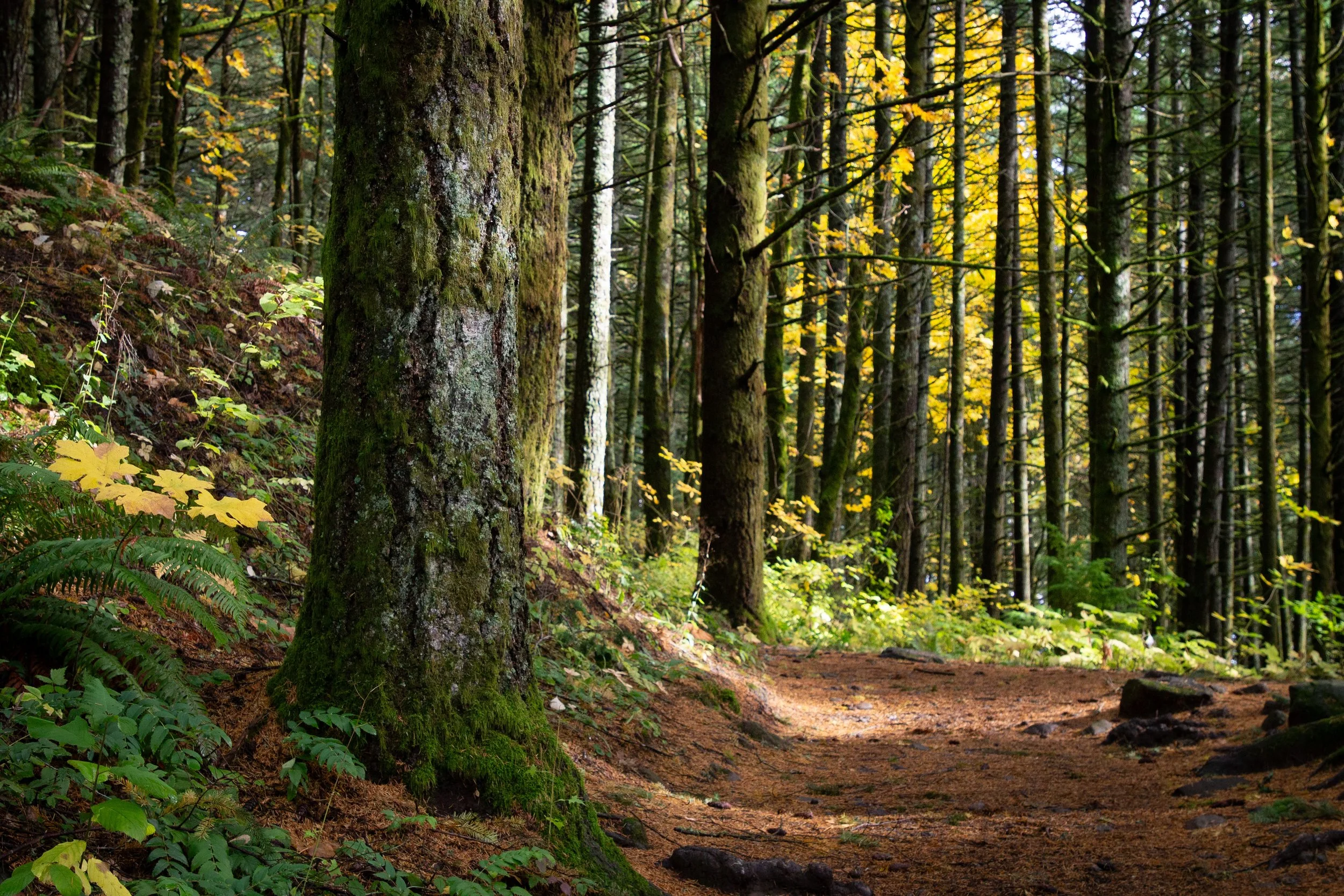
Hamilton Mountain Trail
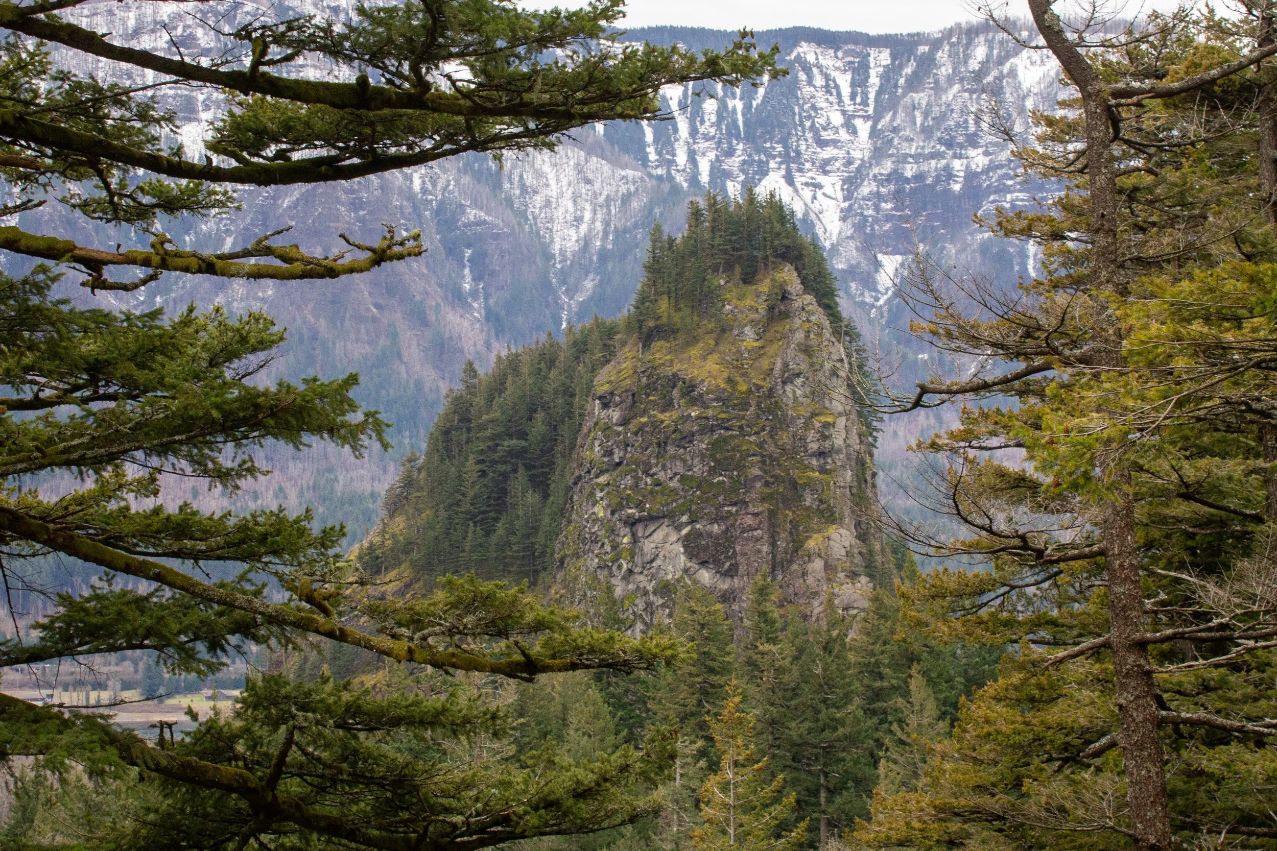
After about 0.4 miles, you’ll reach a clearing in the trees that accommodates a row of power lines. Looking east, Hamilton Mountain towers in the distance. Keep going past the trail that branches off to the left. It leads to Little Beacon Rock, which is an optional side trip on the way back. For now, keep right to head toward Hardy Falls.
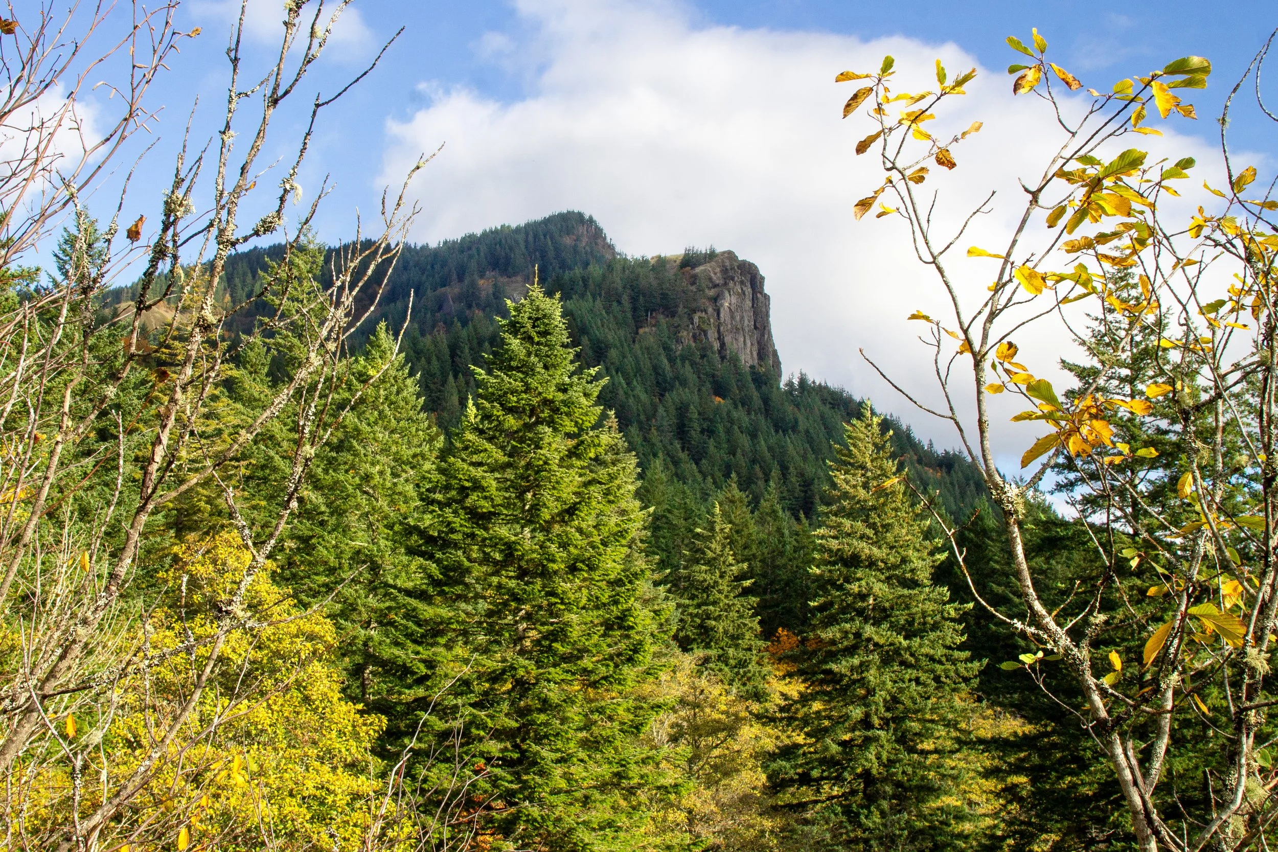
Hamilton Mountain’s summit
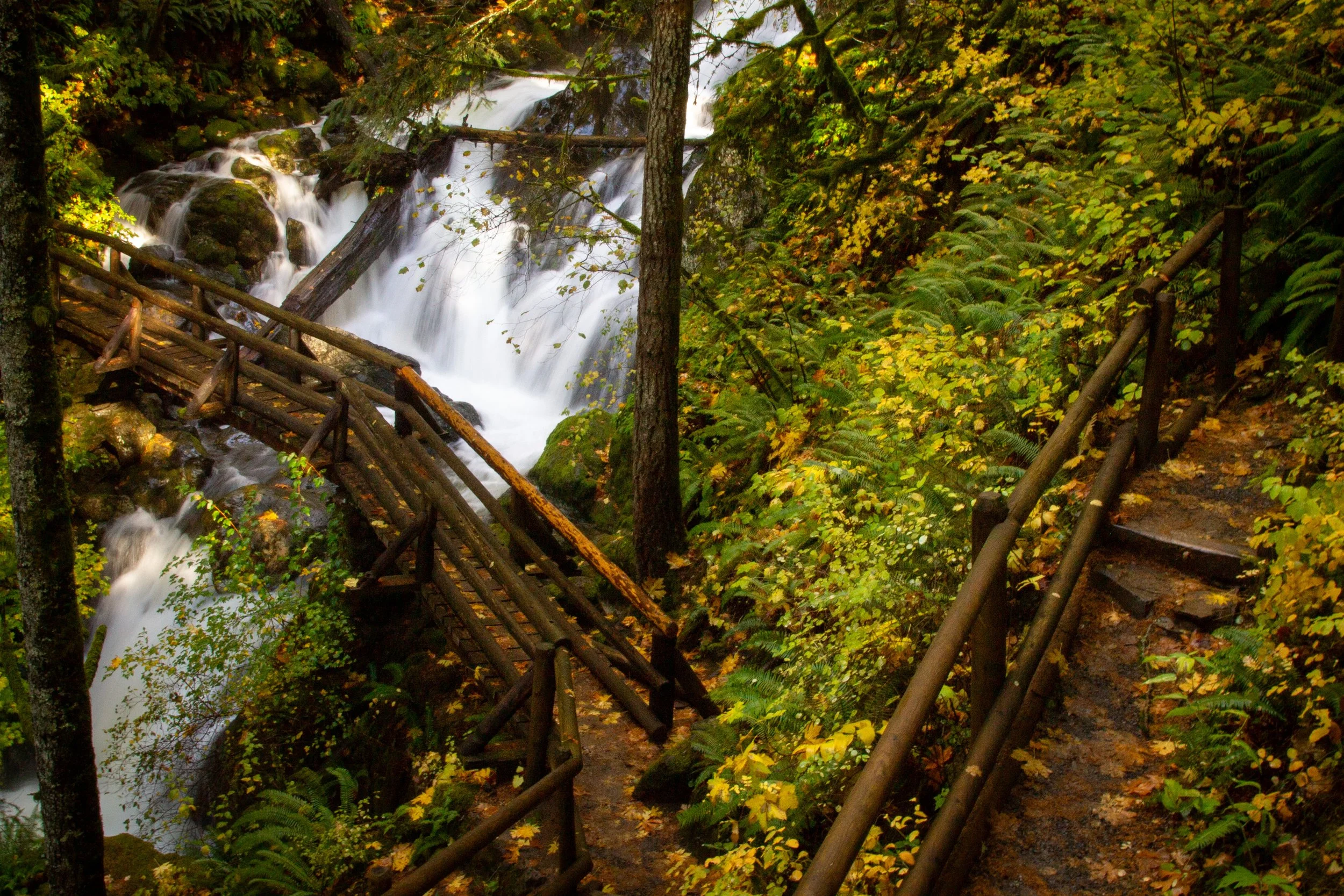
After the trail junction, you’ll reenter the woods. About a mile into the hike is the first waterfall sighting. Look for the Hardy Falls Viewpoint sign pointing to the right just before a wooden footbridge.

Stop at the viewpoint, then cross the bridge to continue the hike
Muddy steps lead to two potential viewpoints. The one to the right is an unfenced precipice overlooking a partially-obscured view of the 90-foot Hardy Falls as it makes a single plunge over a mossy cliff.

Hardy Falls
The viewpoint to the left is a fenced platform. You’ll need to stumble down some rocks and roots to get there, but it’s worth the effort. You can’t really see Hardy Falls from the fenced viewpoint. Instead, it overlooks Hardy Creek’s pretty cascades just upstream of the waterfall.
Hardy Creek
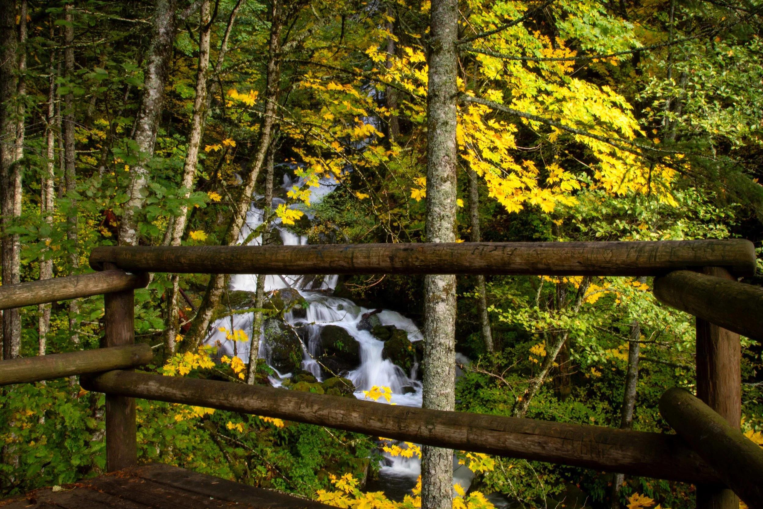
After seeing Hardy Falls, return to the Hamilton Mountain Trail and cross the wooden footbridge. The other two waterfalls are just ahead. In about 0.1 miles, you reach a trail junction marked with signs pointing toward Rodney Falls and Pool of the Winds. We’ll head to Pool of the Winds first since it’s a dead-end.

Approaching Pool of the Winds
The fork to the left heads up to the fenced viewpoint for Pool of the Winds. This magical 20-foot chute of water is the upper tier of Rodney Falls. It tumbles, straight as an arrow, through a small, cylindrical cave. Mist from the falls shoots out of it, anywhere from a fine spray to thick clouds, depending on how much water is falling. During wetter months, you’ll come away feeling like you just stepped out of a cold shower. From the rippling pool beneath the falls, water cascades down a rocky cliff face, forming Rodney Falls.
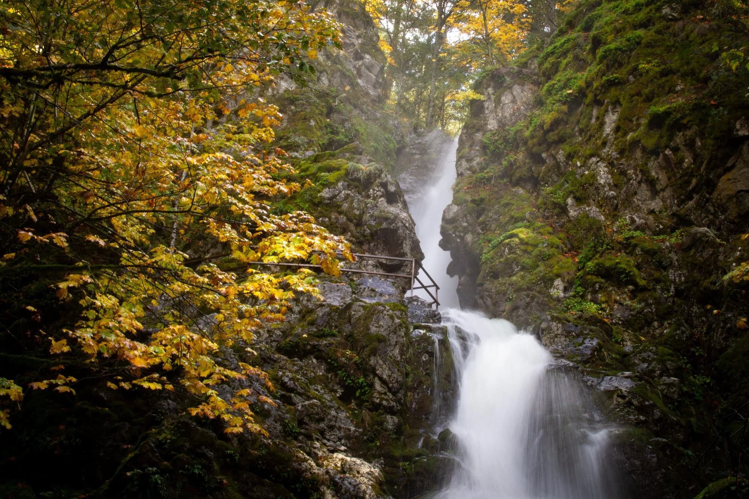
Pool of the Winds
After admiring Pool of the Winds, return to the trail junction and take a left. A picturesque footbridge crosses in front of the 75-foot Rodney Falls. Take a moment on the bridge to watch the elegant streams of water tumble over craggy basalt. In summer, Rodney Falls is sedate. In wetter months, water surges over the angular rocks and covers the soft green moss.

Rodney Falls
It’s worth it to cross the bridge and continue another 100 feet or so to reach a view of Rodney Falls from above. This waterfall is a good place to turn around and head back the way you came for a short and easy hike. The trail gets steeper after the falls and doesn’t have another viewpoint for another mile. If you’re up for a longer and harder hike, continue on the trail toward the summit of Hamilton Mountain.
Hamilton Mountain
Distance: 5.4 miles out and back or 7.2-mile loop
Elevation gain: 2,000 feet
Difficulty: Hard
ADA access: No
Season: Spring through fall. People hike up Hamilton Mountain in winter, but expect snow toward the top.

Hamilton Mountain Trail continues past Rodney Falls
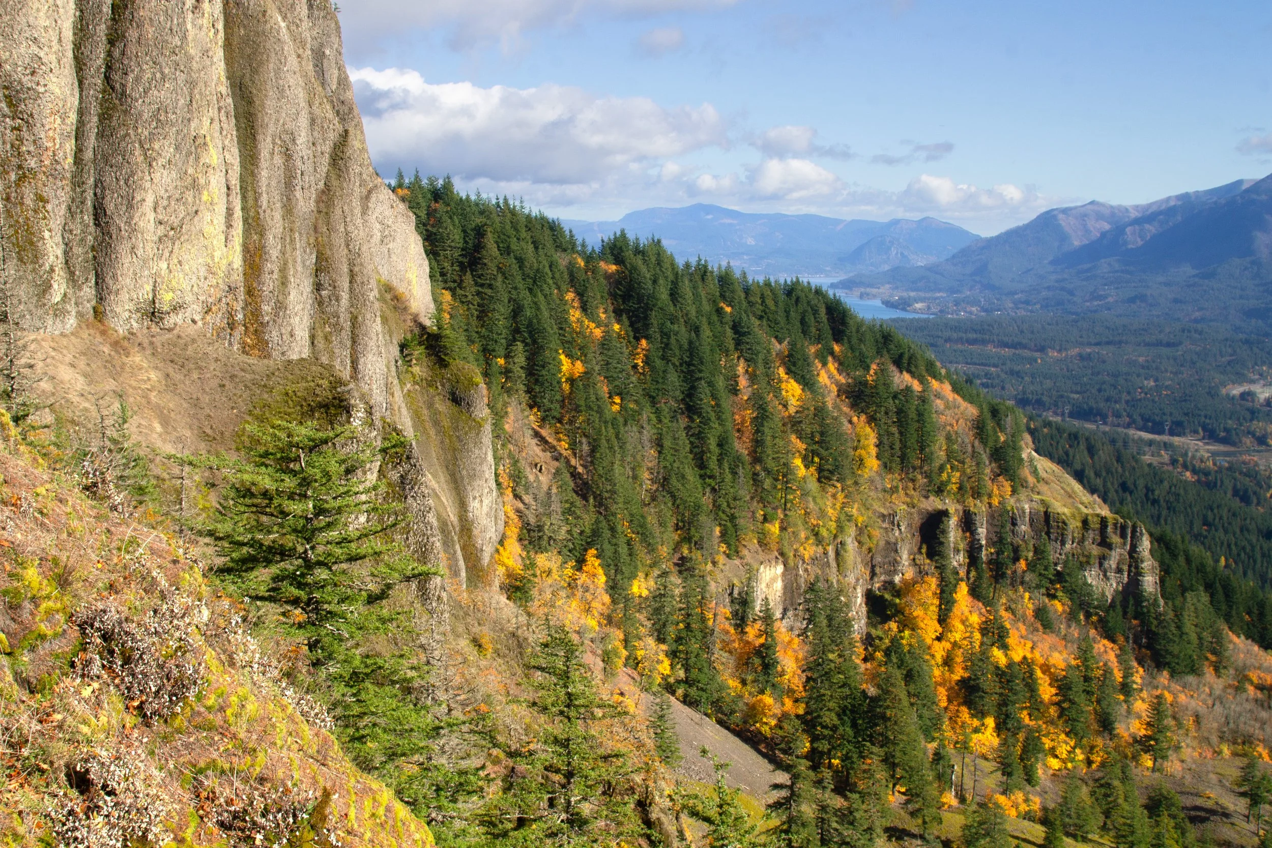
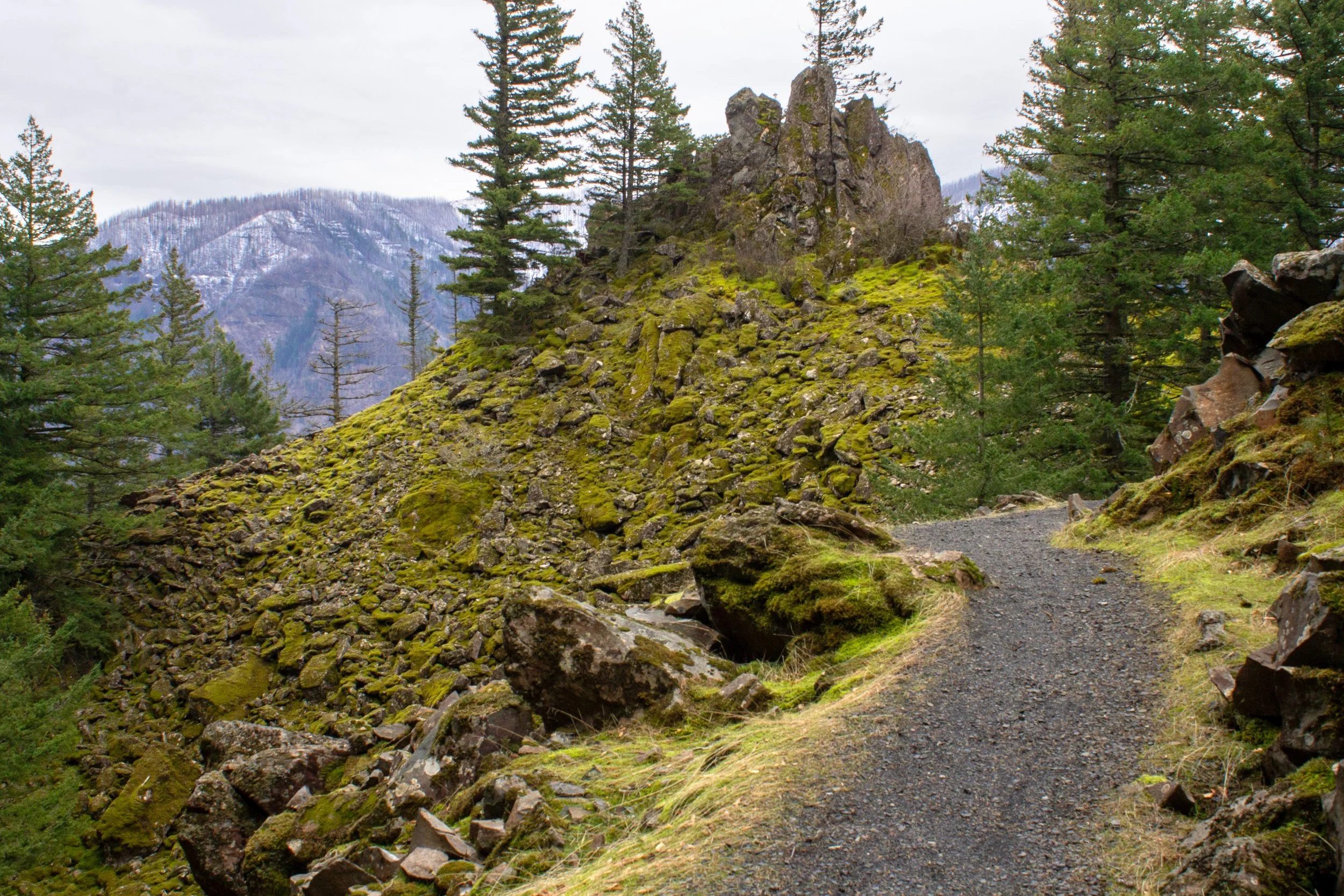
Just past Rodney Falls, a sign along the trail points toward Hamilton Mountain. Just ahead, you’ll reach a trail junction, which is the return of the loop portion of the hike. Keep right to head toward the summit. From here, the Hamilton Mountain Trail becomes a lot different, namely, harder. The terrain changes from a steady uphill climb to steep switchbacks. Parts are in rough shape, blurring the line between hiking and scrambling. You’ll start seeing glimpses of the Columbia Gorge through the trees.
Spur trail on Little Hamilton Mountain
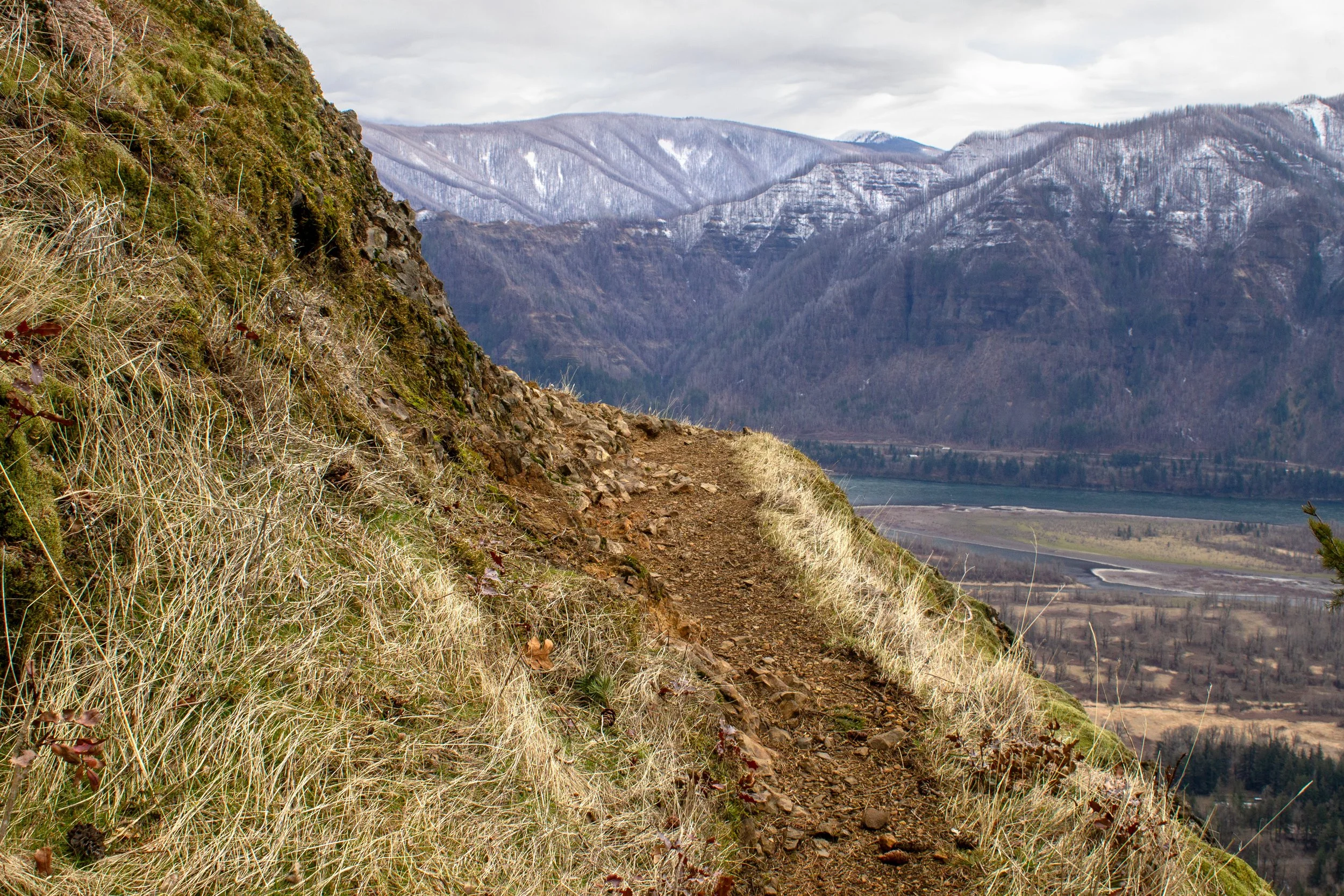
After what feels like a walk to the moon, or at least Mt Everest, the views finally open up. About a mile after Rodney Falls is a rocky outcropping called Little Hamilton Mountain. Looking west, you’ll see the Columbia River and Beacon Rock. Take care with kids and dogs around the sheer cliffs here. Little Hamilton Mountain has some of the best views on the hike and makes a good turnaround point if your hiking companions keep asking you why you brought them on this death march. Or so I’ve heard. I’d be about 4 miles total.
View from Little Hamilton Mountain
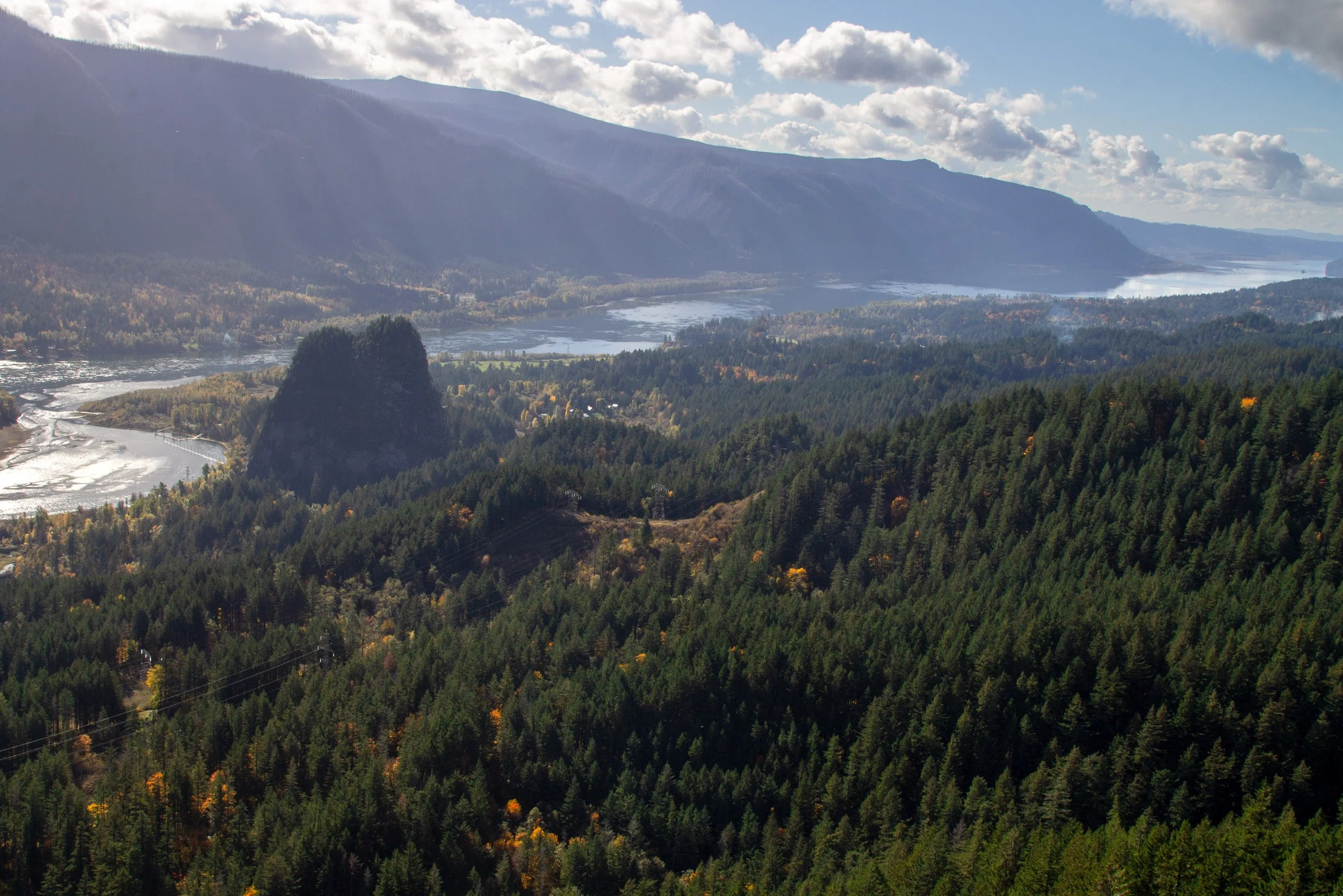
After Little Hamilton Mountain, you leave the views for a bit as you hike behind a ridge. At this point, your companions may start glaring at you and asking if you lied about the hiking distance. Because, yes, I had lied. It’s the only way they would have done it. In my defense, you’ll get a spectacular vista of Hamilton Mountain’s summit, Bonneville Dam, and the Columbia Gorge stretching out to the east in about a quarter mile.

Hamilton Mountain and Bonneville Dam
From here, continue up the switchbacks to the summit. You can turn around when you reach the top for a 5.4-mile out-and-back hike, or continue on the trail to make a loop around to the north side of Hamilton Mountain, 7.2 miles in total. Either way, you’ll get to walk in front of Rodney Falls again on the way back.
Hamilton Mountain summit
Little Beacon Rock
Extra distance: about 0.5 miles
Difficulty: Easy
ADA access: No
Season: All year
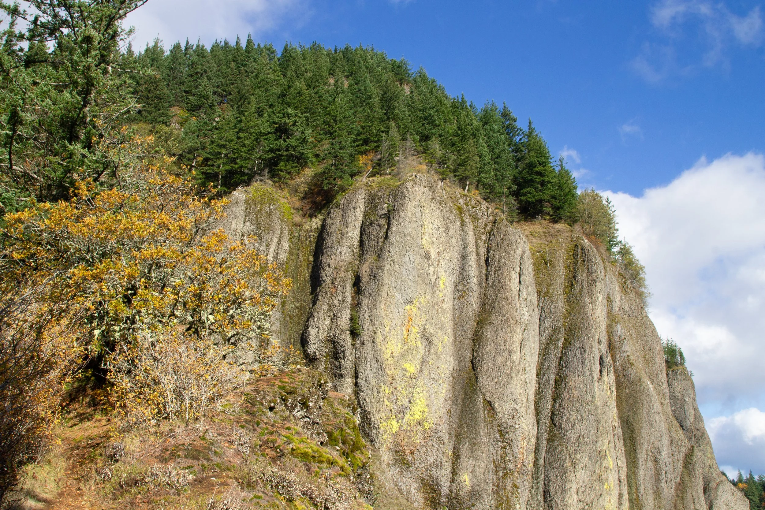
Unlike the hike up Hamilton Mountain, Little Beacon Rock is a fairly low-commitment side trip. From Rodney Falls, head back past the Hardy Falls Viewpoint to the trail junction under the power lines. Keep right at the fork onto the Hadley Trail. You’ll start seeing rocky pinnacles and moss-covered talus slopes.
Hadley Trail
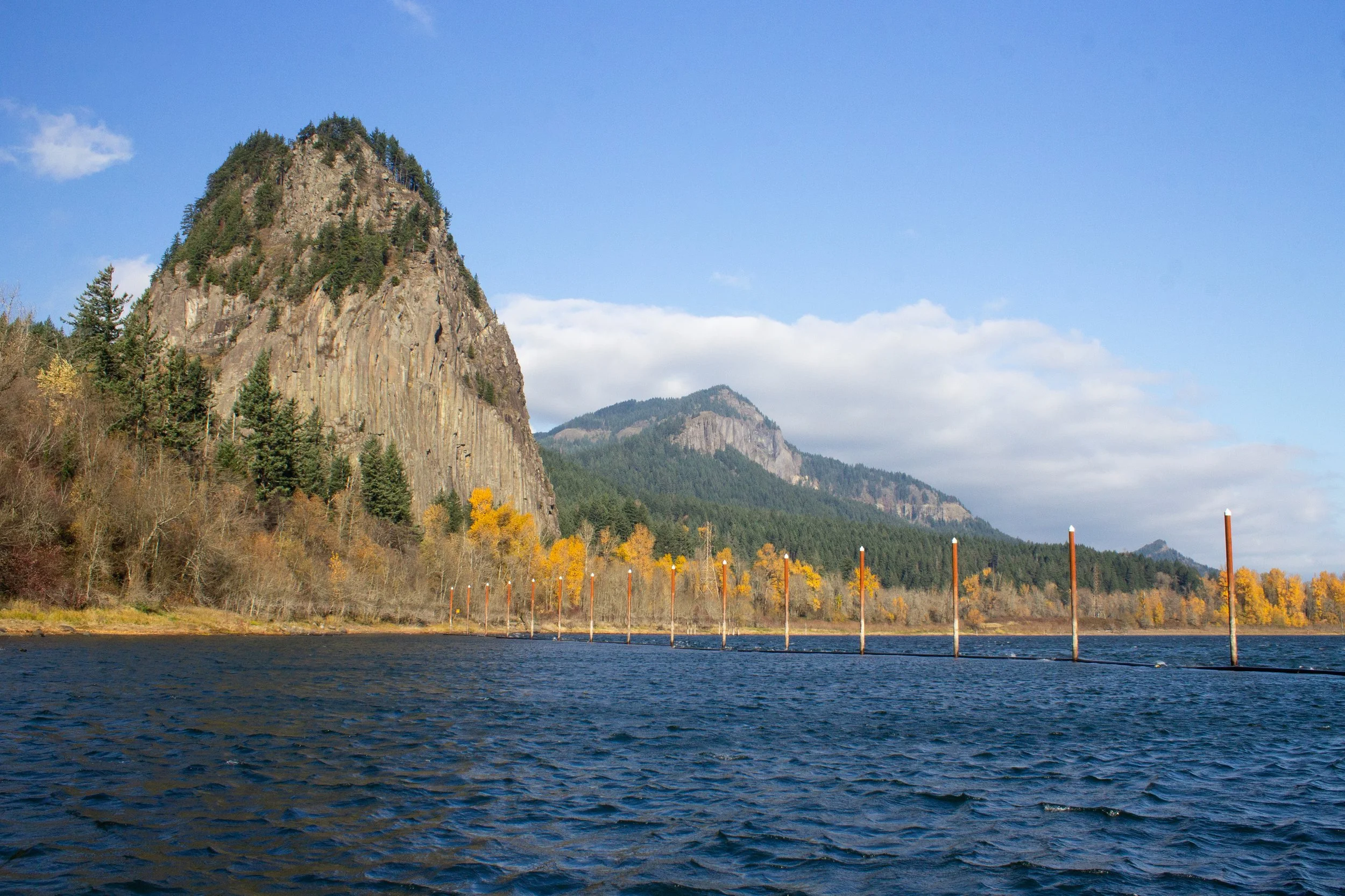
In about a quarter mile, keep left at the fork to make the short rocky scramble up Little Beacon Rock. At the top, you’ll get a glimpse of (big) Beacon Rock through the trees.
Beacon Rock
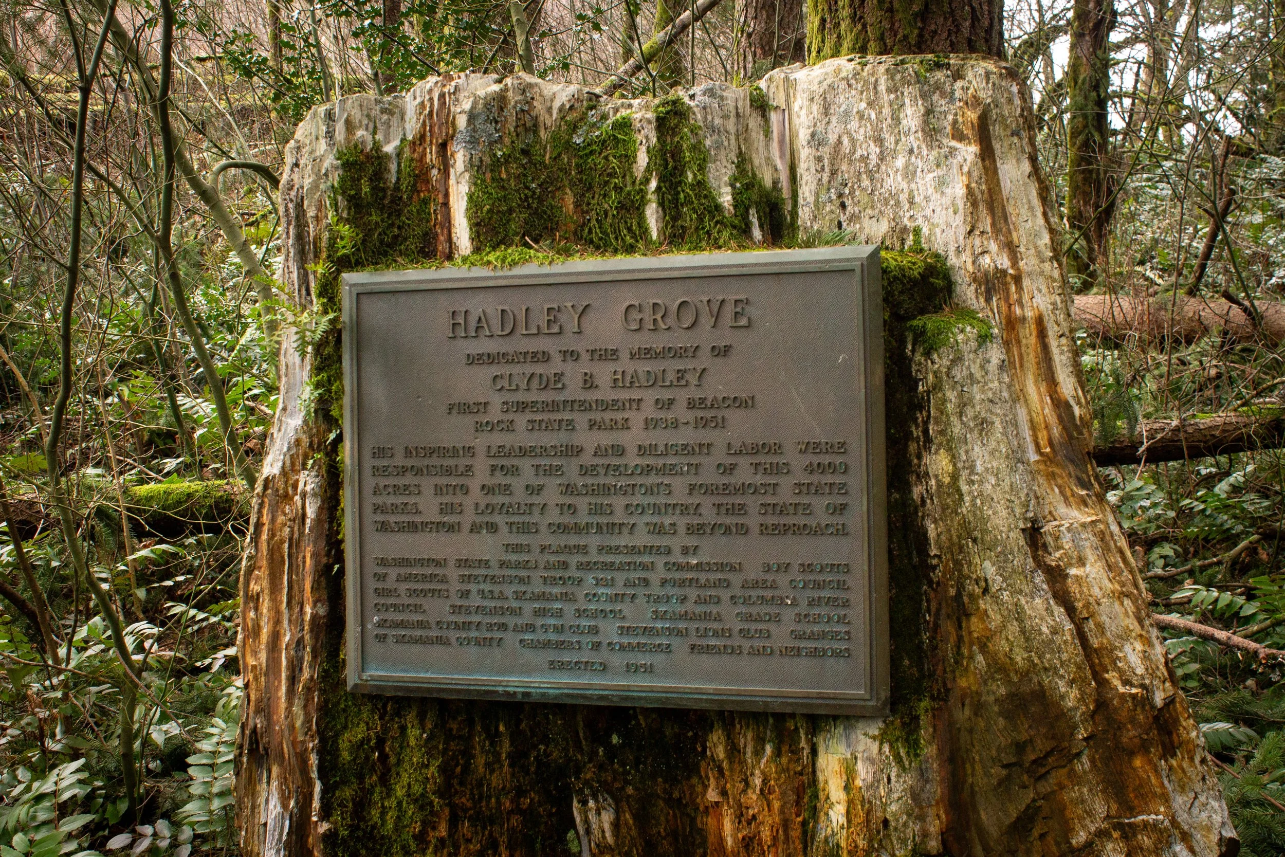
Then, head back down Little Beacon Rock and take a left to get back onto the Hadley Trail. You’ll see a memorial plaque on a stump of petrified wood dedicated to Clyde B. Hadley, the first superintendent of Beacon Rock State Park.
Hadley Memorial
The trail ends at the Hadley campground. Follow the road through the campground and back to the parking lot for the Hamilton Mountain Trailhead (about 0.3 miles).
More at Beacon Rock State Park
Beacon Rock
The hike to Hardy Falls, Rodney Falls, and Pool of the Winds is the second-most popular hike in Beacon Rock State Park. The biggest draw is the 1.8-mile trek up the park’s namesake monolith, Beacon Rock. At the base of Beacon Rock are lightly trafficked trails that most people overlook.
Check out my Beacon Rock State Park hiking guide for all the options.
Getting there
To reach the Hamilton Mountain Trailhead from Portland, cross the I-5 or I-205 bridge into Vancouver, WA, and take Highway 14 East until Beacon Rock State Park. Look for a nondescript left turn across from the parking area for Beacon Rock. The parking lot is paved, and no problem with a low-clearance vehicle.
Sometimes in the winter, a gate blocks the road to the Hamilton Mountain Trailhead parking lot. When this happens, you can park at Beacon Rock on the south side of Highway 14. Cross the highway, walk around the gate, and head up the hill. The Beacon Rock parking lot is also a potential overflow parking area.
Enjoy your hike to Hardy Falls, Rodney Falls, Pool of the Winds, and beyond!
With love,
Emma
Explore nearby


Find the best short hikes in the Columbia Gorge.

Check out my comprehensive list of Columbia Gorge waterfalls.