

McDowell Creek Falls County Park Hike


Despite having incredible waterfalls reminiscent of Silver Falls State Park, McDowell Creek Falls County Park receives only a small fraction of its visitors. The easy, family-friendly loop hike connecting the falls may be the most overlooked waterfall hike within an easy driving distance of Portland, Oregon. As a bonus, it’s free to visit, and your dog can come along on the trails. Next time you are craving an amazing waterfall hike in the Cascade foothills but don’t want to brave the crowds at Silver Falls, try out the loop trail at McDowell Creek Falls County Park.
McDowell Creek
Know before you go
Parking is free at McDowell Creek Falls County Park. You don’t need a pass or permit.
There are three parking lots. Each has a small picnic area. You’ll pass the largest parking lot first, called the Lower Parking Lot. If it’s full (it probably won’t be), continue down the road to check the Middle and Upper Parking Lots.
Leashed dogs are welcome at McDowell Creek Falls County Park.
A restroom is in the Lower Parking Lot. It’s not great, and the lock on the door was broken when I visited.
This trail is usually good for year-round hiking. Check conditions before visiting in winter. The stairs on the trail would be challenging when icy.
The waterfalls will look best from late fall through spring.
Many trail junctions on the hike lead to various parking areas and shortcut trails. Some are marked with signs. Having an offline map is a good idea. Or, take a picture of the detailed trail map at the trailhead in the Lower Parking Lot.
The trail is very well-maintained overall. Watch out for a broken stair on the steps next to Majestic Falls.
McDowell Creek Falls County Park
On the McDowell Creek Trail
Quick info
Distance: 1.6 miles
Elevation gain: 300 feet
Difficulty: Easy
Pass required: None
Dog friendly: Yes, leashed dogs are welcome on the trail.
ADA access: No
Basic directions: From the Lower Parking Lot, take the footbridge across the creek. After 0.2 miles, you’ll reach a fork in the trail which is the loop portion of the trail. You can go either direction to do the loop.

Map at the trailhead
The details
The trail begins at a bridge over McDowell Creek
From the Lower Parking Lot, look for the trail map by the wooden footbridge crossing McDowell Creek. Begin the hike by crossing the bridge, taking a moment to notice the remarkable clarity of the water passing beneath it. Follow the trail along the creek through a forest of Doug fir, maple, and alder, many of which are covered with an impressive carpet of moss. After 0.2 miles, you’ll reach the first trail junction just before Royal Terrace Falls.
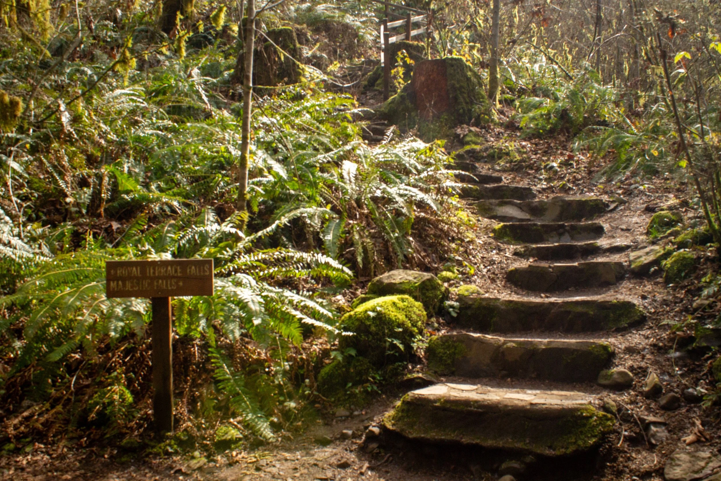
First trail junction
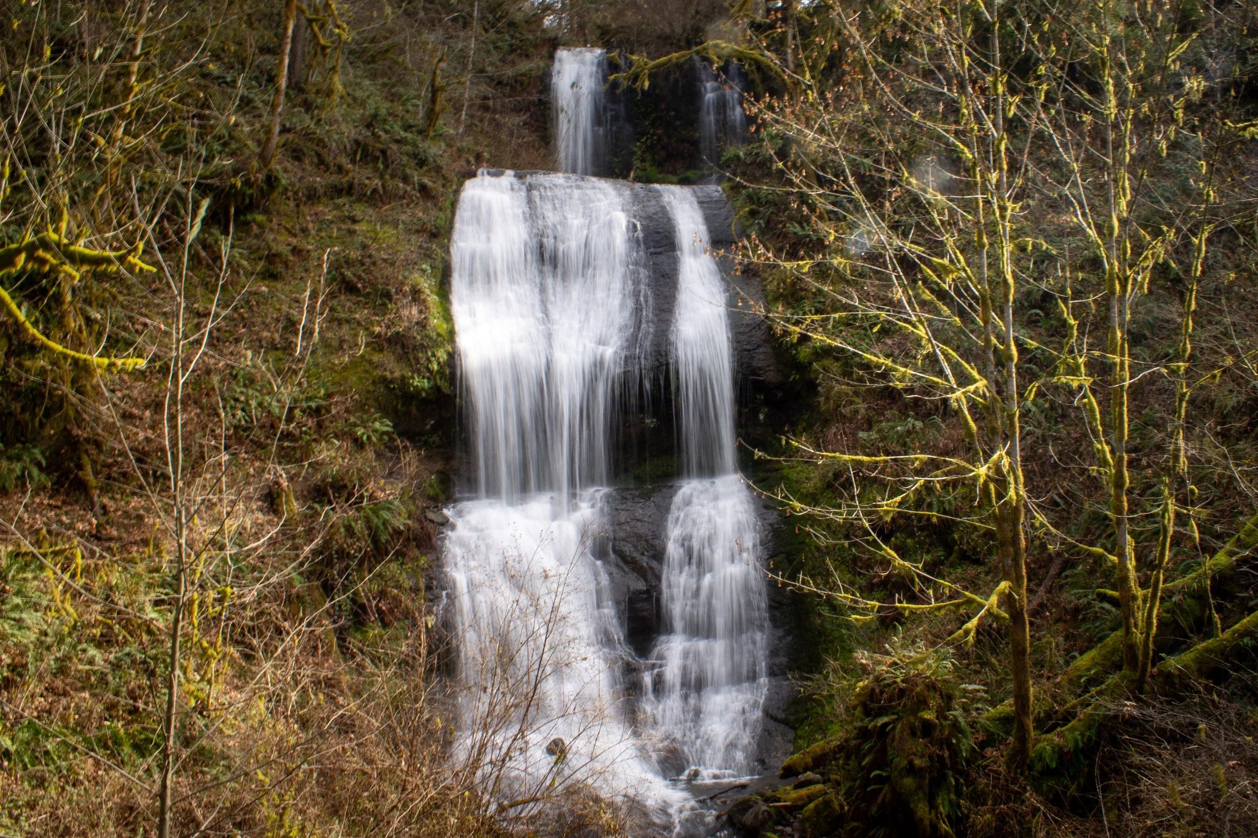
This first trail junction begins the loop portion of the hike, which you can do in either direction. Taking a right will lead you up a long set of stairs through sword ferns alongside the upper tiers of 120-foot Royal Terrace Falls.
Royal Terrace Falls
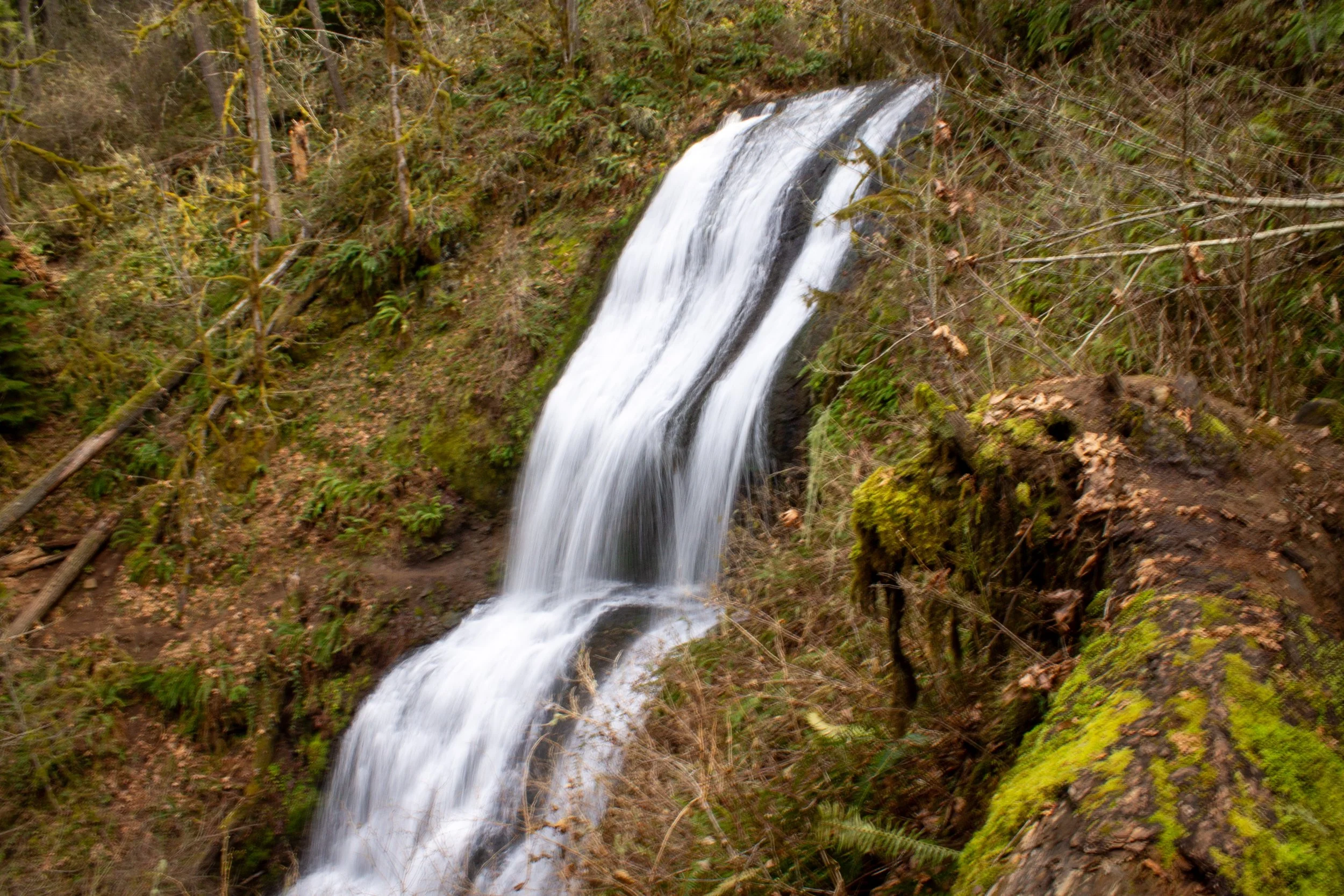
No matter how many waterfalls I visit in Oregon, no two are the same. Royal Terrace Falls is memorable for the smoothness of the rock that makes up its gently curved tiers. It reminds me of a wide ribbon that curls as it’s unspooled. Unlike the Silver Falls State Park waterfalls and most of those in the Columbia Gorge, Royal Terrace Falls was not formed by basaltic lava flows from northeastern Oregon. Instead, the falls tumble over rocks made of volcanic breccia and sandstone. The breccia is part of the Little Butte Volcanics, a series of eruptions during the formation of the early Cascades.

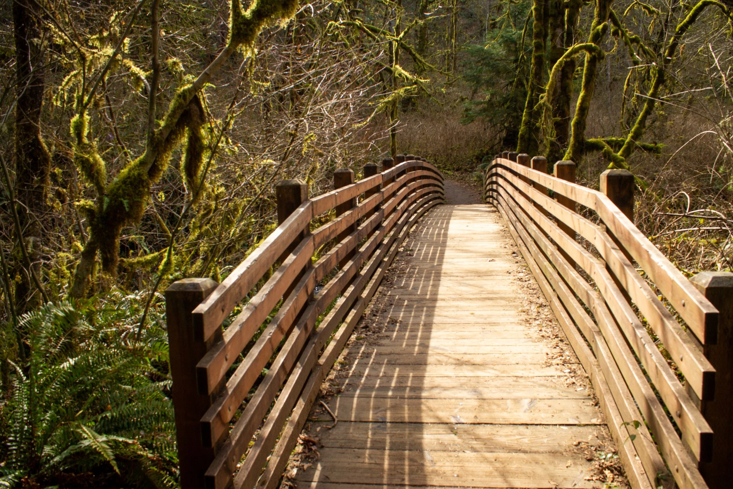
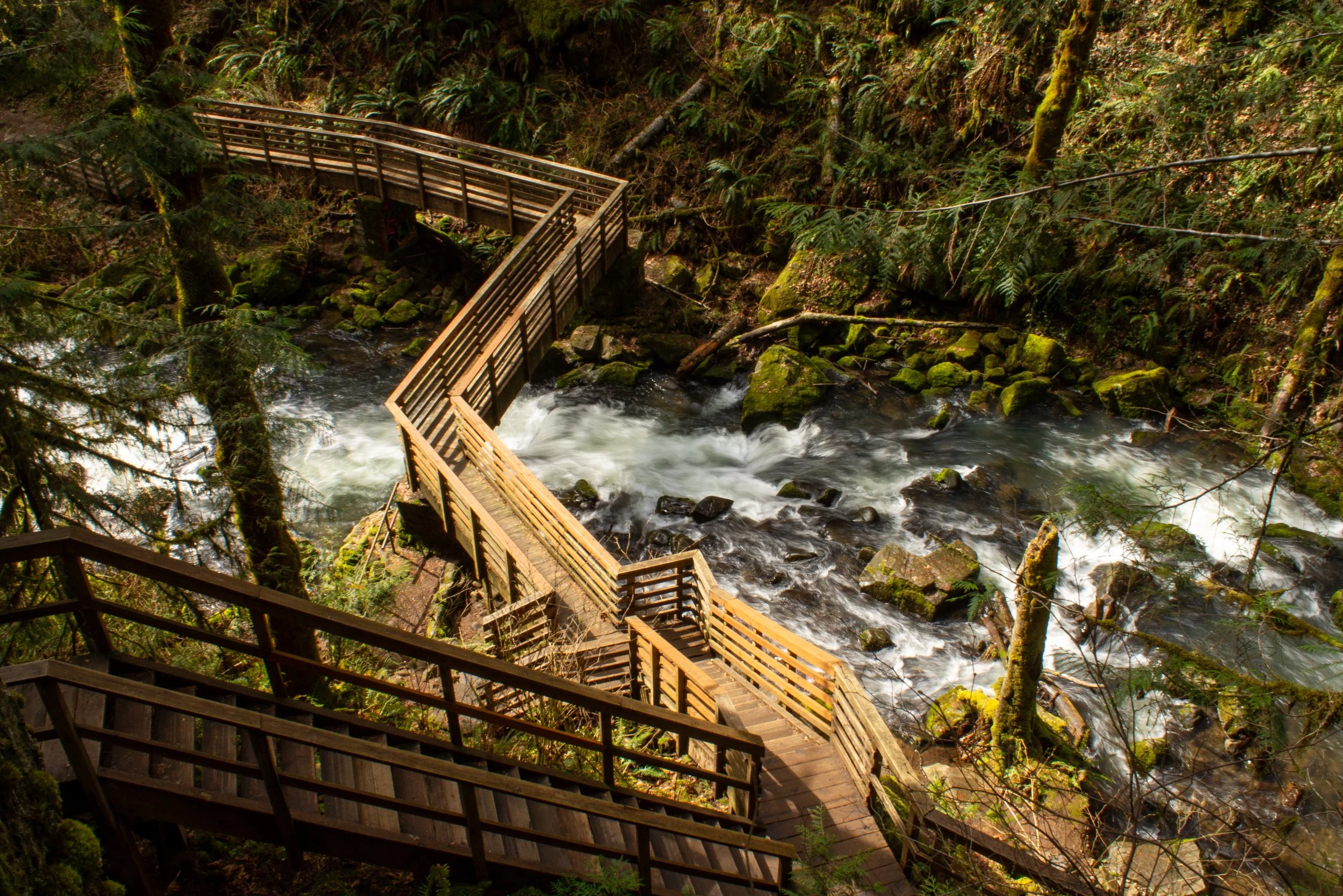
Footbridge across Fall Creek
At the top of the stairs, you’ll reach a fenced overlook with an overhead view of Royal Terrace Falls and Fall Creek. After admiring the overlook, take the small wooden footbridge across the creek. You’ll see a fork to the right just before the footbridge that looks like a trail but doesn’t lead anywhere.
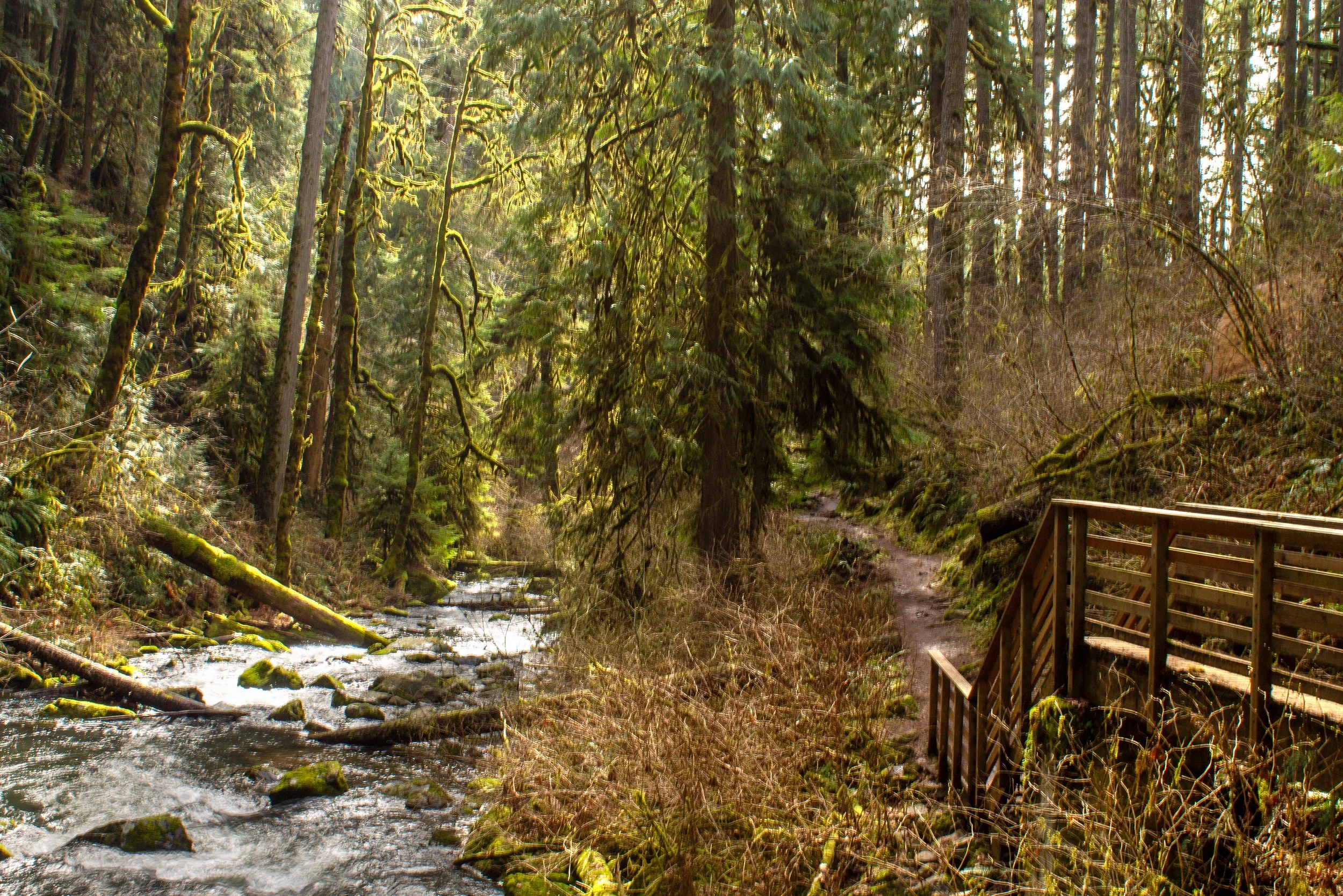
Continue on the forested trail, knowing that the uphill walking is almost done. You’ll be able to see glimpses of the surrounding Cascade foothills through the trees. Keep right when you reach an unmarked trail junction to stay on the loop trail. Shortly after the junction, you’ll cross a paved road. About 0.3 miles after the paved road, you’ll pass the Upper Parking Lot.

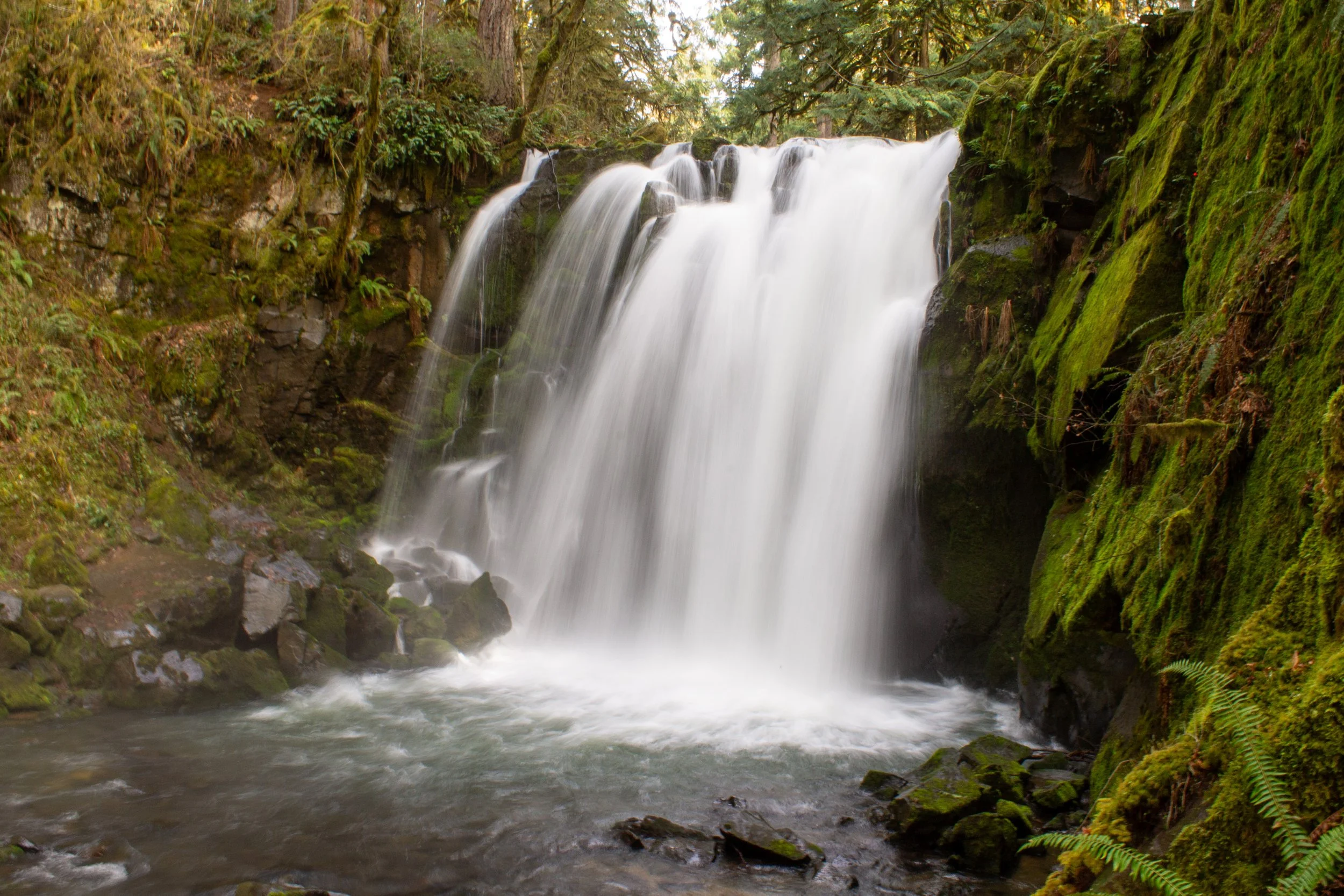
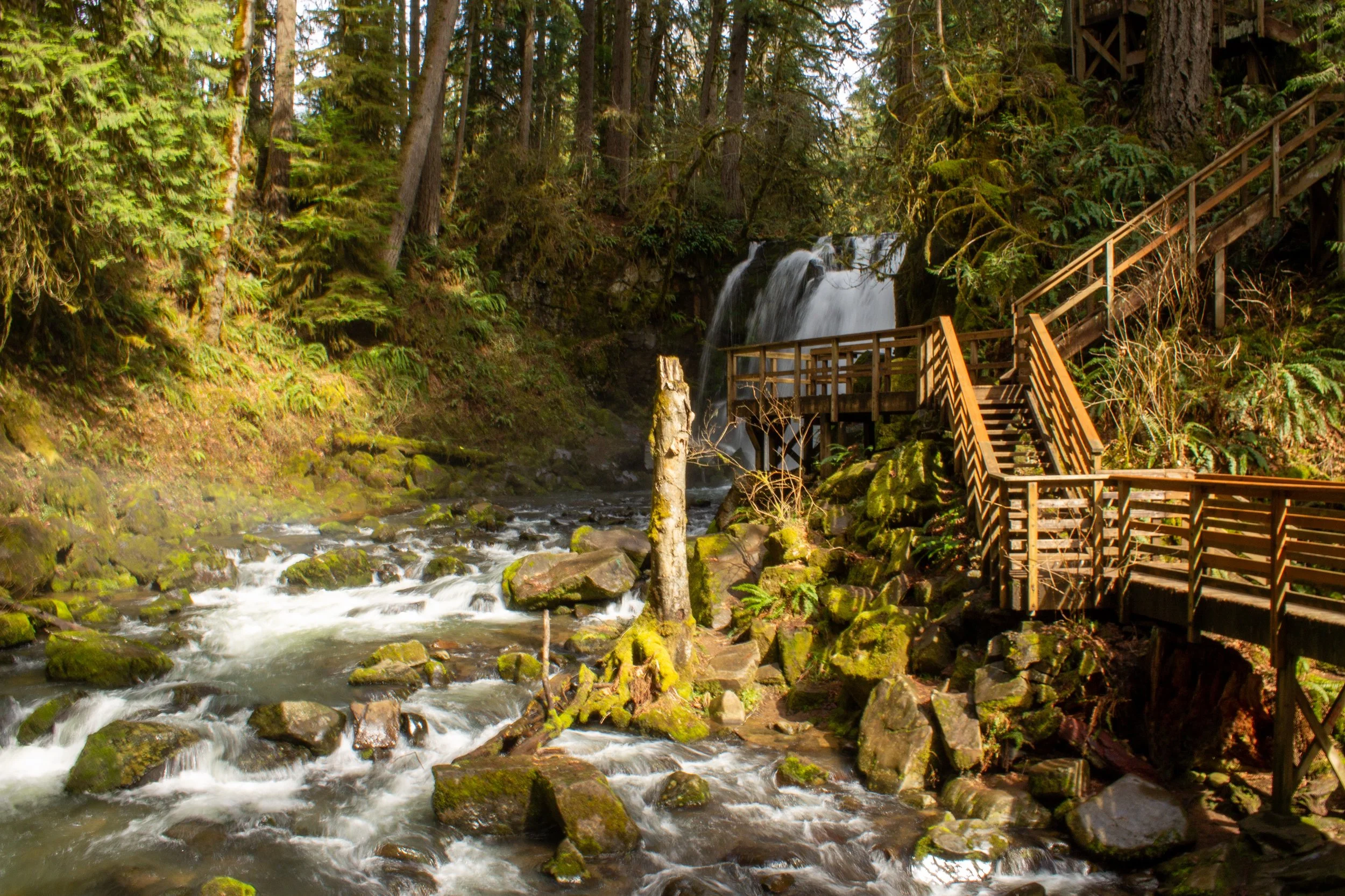
Top of Majestic Falls
Here, the trail returns to McDowell Creek just before its plunge as Majestic Falls. A large fenced viewpoint overlooks McDowell Creek and the top of the falls. After admiring Majestic Falls from above, take the stairs down to the viewpoint at its base. Watch for the missing step.
Stairs lead to base of Majestic Falls
The viewpoint at the base of the falls is the perfect spot to admire its 40-foot plunge over a mossy cliff. While the rocks here look a lot like the flood basalts that formed Silver Falls State Park, they’re made of diabase, close to 23 million years old.
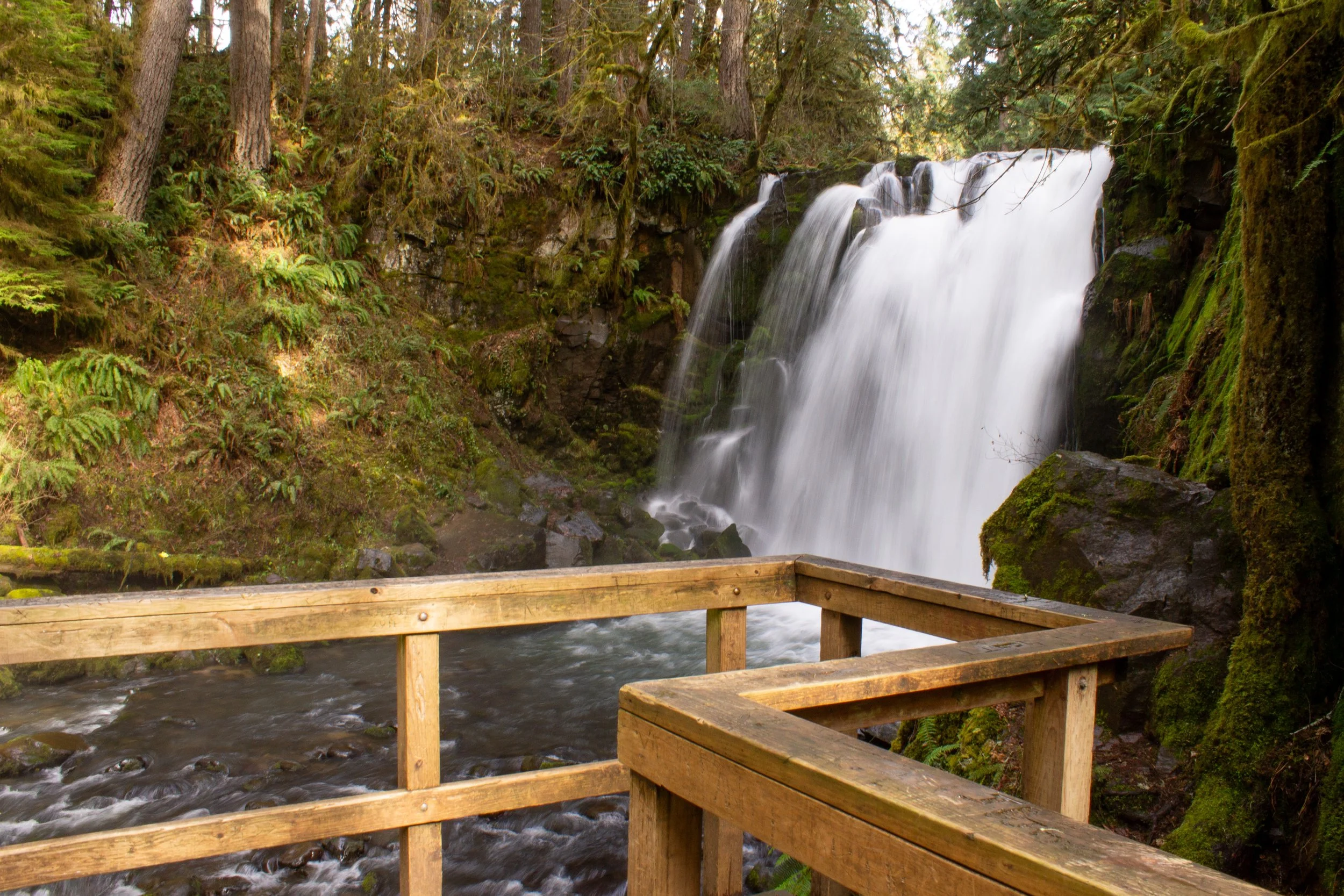
Majestic Falls
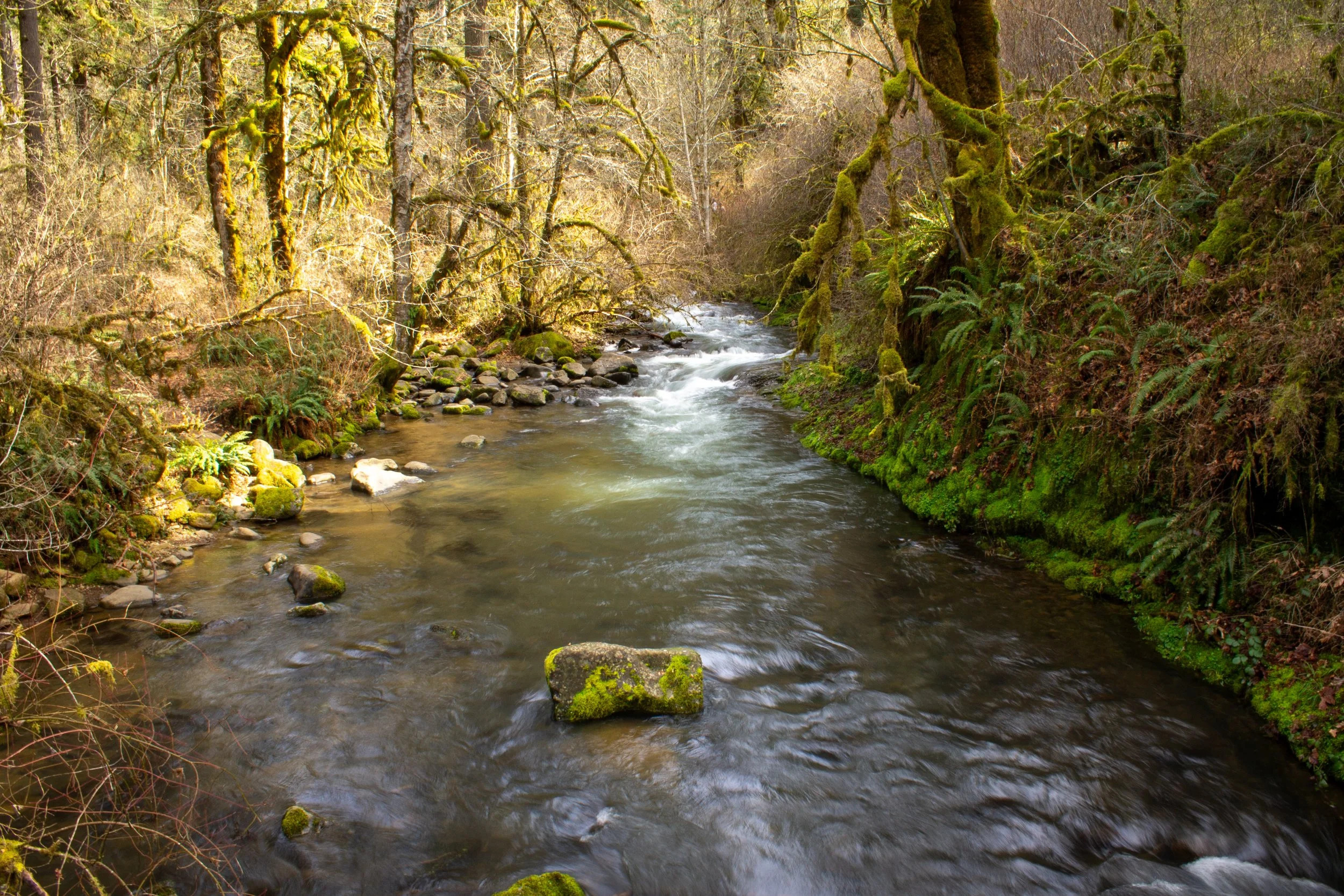
After you leave the viewpoint, take the bridge across McDowell Creek to continue the loop trail. You’ll be staying close to the creek for the rest of the hike.
McDowell Creek and Majestic Falls
Shortly after leaving the stairs and returning to the unpaved trail, look for the 15-foot Crystal Falls in McDowell Creek. The Crystal Pool is at its base, a popular swimming hole in the summer. You’ll then cross paved McDowell Creek Road and reach an unmarked trail junction. Keep left at the junction. The trail to the right leads to the Middle Parking Lot and its picnic area. Take the wooden footbridge across McDowell Creek. Continue for 0.2 miles until you reach the base of Royal Terrace Falls.

Royal Terrace Falls
A bridge in front of Royal Terrace Falls provides an excellent vantage point to admire the waterfall’s three impressive tiers. After crossing the bridge, you’ll return to the trail junction that completes the loop portion of the hike. Take the fork to the right to return to the Lower Parking Lot. Once you’re back at the parking lot, you can look for a short side trail out to 20-foot Lower McDowell Creek Falls. If you’re facing the creek from the parking area, it will be to your right.
Royal Terrace Falls
Getting there
Address: 43170 McDowell Creek Dr, Lebanon, OR 97355
To get to McDowell Creek Falls County Park from Portland, take I-5 South for about 75 miles. Take Exit 228 and then turn left onto OR-34. Take OR-34 for about 5 miles, then take the exit for Denny School Rd. After about 4 miles, turn right onto US-20 East and follow it for about 5 miles. Turn left onto Old Santiam Highway, then right onto Fairview Road. After a mile, turn left onto McDowell Creek Dr and follow it for 8 miles until you reach the parking area on your right. The drive from Portland takes about 1 hour and 45 minutes.
Enjoy your day at McDowell Creek!
With love,
Emma
Explore nearby

Try out the best waterfall hikes in Silver Falls State Park.

Find beautiful Abiqua Falls.

Visit the waterfalls of the Columbia Gorge.
References:
Miller, Marli Bryant. Roadside Geology of Oregon. Missoula, Montana: Mountain Press Publishing Company, 2014.
“Royal Terrace Falls, Majestic Falls, McDowell Creek County Park.” Oregon Geology, vol. 69, no. 1, Fall 2009, p. 96. https://www.oregongeology.org/pubs/og/OGv69n01.pdf