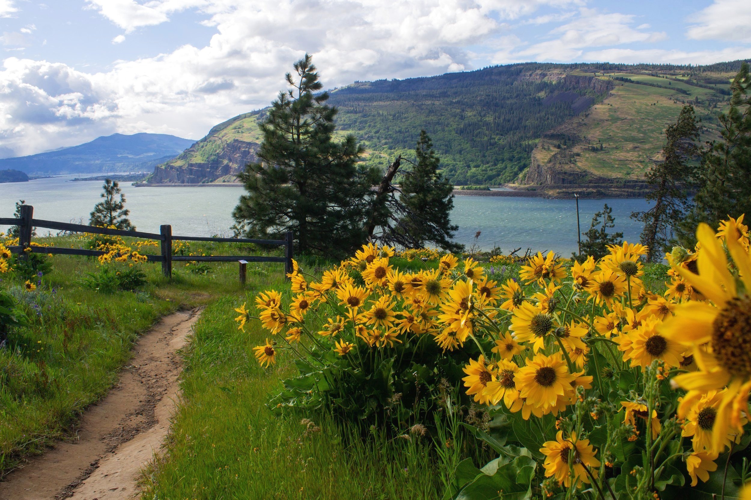
Mosier Plateau Trail Wildflower Hike
Wildflower season has arrived in the Columbia Gorge or, as I like to call it, kneeling season. Springtime means hunching, crouching, and propping myself on my elbows and knees on dirt trails to have my pictures give even the smallest hint of how beautiful the wildflowers are in person. Among my favorite kneeling spots is the Mosier Plateau Trail, one of the best wildflower hikes for both flowers and river views. It’s a great weekend destination since it’s one of the few Columbia Gorge wildflower hikes with a parking lot that keeps up with demand. Here is everything you need to know about hiking the Mosier Plateau Trail.
Bachelor button blooms in front of Mosier Creek Falls
Know before you go
Wildflower season varies each year based on the weather, but late April and early May are usually safe bets for spectacular blooms.
The Mosier Plateau Trail has excellent views and a cool waterfall, making it worth visiting even outside the wildflower season.
Parking is free in Mosier’s public parking lots. You don’t need a pass or permit.
The Mosier Plateau hike is popular, especially during wildflower season. The large parking lot usually has enough spots for everyone visiting. I’ve never had a problem parking here.
Look for port-a-potties and picnic tables next to the parking lot.
The Mosier Plateau Trail has unshaded uphill stretches, then open and exposed windy ones. Bring layers.
Leashed dogs are allowed on the trail. Please keep your dog on a leash. Wildflower habitat is fragile and it’s hard to watch off-leash dogs trample the flowers. There’s also poison oak near the trail. I probably should have led with that.
Please stay on the trail. Don’t pick the flowers or walk over them as part of a photo shoot. I know these things go without saying, but wow have I seen some behaviors on wildflower hikes.
There are some drop-offs near the trail but they are easy to avoid if you’re hiking with small children. Watch for poison oak and (although unlikely) rattlesnakes.
Lupines and balsamroot on the Mosier Plateau Trail
The Mosier Plateau Trail
Distance: 3 miles out and back with a lil’ loop at the end
Elevation gain: 700 feet
Difficulty: Easy/moderate
Pass required: None
Dog friendly: Yes, leashed dogs are welcome on the trail.
ADA access: No
Season: This hike is great year-round but best when the wildflowers peak around late April to mid-May.
The Mosier Plateau Preserve overlooks the Columbia Gorge
Finding the trailhead:
This parking lot is the closest to the trailhead and fills up first. Look for more parking a little farther from the bridge.
The Mosier Plateau Trailhead isn’t hard to find. You’ll see the sign to your right just past the white bridge on Highway 30. The trick is that you can’t park right next to it. Park in the Mosier’s public parking lots (by the large totem pole) and walk east about 0.25 miles. Cross the bridge using the shoulder. You’ll see the trailhead on the other side of it.
Mosier Plateau Trailhead
The details:
After you take a few steps up the hill from the road, the beginning of the hike is a flat and easy stroll. Wildflowers decorate the tall grasses along the trail from start to finish. Near the trailhead, look for bachelor buttons, fiddleneck, and cow vetch.
Bachelor buttons and fiddleneck blooming near Mosier Creek
In about 0.1 miles, you’ll reach the Mosier Pioneer Cemetery, where you’ll see the graves of the town’s founders and some of its early residents. Lilacs bloom near the graves in spring.
Mosier Pioneer Cemetery
Past the cemetery, the trail continues along a small canyon. Mosier Creek flows at the canyon’s base. Next to the trail, look for cow vetch, prairie stars, Columbia desert parsley, and cluster lilies in early spring. Later, bachelor buttons, fiddleneck, and lupines emerge.
Mosier Plateau Trail
The landscape around the Mosier Plateau Trail reflects the part of the Columbia Gorge where mossy, fern-filled conifer forests transition to open grasslands. Although not quite the same as the high desert landscape farther east, you’ll see ponderosa pines and scrub oaks along the trail.
Just past this tree is Mosier Creek Falls
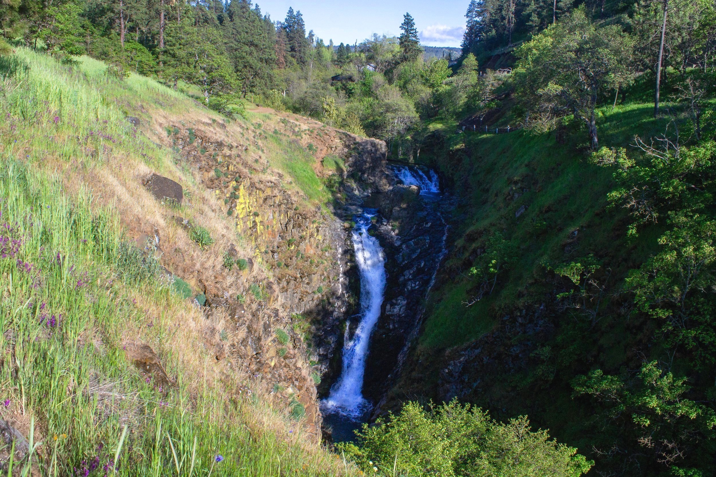
About 0.25 miles into the hike, you’ll reach the viewpoint for Mosier Creek Falls, one of the most overlooked waterfalls in the Columbia Gorge. This viewpoint looks directly at the waterfall’s two picturesque tiers as they tumble 100 feet down to the canyon below. Between them is a small plunge pool that serves as a swimming hole in the summer.
Mosier Creek Falls
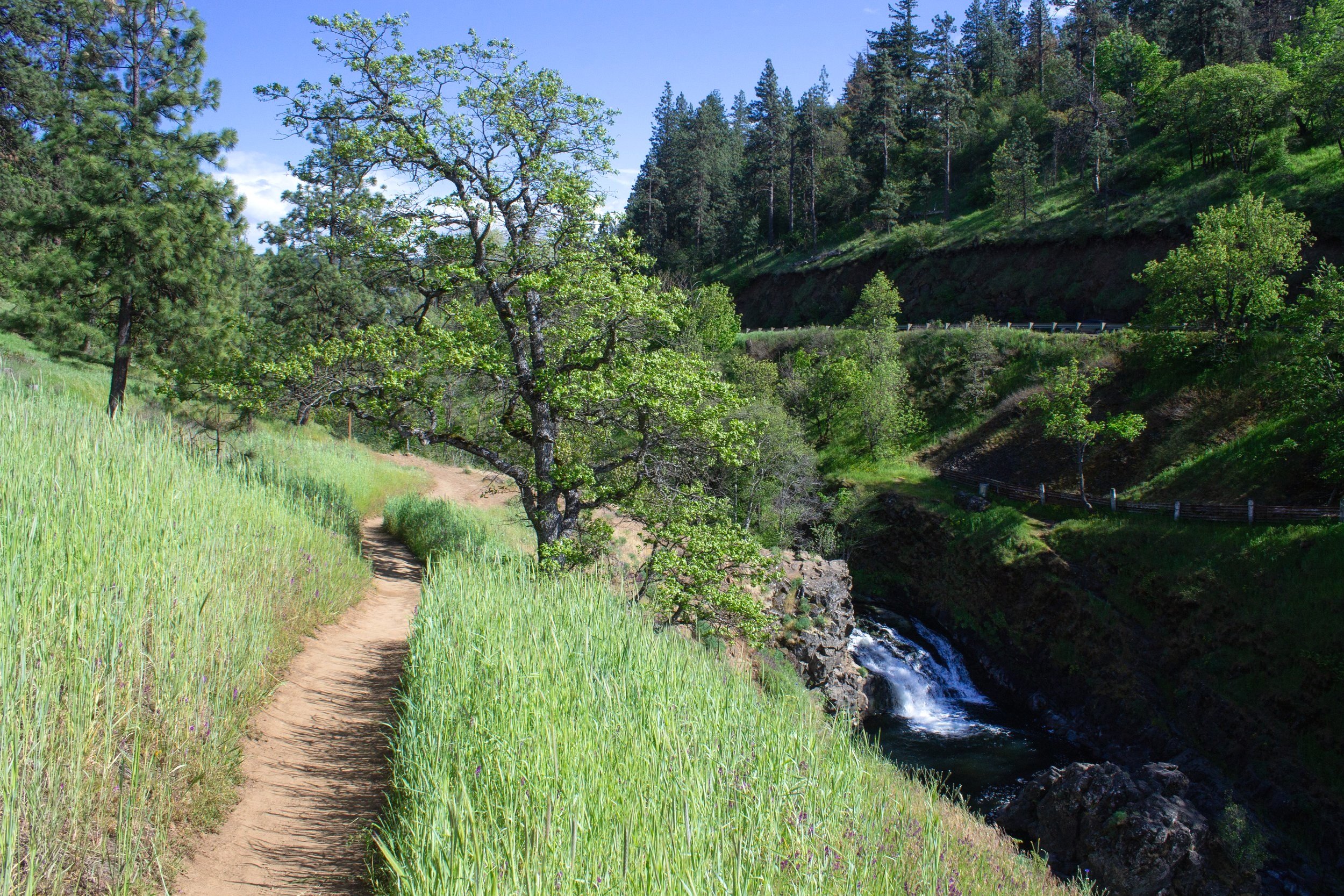
Just ahead, you’ll reach another viewpoint where you can admire Mosier Creek Falls from above. If you visit early in wildflower season, around the time when the first balsamroot flowers appear, look for the serviceberry bush blooming at the top of the waterfall’s lower tier.
The trail continues to the top of Mosier Creek Falls
From the rocky outcropping next to the top of the falls, you’ll see a path where swimmers have descended to the pool between the waterfall’s tiers. In the chill before swimming season, yellow desert parsley and purple cow vetch add color to the rocks beside the waterfall.
Desert parsley blooms next to Mosier Creek Falls
Shortly past Mosier Creek Falls, you’ll begin climbing up to the top of the plateau. Although only about 0.5 miles long, this section accounts for most of the hike’s elevation gain and always feels much longer to me. Prepare to remove your layers as you begin the Journey of a Thousand Switchbacks (okay, actually about five).
The switchbacks begin
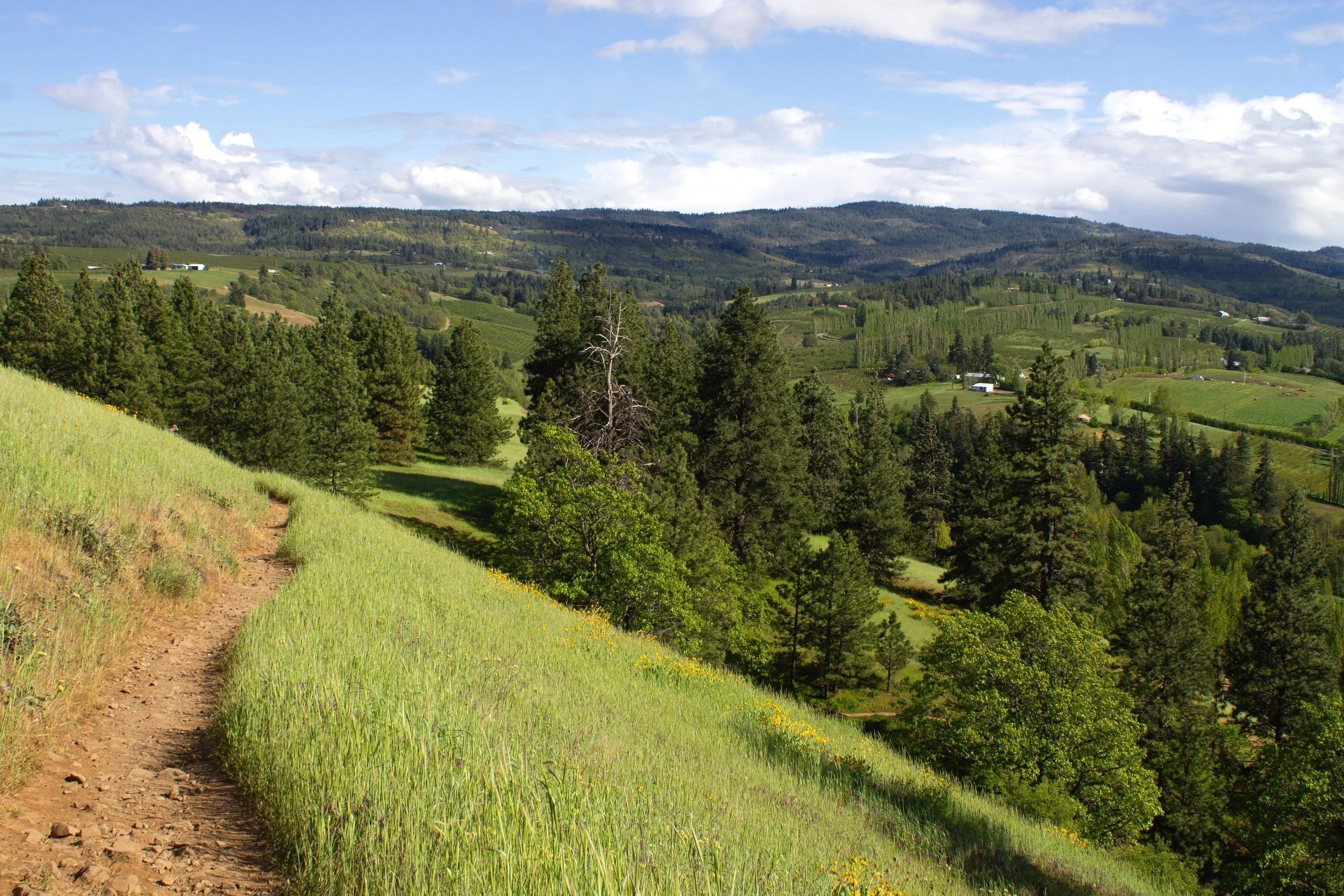
As you make your way uphill, the scenery gets better and better. Farms, vineyards, and forests cover the hills around Mosier. You might see horses grazing in the fields below. You’ll know you’re getting near the top when you catch a glimpse of the Columbia River in the distance.
You’ll start seeing views of Mosier as you climb
Small and delicate wildflowers mingle with the grasses along the trail. Towards the top of the hill, the first showy sunflower-like balsamroot flowers appear. Up ahead are many, many more.
Balsamroot flowers become more abundant the higher you get
Between a few of the switchbacks are wooden staircases. Grasses and wildflowers are slowly consuming them, and I can’t help but admire the industry of the plants.
Wooden staircase on the climb to the top of the plateau
Butterflies flit across the trail between visits to the flowers. I saw a few monarchs and painted ladies on my last hike.
A painted lady butterfly that landed on the trail
And finally, the trail levels out. It’s worth taking a moment to have a last look at the rolling hills before continuing to the plateau.
The views are stunning from Mosier Plateau
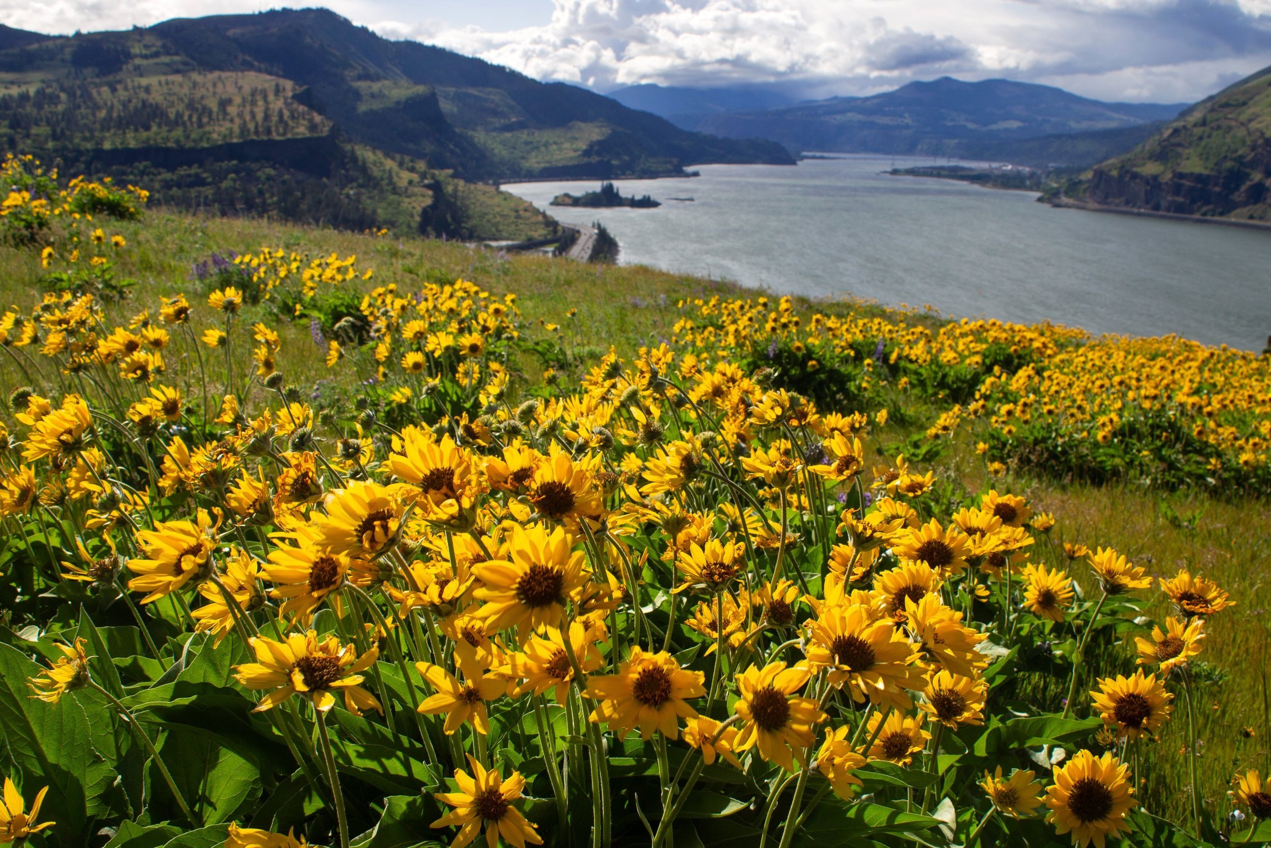
From here on, balsamroot is the star of the show. From dense clumps to thick carpets, this flower covers the Mosier Plateau with yellow blooms during peak season. Alongside them are tall and striking purple lupines.
Balsamroot is everywhere on Mosier Plateau
Just as appealing as the wildflowers are the phenomenal views from the Mosier Plateau. Just after you’ve climbed the hill to the top, you’ll reach Mosier Cape Viewpoint, which overlooks the Columbia Gorge to the west. You’ll see the town of Mosier, the Columbia River, the hills and bluffs of the Gorge, and the striking diagonal cliff of Coyote Wall from this viewpoint.
Mosier Cape Viewpoint
Follow the guardrail to continue the trail across the plateau. Where the railing ends, you’ll see a path where people have left the trail to reach the edge. Please resist the temptation to take this path. The views and photo opportunities are excellent from the main trail.
Follow the railing to explore the plateau
Past the viewpoint, the trail loosely follows the cliffs of the Mosier Plateau. Everywhere you look are wildflowers. In the distance, the blue of the Columbia River adds the perfect contrast to the abundant yellow.
So much balsamroot!
Meanwhile, lupines add variety to the wildflower bonanza.
Lupines
Besides the beauty, I should mention that the Mosier Plateau feels like one of the windiest places on Earth other than a Minnesota used car lot in January. You’ll want to put on any layers you took off once you’re at the top. If, like me, your haircut is a bob, you’ll be newly aware that it’s too short to pull back but too long to stay out of your eyes and camera lens. A hat might help or it might blow off. Bobby pins, I think, would be the right gear for this hike. Or perhaps a stylish helmet.
The trail starts heading gradually downhill as you walk north. You’ll start seeing more of coastal manroot’s dainty white flowers amid the balsamroot and lupines.
Coastal manroot blooming in front of balsamroot bunches
Towards the end of the hike, you’ll reach a short (about 0.1-mile) loop, marked with a sign. Heading clockwise, you’ll pass a bench with a stunning view just after starting the loop.
A bench at the start of the small loop on the Mosier Plateau Trail
The loop winds through wildflower fields. You’ll have great views of Washington across the Columbia River.
A small loop ends the Mosier Plateau Trail
The trail gets close enough to the plateau’s edge to see the Historic Columbia River Highway below. These cliffs are still easily avoided if you’re hiking with small children.
Desert parsley near the cliffs of the Mosier Plateau
After finishing the little loop, you’ll start making your way back up the hill.
Have a last look at the wildflower fields of the Mosier Plateau, then head back the way you came to return to the parking lot.
Lupines on Mosier Plateau
Post-hike explorations
Patio at Analemma Wines
Mosier has a few excellent wineries just down the road from the Mosier Plateau Trail.
If you hike early in the season, the cherry trees at Idiot’s Grace Wines are a treat.
Across the road from Idiot’s Grace is Garnier Vineyards, which has the best views in town. Its back patio overlooks the vineyard and the Columbia River.
My favorite wines in the area are from Analemma Wines, which I enjoy despite the pun my friends make about my name (Emma) whenever we visit. After having a glass or a tasting, stroll along the vines to reach great views of the Gorge.
Getting there
To reach the Mosier Plateau Trail from Portland, take I-84 East until Exit 69 for Mosier. Follow Highway 30 for about 0.5 miles and look for the free public parking lot on your left. It will be just past the little picnic area around the totem pole. From the parking area, walk east for about 0.25 miles and cross the white bridge. The trailhead is on the other side of the bridge on the right.
The drive from Portland to the Mosier Plateau Trail takes about an hour.
Enjoy your hike to the Mosier Plateau and its wildflowers!
With love,
Emma
Explore nearby
Try out the other best wildflower hikes of the Columbia Gorge.
Hike to Mosier Twin Tunnels.


