

20 Best Short Hikes in the Columbia Gorge
Disclosure: Post contains affiliate links.
Sometimes, the biggest challenge of creating a list of things to do is making it long enough. Other times, it’s harder to keep it from spiraling out of control. I live in Portland and love nothing more than trying out a new trail. As my brainstorming list approached 30 short hikes in the Columbia Gorge, I realized I would have to set a high bar to keep my article from becoming an encyclopedia. With that in mind, here are my 20 favorite hikes under 5 miles in the Columbia Gorge. I arranged them by geography in case you want to tackle more than one on the same day. Most are great excursions for families. All offer big rewards for the effort. Enjoy!
1. Bridal Veil Falls
Distance: 0.5 - 1 mile (two trails, each about 0.5 miles)
Elevation gain: 100 feet
Difficulty: Easy
Kid-friendly: Yes
Dog-friendly: Yes, leashed dogs are welcome on the trails.
Pass required: Oregon State Park Pass, $10/day or $60/year
ADA access: Some. There is a flat, paved 0.5-mile trail to the viewpoint. The trail to the falls has steep sections and unpaved sections. Accessible restrooms.
Restrooms: Yes
Drive time from Portland: 30 minutes
The short trek to Bridal Veil Falls is one of the most underrated hikes near Multnomah Falls and a perfect introduction to the Columbia Gorge. As a bonus, you’ll find all the amenities here, like a large parking lot, picnic tables, and flush toilets. It’s a great destination if you’re hiking with small children or want an easy stop to stretch your legs on a road trip.
Just after the trailhead, a fork lets you choose between two destinations: the waterfall or the overlooks. Keep right at the fork and head to Bridal Veil Falls. A 0.3-mile trail will lead you through the forest and past pretty Bridal Veil Creek. Just about when you start settling into the rhythm of the hike, you’ll see the stunning 120-foot Bridal Veil Falls make its two-tiered, slightly offset plunge. If you have time and energy after seeing the waterfall, return to the fork and take the other trail. A flat, paved loop leads to a couple of overlooks that are some of the easiest to reach in the Columbia Gorge and offer excellent views of the Columbia River.
2. Angel’s Rest

Distance: 4.8 miles out and back
Elevation gain: 1500 feet
Difficulty: Moderate
Kid-friendly: Yes, most of the way. I’d avoid the viewpoint at the top with small children due to the drop-offs.
Dog-friendly: Yes, leashed dogs are welcome on the trail.
Pass required: Oregon State Park Pass, $10/day or $60/year. This trail is very popular, and parking is limited. Arrive early on summer weekends (by 8:00 - 8:30 AM).
ADA access: No
Restrooms: No, the closest restrooms are at Bridal Veil Falls.
Drive time from Portland: 30 minutes
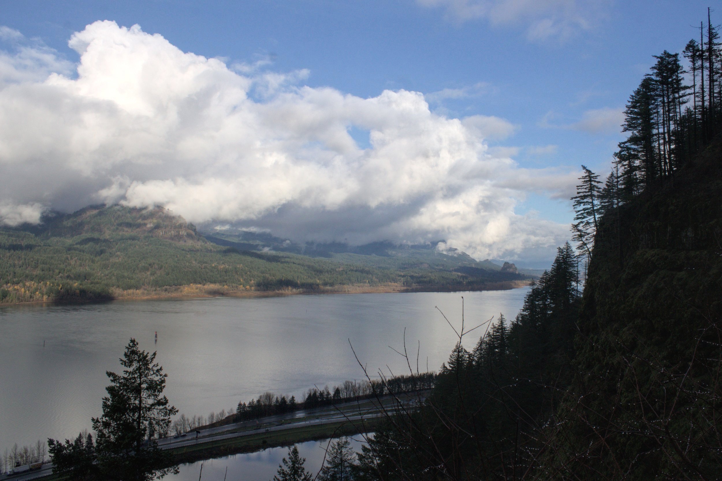
The hike to Angel’s Rest Viewpoint is one of the most spectacular in the Columbia Gorge. Well, if you can find a parking spot, that is. Being one of the closest hikes to Portland, this one gets crowded. Even in winter, it can be challenging to park on the weekend. If you get an early start, you’ll find plenty here to reward your effort. The trail begins in a conifer forest and passes Coopey Falls after about a mile. Shortly after the waterfall, you’ll leave the tree cover and begin hiking through an area cleared by past wildfires. While the tree trunks are nothing but charred remnants, the undergrowth is thick and, in spring, full of wildflowers.
Look north as you climb the switchbacks to see the hills of Washington and the Columbia River. At the top, a ridge of andesite leads to panoramic views of the Columbia Gorge. Although a family-friendly hike for most of the way, you may want to stop at the rock scree field before the final viewpoint to avoid the steep drop-offs. You’ll still get great river views. On a clear day, look for a distant downtown Portland.
3. Wahkeena Falls
Distance: 0.4 miles out and back to Wahkeena Falls (1.4 miles to Lemmons Viewpoint or 2 miles to Fairy Falls)
Elevation gain: 600 feet to Lemmons Viewpoint
Difficulty: Moderate
Kid-friendly: Yes
Dog-friendly: Yes, leashed dogs are welcome on the trail.
Pass required: None, but the small parking lot fills up quickly. Arrive by 9 AM or in the late afternoon on summer weekends.
ADA access: There is a paved ramp to the viewpoint at the base of Wahkeena Falls. The trail becomes steep past the viewpoint.
Restrooms: Restrooms are open seasonally near the picnic area. In winter, head to the Multnomah Falls Lodge.
Drive time from Portland: 35 minutes
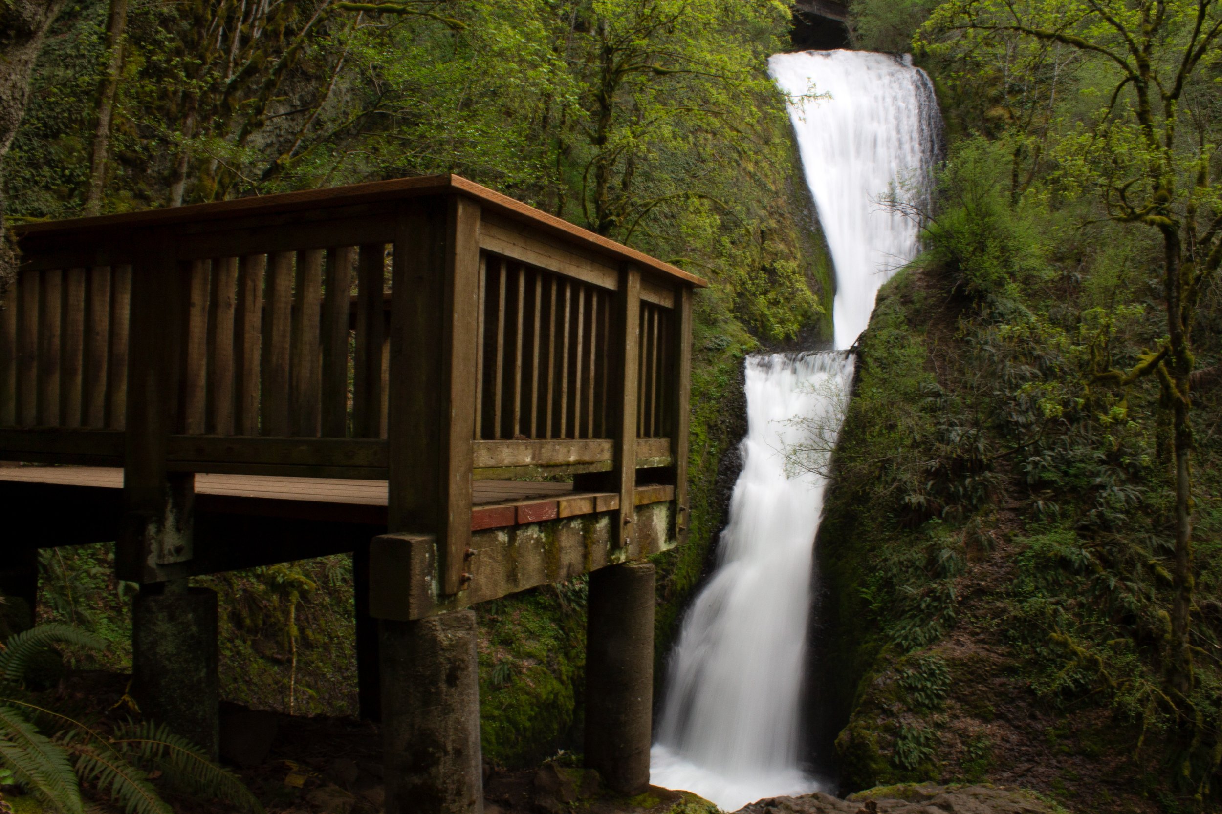
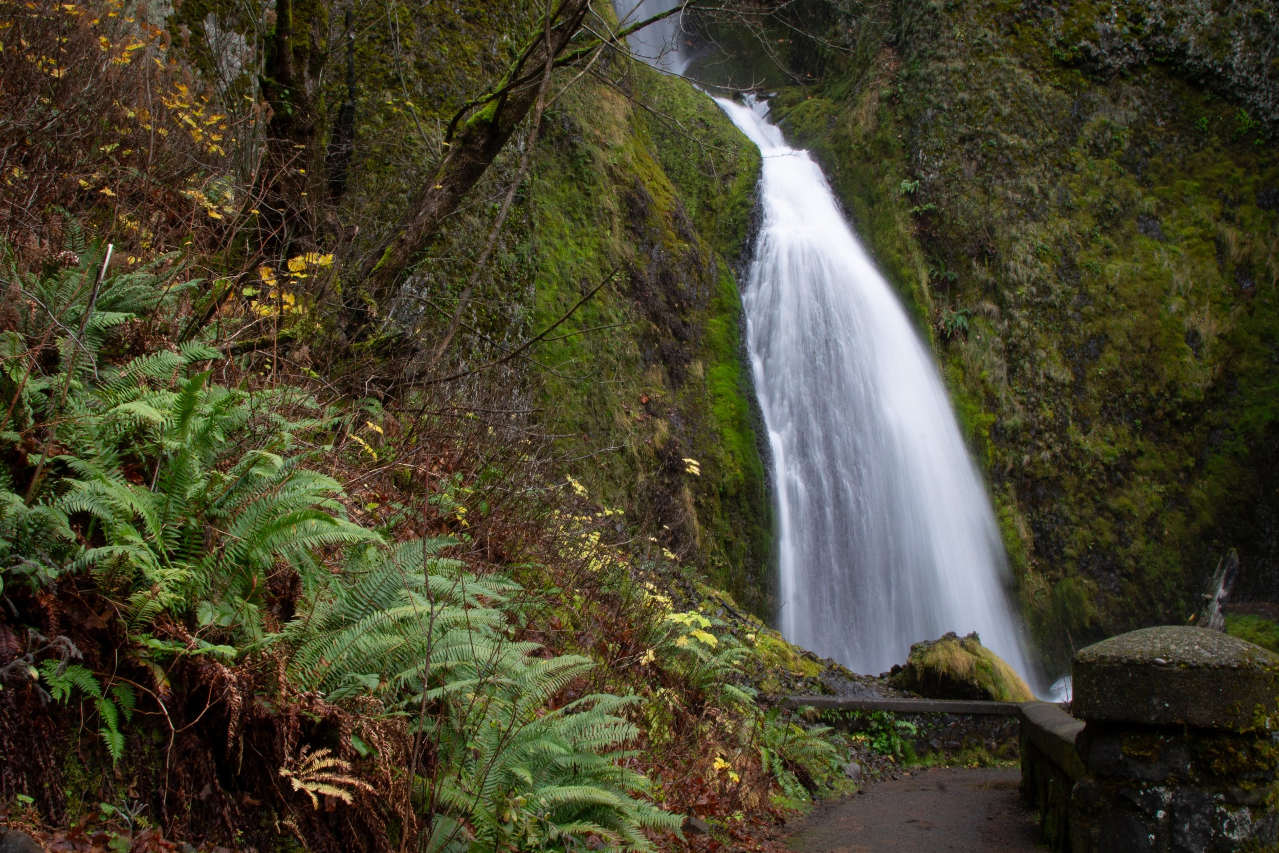
Wahkeena Falls is a subtle and intriguing waterfall. Unlike the dramatic vertical plunges of Multnomah Falls and Latourell Falls, the 242-foot Wahkeena Falls makes a meandering path through mossy boulders and dense undergrowth before flowing into Wahkeena Creek. Its height is easiest to appreciate in winter when the leaves no longer hide it from view.
Although you will get a sense of the falls from the viewpoint at its base, a short hike will take you to a stone bridge across its higher tiers. Although only about a quarter mile long, this steep hike is a workout by the time you feel the cold mist coming off the waterfall. If you continue past the bridge, another series of switchbacks will take you to Lemmons Viewpoint, an overlook with Columbia Gorge views in three directions. Another 0.3 miles past the viewpoint, you’ll reach the ethereal 20-foot Fairy Falls.
For a challenging 5-mile hike starting from Wahkeena Falls, check out the Wahkeena Falls - Multnomah Falls Loop.
4. Multnomah Falls
Distance: 2 miles out and back
Elevation gain: 800 feet
Difficulty: Moderate
Kid-friendly: Yes
Dog-friendly: Yes, leashed dogs are welcome on the trail.
Pass required: Seasonal timed entry permits are required to park from Memorial Day until Labor Day ($2). Learn all about Multnomah Falls Timed Entry Permits here.
ADA access: The viewpoint at the base of Multnomah Falls is flat and paved. The restrooms in the lodge are on the ground floor. Accessible parking. There are a few stairs to reach the steep, paved trail to Benson Bridge.
Restrooms: Yes, in the Multnomah Falls Lodge.
Drive time from Portland: 30 minutes
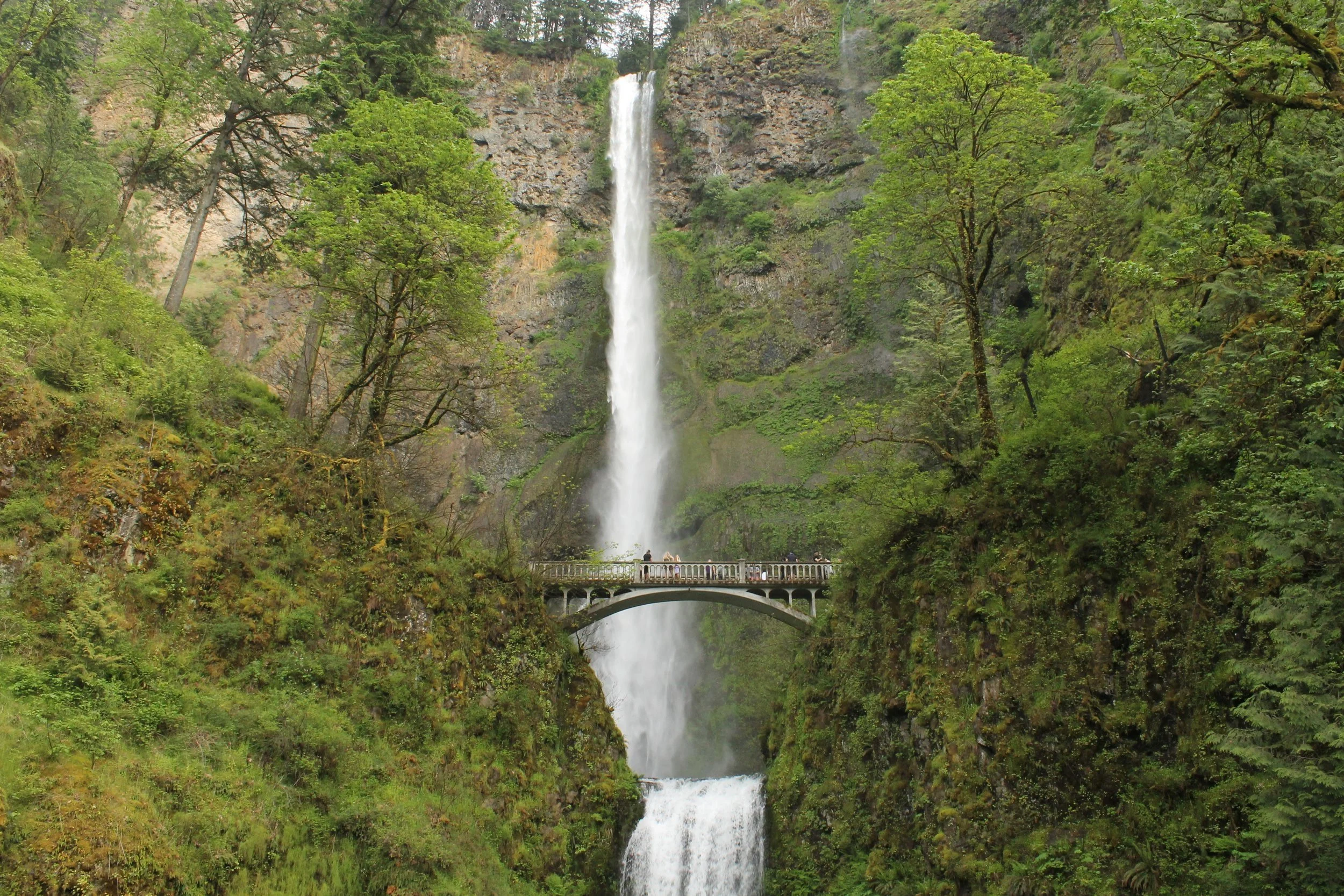
I’ve been to Multnomah Falls many times and, honestly, the best views are from the base of the falls. No hiking required. The second-best views are those from Benson Bridge, the bridge that crosses in front of the waterfall. So why climb to the top of the falls? My best answer is that when I see Multnomah Falls, I want more time with it. Just walking up and taking a picture of it isn’t enough. I want to see every angle, rock, and detail. It’s just that cool.
If you persevere up the 11 switchbacks (I suspect they are numbered for the sake of public morale), you will see the lip of the falls as the water begins its 600-foot drop. It’s also satisfying to see the tiny people and car specks down at the bottom where you started, validating the tiredness of your legs. If you continue past the top of the falls, you’ll pass Dutchman Falls, Weisendanger Falls, and Ecola Falls, all in under a mile. As added incentives, the trail becomes less steep past the top of Multnomah Falls, and the scenery is unbeatable.
Check out my list of the best hikes near Multnomah Falls for longer hiking options.
5. Ponytail Falls

Distance: 0.8 miles out and back
Elevation gain: 300 feet
Difficulty: Easy
Kid-friendly: Yes
Dog-friendly: Yes, leashed dogs are welcome on the trail.
Pass required: None, but the parking lot is small at the trailhead. Arrive early on summer weekends.
ADA access: No, not beyond the viewpoint at the base of Horsetail Falls.
Restrooms: No
Drive time from Portland: 40 minutes
One of the biggest bang-for-your-buck hikes in the Columbia Gorge is the short trail from Horsetail Falls to Ponytail Falls. The hike begins at one of the prettiest trailheads imaginable, where Horsetail Falls makes a gently sidewinding plunge into a pool surrounded by an elegant stone wall. To the left, look for the trail that will take you up switchbacks next to the waterfall. The trail continues to Ponytail Falls, a graceful upper tier of the larger Horsetail Falls. One of the treats of this trail is getting to walk behind Ponytail Falls. As you follow the trail along an eroded cliffside, look out past the tumbling water to see the distant hills of Washington across the river.
6. Triple Falls

Distance: 3.6 miles out and back from the Oneonta Gorge Trailhead or 4.2 miles out and back from Horsetail Falls
Elevation gain: 700 feet
Difficulty: Moderate
Kid-friendly: Yes, for older children. There are steep drop-offs near Triple Falls. I’d skip this trail if you see snow or ice on it.
Dog-friendly: Yes, leashed dogs are welcome on the trail.
Pass required: None, but parking is limited at both potential trailheads. Arrive early on summer weekends.
ADA access: No
Restrooms: No
Drive time from Portland: 40 minutes
Most trail guides recommend hiking to Triple Falls from the Oneonta Gorge Trailhead, but I’m not sure why. I prefer starting from Horsetail Falls because, for a similar amount of effort, you get to see three more waterfalls and a whizbang viewpoint on your way. From Horsetail Falls, you’ll reach lovely Ponytail Falls, as described above. Continue behind the falls and then round the corner. You’ll soon be overlooking the Columbia Gorge with views equalling those of Lemmons Viewpoint. On a clear day, you can see well past Beacon Rock to the east. As you continue, you’ll pass the strange chasm of the Oneonta Gorge and Middle Oneonta Falls. Then, in less than a mile, you’ll see the unmistakable three plunges of Triple Falls. Although the forest is recovering from the 2017 Eagle Creek wildfire, the waterfall is unchanged and timeless.
7. Elowah Falls and Upper McCord Creek Falls
Distance: 3 miles out and back, done as two short spurs. You can skip either of the waterfalls for a shorter hike.
Elevation gain: 800 feet
Difficulty: Easy
Kid-friendly: Yes. Watch for a missing section of guardrail on the way to Upper McCord Creek Falls.
Dog-friendly: Yes, leashed dogs are welcome on the trail.
Pass required: None, but the parking lot is small. Arrive early on summer weekends. Don’t leave valuables in the car.
ADA access: No
Restrooms: No
Drive time from Portland: 40 minutes
The short hike to Elowah Falls and Upper McCord Creek Falls is one of my favorites because it tends to get overlooked despite being just as stunning as the hikes nearby. After about 0.3 miles through a forest recovering from the 2017 Eagle Creek wildfire, you’ll reach an unmarked fork in the trail. Keep left to make the trek down to Elowah Falls in its striking amphitheater of lichen-covered basalt. Note the impressive basalt columns near the top of the cliffs, suggesting that lava cooled evenly here as it hardened into rock millions of years ago.
After seeing Elowah Falls, return to the fork and veer left to head to Upper McCord Creek Falls. On the way, the trail will become a narrow, guardrail-lined ledge along a weeping basalt cliff. Look north to see views of the Columbia Gorge, including Beacon Rock and Hamilton Mountain. You’ll soon reach a dramatic overhead view of Elowah Falls, then elegant and understated Upper McCord Creek Falls.
8. Cape Horn

Distance: 5.2 miles out and back
Elevation gain: 1200 feet
Difficulty: Moderate
Kid-friendly: Yes
Dog-friendly: Yes, leashed dogs are welcome on the trail.
Pass required: None
ADA access: No
Restrooms: Yes
Drive time from Portland: 40 minutes
Cape Horn is one of the closest hikes to Portland on the Washington side of the Columbia Gorge. Because of its proximity to the city and its fantastic views, this trail gets crowded. Arrive early on weekends to get a parking spot. Although the longer loop hike closes for part of the year to protect nesting peregrine falcons, a rewarding 5-mile out-and-back hike to the Nancy Russell Overlook is an excellent year-round destination.
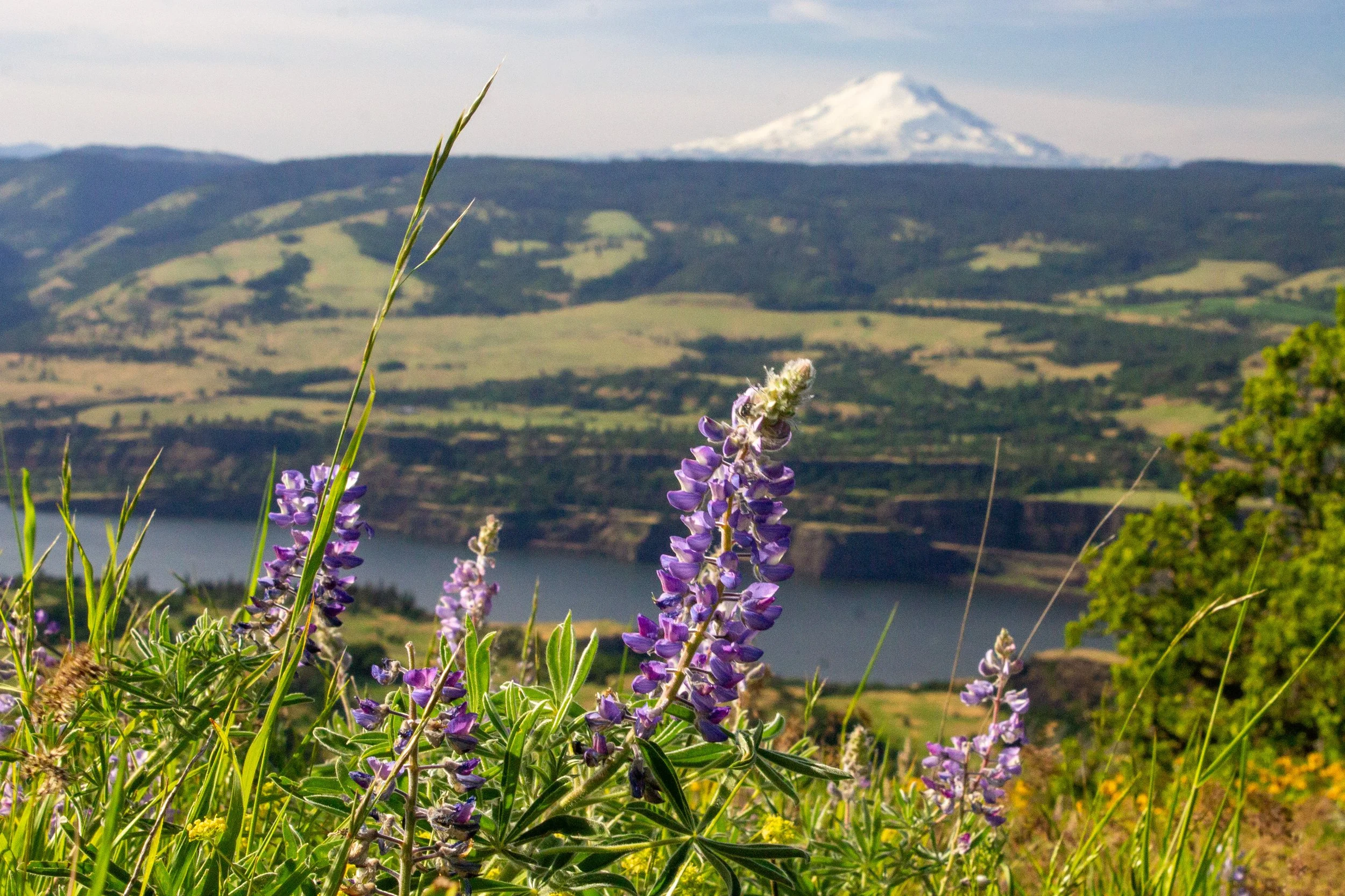
In spring, this trail is one of the best wildflower hikes near Portland. As you make your way through the forest, look for splashes of color from foxgloves, tiger lilies, and monkeyflower. Once you near the overlook, you’ll pass through a field thick with daisies and lupines. Although somewhat overgrown, the overlook at the end still has incredible Columbia Gorge views to the east. Look for a distant Beacon Rock and Hamilton Mountain on the north side of the Columbia River.
9. Beacon Rock

Distance: 1.8 miles out and back
Elevation gain: 700 feet
Difficulty: Moderate
Kid-friendly: Sort of. Guardrails line the trail, but they are not impenetrable. It would be fine with older children.
Dog-friendly: Yes, leashed dogs are allowed on the trails. It can be a challenging trail with a dog when it’s crowded.
Pass required: Washington Discover Pass ($10/day or $45/year)
ADA access: No
Restrooms: Yes
Drive time from Portland: 45 minutes
Beacon Rock is one of the most eye-catching highlights of the Columbia Gorge. When catastrophic floods tore through the Gorge around 15,000 years ago, they stripped away this ancient volcano’s exterior, leaving behind a conical core of basalt andesite. Today, a hiking trail leads to Beacon’s Rock’s summit. This trail is unforgettable both for its incredible views and the engineering involved in its creation. Rail-lined switchbacks take you up the side of the monolith.
On the way to the top, you’ll pass a series of viewpoints that offer incredible Columbia Gorge views in three directions. The summit is a bit underwhelming because tree cover obscures the views, but an interpretative sign there sparks the imagination. It tells the story of the floodwaters that broke down Beacon Rock’s exterior. At times, torrents of glacial meltwater would have been close to the monolith’s summit.
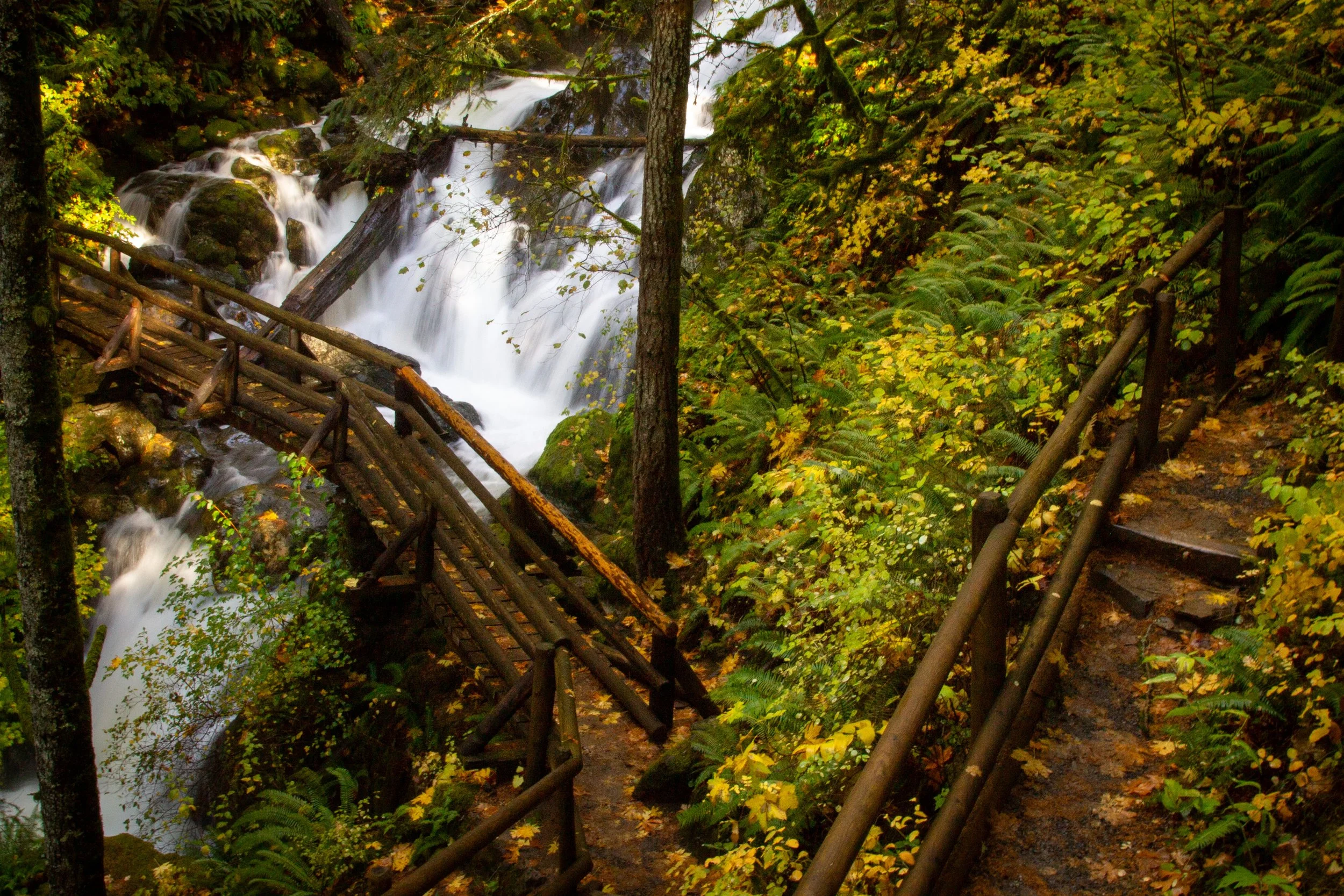
10. Hardy Falls, Rodney Falls, and Pools of the Winds
Distance: 2.5 miles out and back
Elevation gain: 600 feet
Difficulty: Easy
Kid-friendly: Yes
Dog friendly: Yes, leashed dogs are welcome on the trail.
Pass-required: Washington Discover Pass ($10/day or $45/year)
ADA access: No
Restrooms: Yes
Drive time from Portland: 45 minutes
The short trail to Hardy Falls, Rodney Falls, and Pool of the Winds is one of the best waterfall hikes on the Washington side of the Columbia Gorge. The three falls along Hardy Creek are like tiers of the same massively tall waterfall, each with its own character. Hardy Falls is a classic single plunge. Rodney Falls tumbles over angular rocks next to a curved wooden footbridge. Pool of the Winds is the most unusual, where water gushes 20 feet down a hollowed-out vertical cylinder in the rock. If you have energy after seeing the falls, consider adding a short spur to Little Beacon Rock on the way back. This hike is a great one to try out with kids. The trailhead has generous amenities, including picnic tables, flush toilets, and a playground.
For more hikes nearby, check out the other best hikes at Beacon Rock State Park.
11. Wahclella Falls
Distance: 2-mile lollipop loop
Elevation gain: 300 feet
Difficulty: Easy
Kid-friendly: Yes
Dog-friendly: Yes, leashed dogs are welcome on the trail.
Pass required: Northwest Forest Pass or America the Beautiful Pass ($5/day).
ADA access: No
Restrooms: Yes
Drive time from Portland: 45 minutes
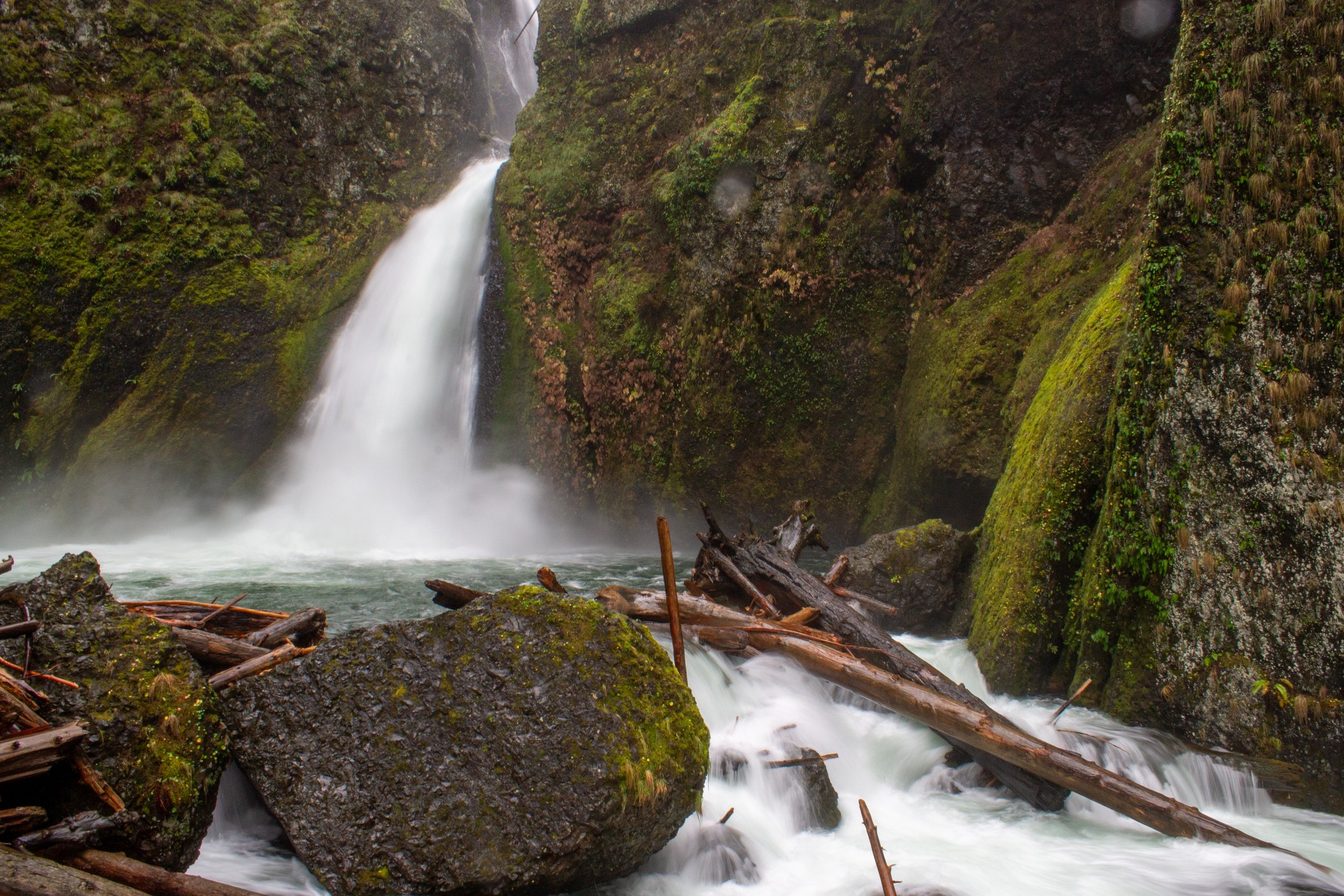
The trail to Wahclella Falls is an approachable beginner waterfall hike with a dramatic finale. The waterfall is spectacular, and the short journey to reach it is nearly as rewarding. Plus, unlike many waterfall hikes in the Columbia Gorge, you don’t need to climb switchbacks to get there. The trail follows Tanner Creek through a forested canyon. In winter and spring, seasonal waterfalls serve as a prelude for what’s to come.
In just over a mile, you’ll see breathtaking Wahclella Falls surging out of a narrow slot canyon. The unusual shape of the canyon forces water to take a circuitous route on its way to the plunge pool below. One of the more powerful waterfalls in the Columbia Gorge, Wahclella Falls is still impressive in drier months. You’ll want to take your time near the falls to appreciate it from different angles. In summer, dip your feet into Tanner Creek to cool off before heading back.
Go ahead and bring your kids and your dogs for this one. If you’re hiking with small children, I suggest doing the hike as an out-and-back journey to avoid some drop-offs. When you reach the trail junction that begins the loop portion of the hike, go right and across the bridge. This direction is the safer way to approach the falls.
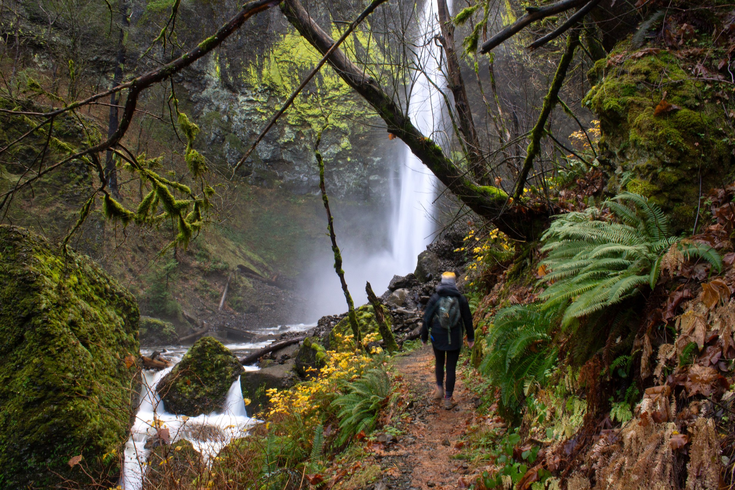
12. Punch Bowl Falls

Distance: 4.5 miles out and back
Elevation gain: 500 feet
Difficulty: Moderate
Kid-friendly: No
Dog-friendly: Leashed dogs are allowed, but the trail is not a good one for dogs. There are narrow stretches near steep drop-offs.
Pass required: Northwest Forest Pass or America the Beautiful Pass ($5/day).
ADA access: No
Restrooms: Yes
Drive time from Portland: 45 minutes
Taking the Eagle Creek Trail to Punch Bowl Falls is an adventure, like a super-charged version of the Wahclella Falls Trail. It follows the steep and striking Eagle Creek Canyon, at times becoming little more than a ledge next to a precipice. Cable handrails provide a sense of security in these sections, at least until you meet someone coming from the other direction.
Other than the crowds, I love everything about this trail. In winter and spring, there are too many seasonal waterfalls for someone with my limited attention span to count. In late spring, wildflowers provide a delicate counterpoint to the rough basalt cliffs. The trail continues for miles, but Punch Bowl Falls is a relaxing and rewarding destination. After a little over 2 miles, you’ll reach a viewpoint where you can see the waterfall make its powerful single plunge into a fishbowl-shaped basalt amphitheater. On your way there, I recommend making the short spur down to Lower Punch Bowl Falls to see Eagle Creek at water level. It’s a great place to cool off on a hot day.
13. Dry Creek Falls

Distance: 4.4 miles out and back
Elevation gain: 700 feet
Difficulty: Easy
Kid-friendly: Yes
Dog-friendly: Yes, leashed dogs are welcome on the trail.
Pass required: Northwest Forest Pass or America the Beautiful Pass ($5/day) to park by the trailhead on Toll Bridge Park. The lot is small and fills up quickly. Look for additional parking on Harvey Rd in Cascade Locks, which doesn’t require a pass.
ADA access: No
Restrooms: Yes, at Toll Bridge Park, but not in the lot off Harvey Rd.
Drive time from Portland: 45 minutes
The short hike to Dry Creek Falls follows an easy, family-friendly section of the Pacific Crest Trail. Although you gain some elevation along the way, it goes by quickly and never gets intense. As you hike, you’ll notice scorch marks on the tree trunks left by the 2017 Eagle Creek wildfire. Although this forest burned, its trees mostly survived. Tall Doug firs still shade the trail. In spring and summer, you’ll find plenty of greenery in the undergrowth, including some wildflowers. In fall, big leaf maples add yellows to the forest.
At the end of the hike, you’ll see picturesque Dry Creek Falls making its single plunge over a distinctive-looking cliff. While the waterfall is lovely, the real treat is seeing the interesting symmetry of the columnar basalt that frames it. In the chaos of volcanic rock formation, it is rare to see such order.
14. Mosier Plateau

Distance: 3 miles out and back
Elevation gain: 700 feet
Difficulty: Moderate
Kid-friendly: Yes
Dog-friendly: Yes, leashed dogs are allowed on the trail.
Pass required: None
ADA access: No
Restrooms: Yes, by the Mosier public parking lot.
Drive time from Portland: 60 minutes
The Mosier Plateau Trail is a great family-friendly hiking destination throughout the year, but late spring is special. During this time of year, wildflowers open up, most notably the large balsamroot blooms that turn the grassy plateau into a field of yellow. On your way to this finale, you’ll pass a historic cemetery and a viewpoint overlooking Mosier Creek Falls. Then, as you trudge up the hill, you’ll see the distant orchards and vineyards of Mosier to the south. In spring, look for vetch, cluster lilies, and other dainty wildflowers before you reach the flashier displays up ahead. After you climb the hill, you’ll be rewarded with stunning views of the Columbia Gorge and, around May, balsamroot flowers everywhere you look.
15. Memloose Hills
Distance: 3.2 miles out and back with a spur
Elevation gain: 550 feet
Difficulty: Easy
Kid-friendly: Yes
Dog-friendly: Yes, leashed dogs are allowed on the trail.
Pass required: None. Hikers aren’t allowed to park at the rest area off I-84. Park at the overlook on Highway 30. Parking is limited. Arrive early on weekends during wildflower season.
ADA access: No
Restrooms: No
Drive time from Portland: 65 minutes
From Mosier, a short drive on scenic Highway 30 will bring you to Memloose Hills, another of the best wildflower hikes in the Columbia Gorge. Before beginning the hike, take a minute to enjoy views of the Columbia River and Memloose Island from the overlook. Across the road, you’ll find the trailhead. In late spring, wildflowers line this trail from start to finish, especially showy balsamroot and lupines.
About halfway into the hike, you’ll reach a trail junction. Going right will take up a hill to a clearing full of wildflowers and views of Mt Hood, Mt Adams, and the Columbia River. Veering left at the trail junction will take you up a gentler slope to a field of lupines and balsamroot. Look for Mt Hood and Mt Defiance on a clear day. If you have time and energy, I recommend doing both spurs. Neither disappoints. If you miss the blooms, hike on a clear day to enjoy the mountain peaks.
16. Tom McCall Point Trail
Distance: 3.4 miles out and back
Elevation gain: 1000 feet
Difficulty: Moderate
Kid-friendly: Yes
Dog-friendly: No, dogs are not allowed on the trail.
Pass required: None
ADA access: No
Restrooms: No
Drive time from Portland: 75 minutes
Season: This trail is closed from November 1st until March 1st to prevent erosion.
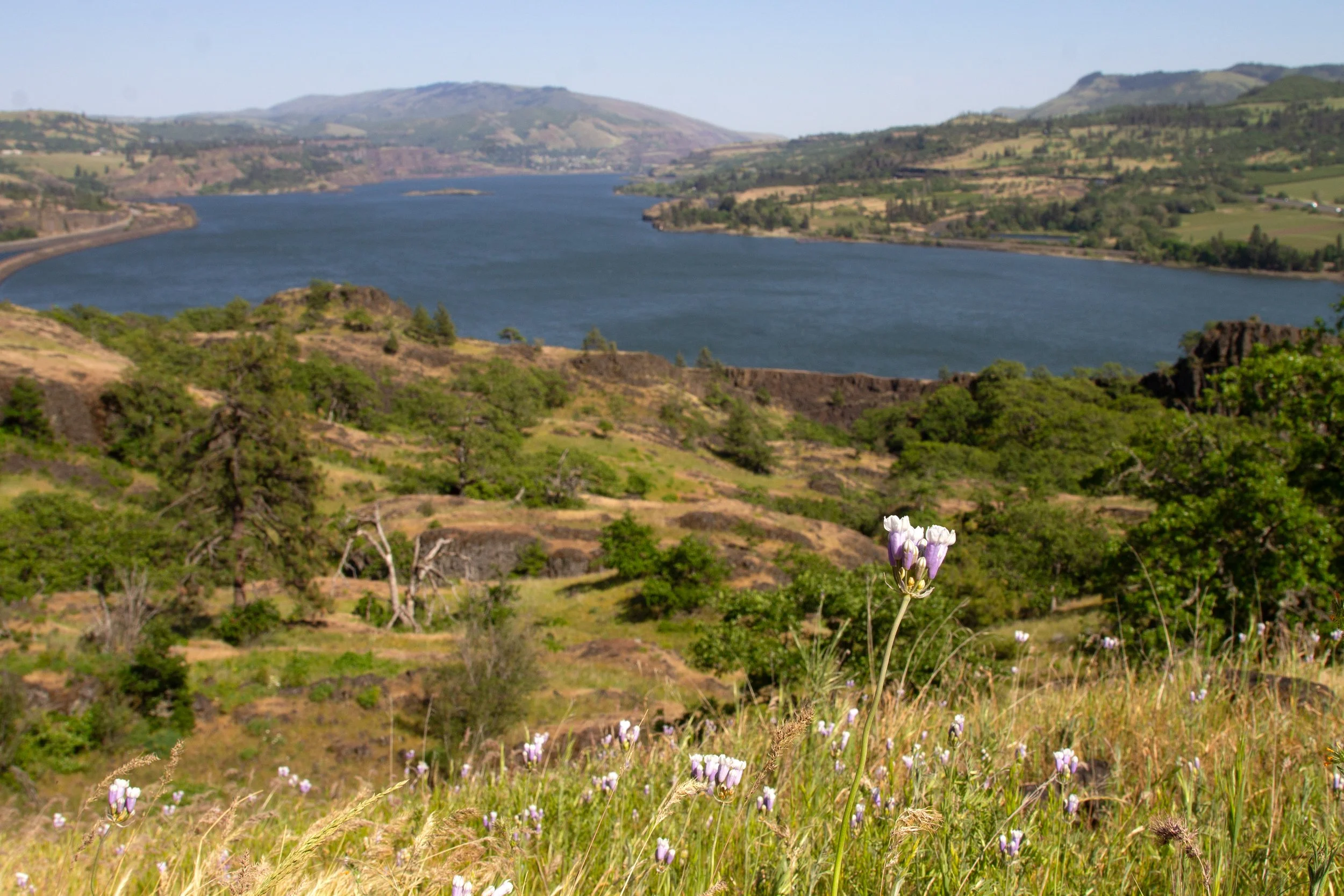
I consider the Tom McCall Point Trail not so much a wildflower hike as the wildflower hike. Remarkable for wildflower variety and abundance, there isn’t a single boring moment on this trail. Even without the blooms, the views are extraordinary. The Tom McCall Trail is so far east in the Columbia Gorge that tree cover is sparse, which opens up expansive vistas in every direction. The trailhead starts from the Rowena Crest Viewpoint, which overlooks the famous curves of Highway 30 and the rugged bluffs of the Gorge. Tom McCall’s summit is equally unforgettable. A trifecta of purple lupines, yellow balsamroot, and red paintbrush cover the ground, creating a colorful foreground for the surrounding Columbia Gorge views, including the snowcapped peaks of Mt Hood and Mt Adams.
For a shorter and easier version of this hike, try the 2.2-mile Rowena Plateau Trail, which starts from the same trailhead. It has less distance and elevation gain but many of the same wildflowers you’ll see on the Tom McCall Trail.
17. Labyrinth Trail
Distance: 3.6 miles out and back
Elevation gain: 900 feet
Difficulty: Easy
Kid-friendly: Yes
Dog-friendly: Yes, dogs are welcome on the trail. They must be on a leash from December through the end of June.
Pass required: None
ADA access: No
Restrooms: Yes
Drive time from Portland: 90 minutes (or save 15 minutes by paying the $2 Hood River Bridge toll)
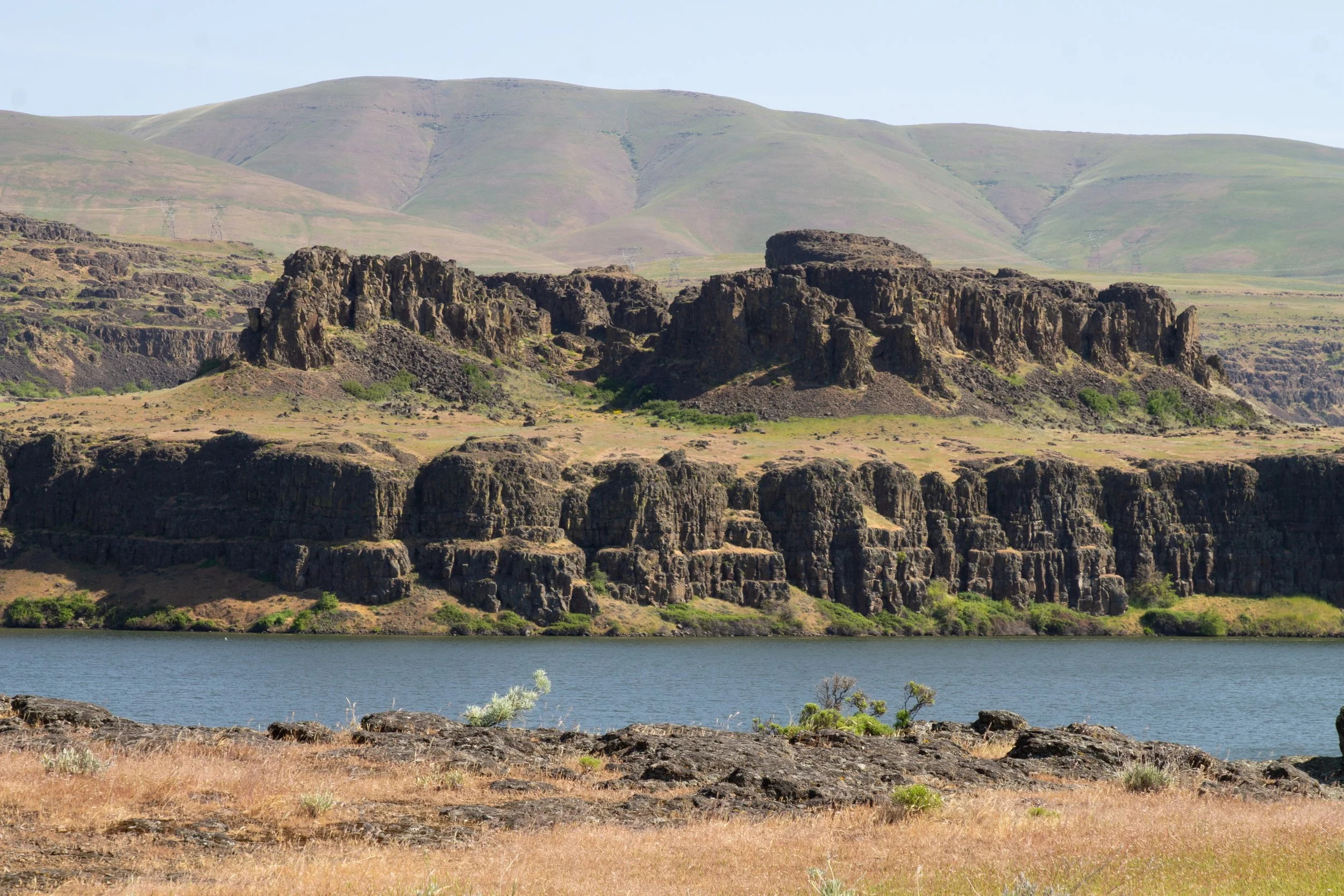
The Labyrinth Trail is one of the first places where wildflowers bloom in the Columbia Gorge in spring. Look for desert parsley, cluster lilies, grass widows, and shooting stars among the earliest blossoms. Even if you miss wildflower season, this hike has plenty to recommend it. You’ll start by walking along Coyote Wall, a distinctive cliff of diagonal columnar basalt. The angle of the cliff comes from crustal compression as the movement of tectonic plates pushes Oregon toward a more stable Washington. As you climb, you’ll pass a cascading waterfall, a strange outcropping of columnar basalt called Accordion Rock, and views galore. The hike ends at a panoramic viewpoint overlooking the Columbia River, Mount Hood, and Mount Defiance. For a longer version, check out the 6.5-mile loop to Coyote Wall.
18. Catherine Creek Universal Access Trail

Distance: 1.2-mile loop
Elevation gain: 100 feet
Difficulty: Easy
Kid-friendly: Yes. You could bring a stroller here.
Dog-friendly: Yes, leashed dogs are welcome on the trail.
Pass required: None
ADA access: The trail is wide, even, and paved without obstacles like steps or tree roots. The grades get steep at times. It has benches. The gravel parking lot would be challenging with a wheelchair.
Restrooms: Yes, accessible porta-potty.
Drive time from Portland: 90 minutes (or save 15 minutes by paying the $2 Hood River Bridge toll)
The Catherine Creek Universal Access Trail is a rare barrier-free hiking trail in the Columbia Gorge. This short, not-too-steep loop is a great choice for families and anyone looking for a laid-back hike with magnificent scenery. In late spring, look for wildflowers like bachelor buttons, poppies, and bitterroot along the trail. The hike will take you close to the Columbia River and has excellent views of the Gorge. Stop for a snack on a bench that looks out onto pretty and diminutive Catherine Creek Falls.
Learn more in my Catherine Creek hiking guide.
19. Lyle Cherry Orchard

Distance: 5-mile lollipop loop
Elevation gain: 1200 feet
Difficulty: Moderate
Kid-friendly: Yes, although there are some steep sections. Watch for rattlesnakes.
Dog-friendly: Yes, leashed dogs are welcome on the trail.
Pass required: None
ADA access: No
Restrooms: No
Drive time from Portland: 95 minutes (or save 15 minutes by paying the $2 Hood River Bridge toll)
Like many of the trails in the eastern Columbia Gorge, the Lyle Cherry Orchard Trail is a fantastic wildflower hike. In late spring, you can see abundant blooms like lupines, balsamroot, coastal manroot, death camas, desert parsley, and buttercups. More than for the wildflowers, though, this hike is about scale. As you make your way up to the former cherry orchard, you’ll be able to admire the staggering dimensions of the Columbia Gorge from a point of elevation. Gazing out over the sweeping vistas, it’s easy to picture massive amounts of glacial meltwater tearing through the land. Everything is so open that the Earth’s vast proportions become obvious and yet ungraspable by ants such as ourselves. Watch your step as you walk. I almost stepped on a rattlesnake here once.
20. Horsethief Butte
Distance: 1.7-mile loop
Elevation gain: 250 feet
Difficulty: Easy
Kid-friendly: Yes, around the butte. I’d avoid climbing up it with younger children.
Dog-friendly: Yes, leashed dogs are allowed, although you’ll likely want to avoid the steepest trail sections.
Pass required: Washington Discover Pass ($10/day or $45/year)
ADA access: No
Restrooms: Yes
Drive time from Portland: 95 minutes
Horsethief Butte is my favorite day trip from Portland that feels like being on vacation somewhere far away. It’s so far east that the landscape is unrecognizable from the lush Doug-fir forests of the western Columbia Gorge. Here, you’ll find arid grassy plains, rolling hills, and exposed rocky bluffs. In early spring, rains turn these grasslands a vibrant shade of green, which quickly fades to the color of straw by summer. Wildflowers decorate the fields in spring and early summer, but at Horsethief Butte, the rocks are the biggest attraction. A short hike will bring you around and on top of the chunky rocks of the butte. If you look closely, you can find petroglyphs here, although they have mostly been effaced by vandalism.
After your hike at Horsethief Butte, I highly recommend stopping to see the Columbia Hills Petroglyphs on your way back to Portland. Unlike those on Horsethief Butte, they are still easily visible. There isn’t a hike here, just a short path for viewing the petroglyphs.
What to bring
Water
Trail snacks
A lightweight waterproof backpack like this Naturehike Day Pack.
Hiking boots that can walk through water and mud. I love my waterproof Timberland hiking boots and will buy them again whenever they wear out. There is a similar pair for men.
Rain jacket. This Columbia jacket for women or men is a great choice for most seasons.
Recreation pass, if needed.

Best short hikes in the Columbia River Gorge, the summary:
Bridal Veil Falls
Angel’s Rest
Wahkeena Falls
Multnomah Falls
Ponytail Falls
Triple Falls
Elowah Falls and Upper McCord Creek Falls
Cape Horn
Beacon Rock
Hardy Falls, Rodney Falls, and Pools of the Winds
Wahclella Falls
Punch Bowl Falls
Dry Creek Falls
Mosier Plateau
Memloose Hills
Tom McCall Trail
The Labyrinth
Catherine Creek Universal Access Trail
Lyle Cherry Orchard Trail
Horsethief Butte
Enjoy your hike in the Columbia River Gorge!
With love,
Emma
Explore nearby

Check out the hike to Latourell Falls. It was under construction when I wrote this article, otherwise it would have been on the list.

The Wind Mountain Trail is an underrated short hike in the Columbia Gorge.
Check out the short-ish hike to Gillette Lake.


Check out the best short hikes near Mt Hood.