

Wind Mountain Trail in the Columbia Gorge


The Wind Mountain Trail leads to some of the best views in the Columbia Gorge. The hike to the summit is a steep uphill slog that can be humbling despite the short distance. My nickname for it is But-I-Work-Out-Sometimes Mountain. Located next to Washington’s famous Dog Mountain, Wind Mountain has similar vistas with a fraction of the visitors. While it lacks the spectacular wildflowers displays in spring, longstanding cultural significance adds to its appeal. It’s a place of struggle, self-discovery, and spirits. Here is everything you need to know about hiking up Wind Mountain.

The Wind Mountain Trail ends at spectacular Columbia Gorge views
Know before you go
It’s free to hike up Wind Mountain. You don’t need a pass or permit to park.
The trailhead doesn’t have restrooms or other amenities.
Park in the unsigned lot about 0.2 miles before the trailhead.
Leashed dogs are welcome on the Wind Mountain Trail.
The top of Wind Mountain has many loose rocks and drop-offs. It’s not family-friendly. Older kids would do fine.
Wind Mountain is a place of spiritual importance for local Native American tribes. Please be respectful during your visit. Stay on the trail and in designated viewing areas.

Views from Wind Mountain
On the Wind Mountain Trail
Distance: 2.5 miles out and back
Elevation gain: 1,100 feet
Difficulty: Moderate due to uphill walking
Pass required: None
Dog friendly: Yes, leashed dogs are welcome on the trail.
ADA access: No
Season: All year
The details
The Wind Mountain Trailhead is a little tricky to find. It has no signs and isn’t right next to the parking lot. As you’re driving in on Girl Scout Rd, park in the unmarked parking area.

Park here
Continue down Girl Scout Rd on foot for about 0.2 miles until you see a trail on your right. It’s unlabeled, but you’ll see a boot brush and a sign about stowaway seeds. Begin the Wind Mountain Trail here.

Start here
Once you start the trail, the hike is straightforward. You’ll head steadily uphill for a little over a mile. The trail is narrow but in good shape and easy to follow. Until you reach the top of Wind Mountain, the path is forested. The canopy is Doug fir, hemlock, and big leaf maples. The undergrowth is mostly Oregon grape. The trees help protect the trail from the wind. You’ll hear them sway and creak on blustery days.

Wind Mountain Trail
The hike begins up the north side of Wind Mountain. About halfway up, just before the trail begins wrapping around the east side, you’ll pass a spur trail leading to an overlook. It’s easy to miss and, honestly, probably best if you do. I walked by it twice and had to backtrack to find it.

Step over the log to start the spur trail
Once you start the spur, it’s a steep scramble with drop-offs nearby. It ends at a narrow rocky plateau. The views to the east are cool but not as impressive as those at the top of Wind Mountain. I also didn’t love how strong the wind was while I had cliffs on three sides. To get back up, clinging to exposed tree roots is a crucial part of the process.

The spur trail ends at a wind-buffeted ledge
After the spur, you’ll get about three steps on even ground, then continue the uphill march. Switchbacks help keep the hike from getting too strenuous. Once you start getting close to the top, you’ll cross a few rock scree slopes. These tree-less patches hint at the views to come. The rock that makes up Wind Mountain is unusual for the Columbia Gorge. It’s diorite that’s about 5 million years old, the result of a volcanic intrusion. Similar rock makes up Shellrock Mountain across the river in Oregon, but not Dog Mountain, which is older basalt.

Rocky slope on the way up Wind Mountain
About the time you start feeling like you’ve spent your whole life walking uphill, you’ll reach the top of Wind Mountain. The first of several signs asks that visitors respect the land here and leave things undisturbed.
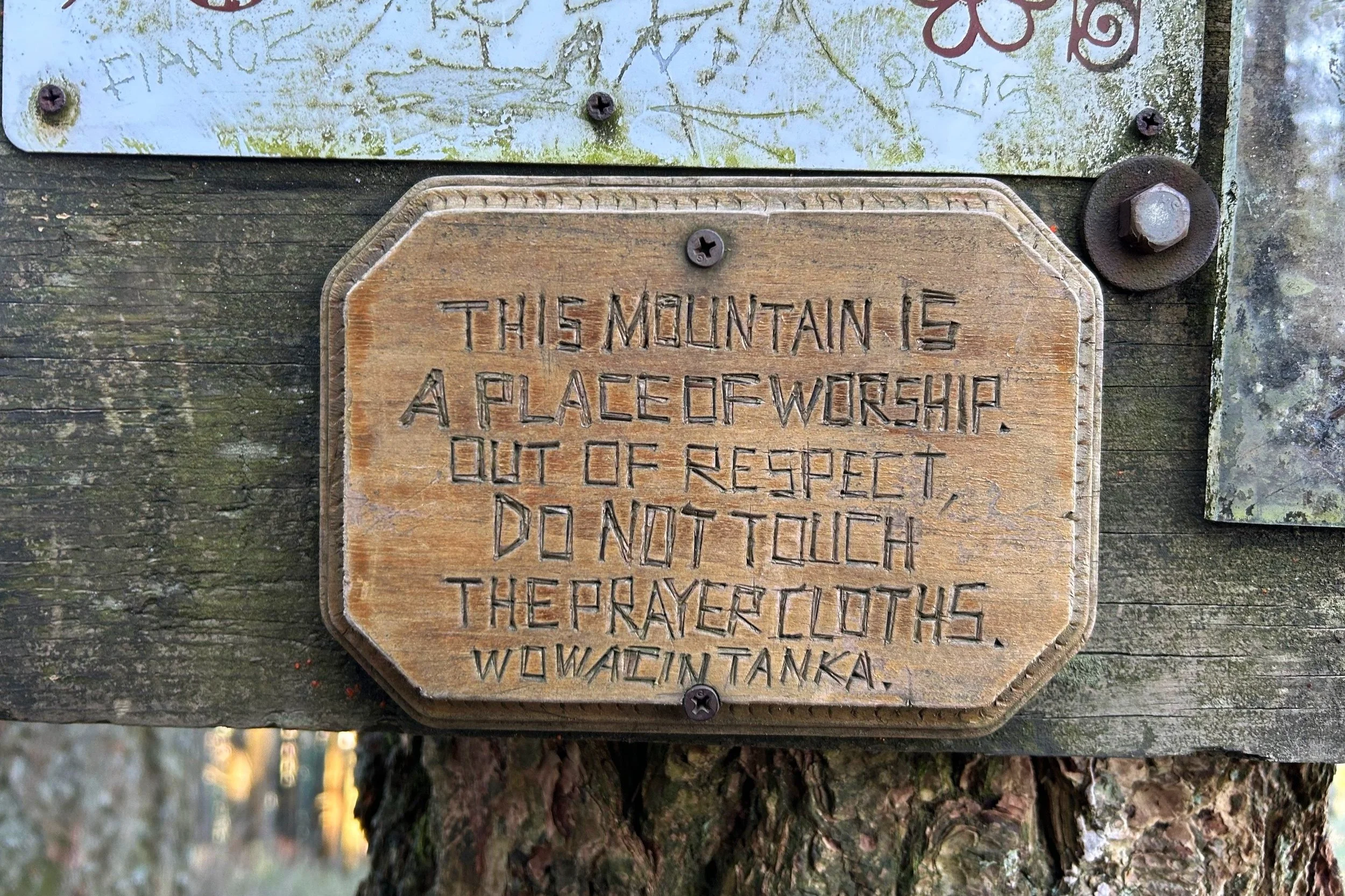
Signs describe the spiritual importance of Wind Mountain
Just ahead is an interpretive sign about the cultural significance of Wind Mountain. Beginning hundreds of years ago, young people would fast and spend the night on the mountain for vision quests, the search for spiritual guardians. Take a moment to look at the small map of the summit on the sign. It tells which areas are fair game to explore.
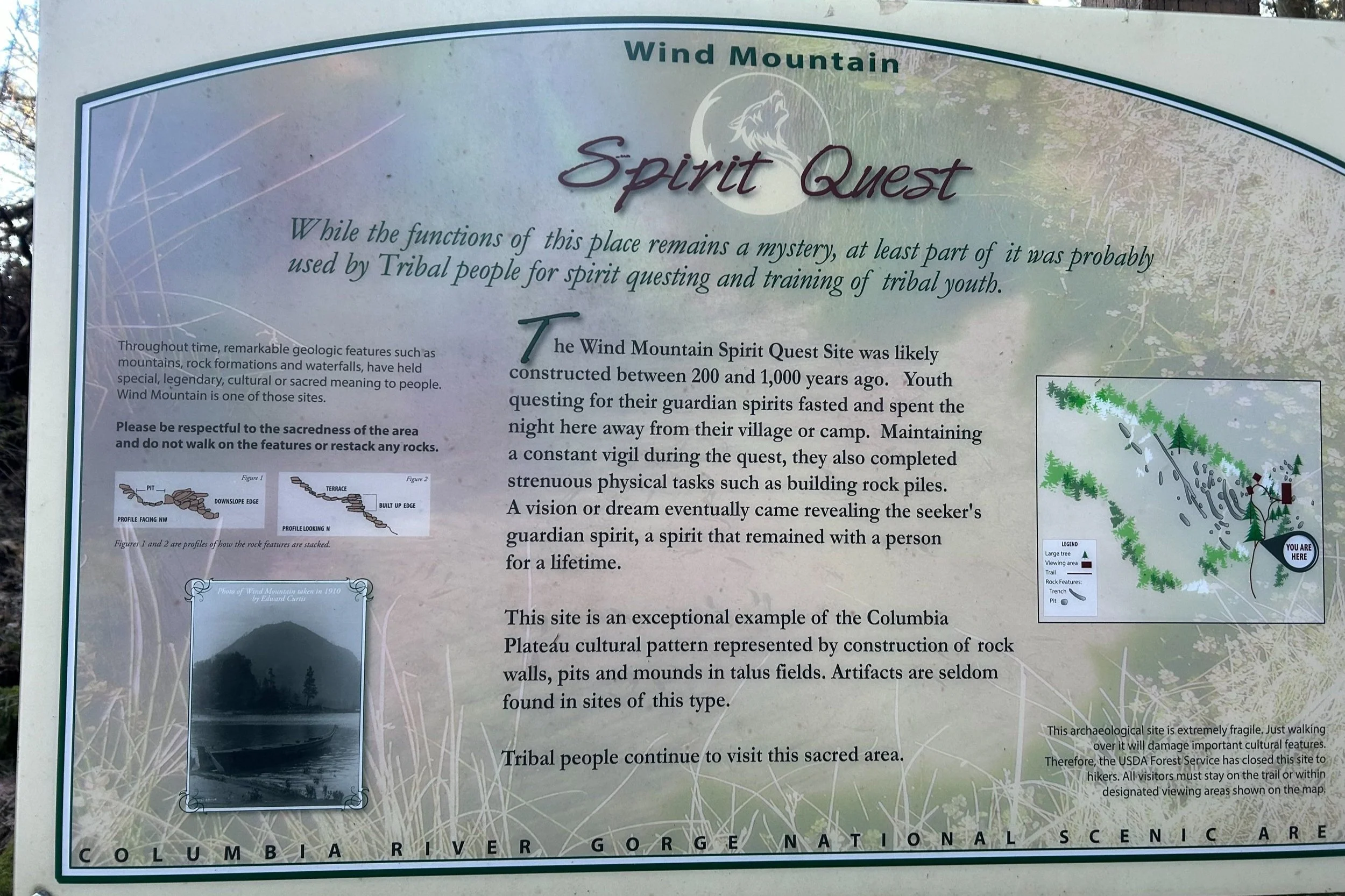
Interpretive sign on Wind Mountain
A tiny loop at the top of Wind Mountain connects you to three viewing areas. When you reach the fork in the trail, you can go right to see the views to the west first or left to look south and east. Let’s head right. Make your way over some tippy rocks past the trees to reach incredible views of the Columbia Gorge. You’ll see Wind River flowing into the Columbia River by the town of Carson. Farther west is Beacon Rock, looking tiny at a distance.

Viewing area on Wind Mountain
To the north, you’ll get a glimpse of Mount St Helens on a clear day. Even when it’s windy, this side of the mountain is protected and surprisingly calm. Have a seat on the least tippy of the tippy rocks for a snack break. It’s one of the prettiest places you’ll ever have a granola bar.
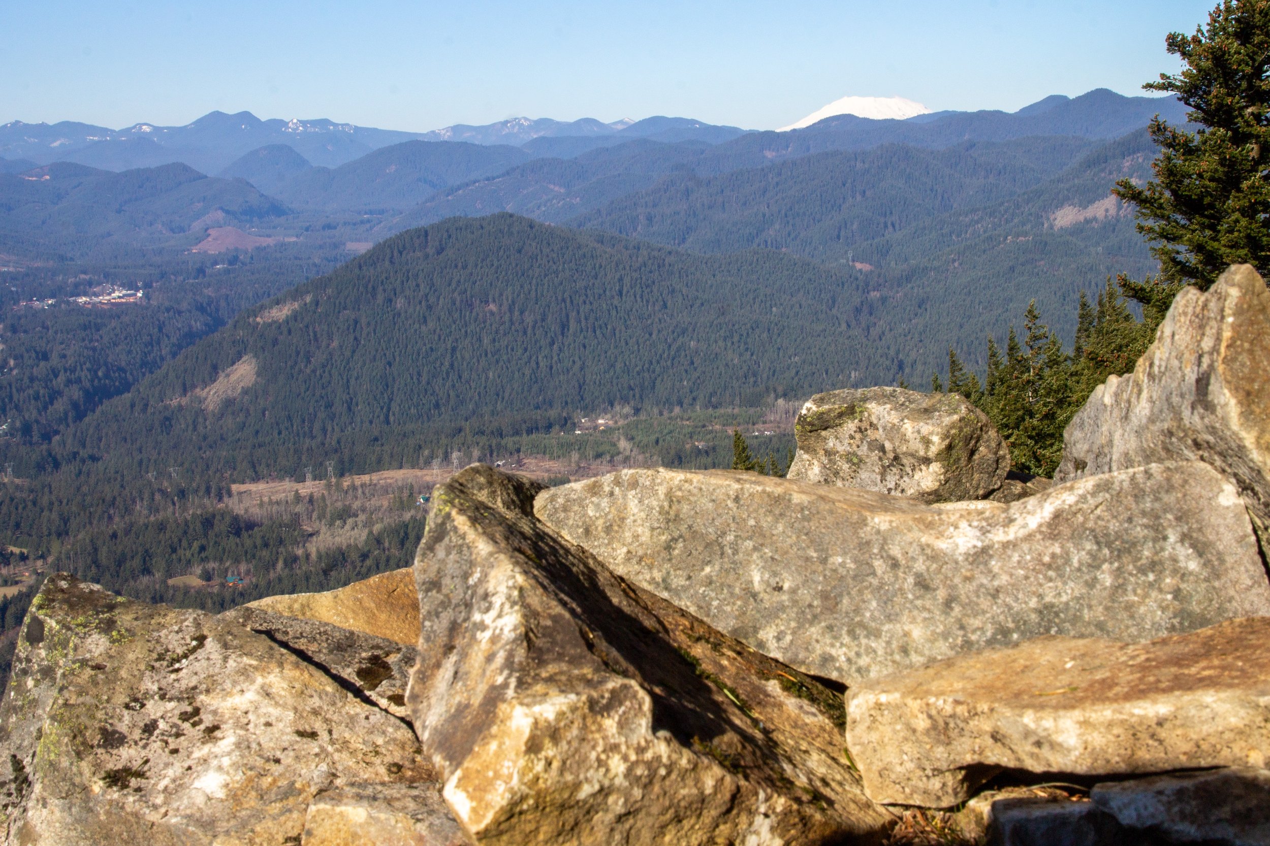
Mount St Helens pops up above the hills
Once you’ve taken in the views to the west, return to the little loop and continue to the other two viewing areas. They’re next to each other. Looking east, you’ll see Dog Mountain and Augspurger Mountain. To the north is the summit of Mt Adams on a clear day. Across the Columbia River are Oregon’s Mitchell Point and Mt Defiance.

The tippy top of Mt Adams
These viewing areas are where the mountain’s human history becomes visible. The talus slope is not a random heap of rocks. People have created some walls and shelters from the plate-like stones. Unlike the west side of the mountain, the wind is punishing in the eastern viewing areas. While shivering, I thought of the youth who spent the night here on spiritual journeys. I hope it was summertime when they came. During my mid-January visit, I could barely stand to take my hands out of my gloves long enough to take pictures. Hoarfrost lined the makeshift shelters, showing no sign of melting despite the bright midday sun. The interpretive sign talked of physical labor being part of the vision quest. I also suspect it was too cold to hold still.

Look for manmade structures in the viewing areas
Once you’ve seen the views from Wind Mountain’s summit, return the way you came.
Enjoy your hike at Wind Mountain!
With love,
Emma
Getting there
To reach Wind Mountain from Portland, take Highway 84 and cross at the Bridge of the Gods. Then, take Highway 14 E until Wind Mountain Rd. Or, save $3 and take Highway 14 from Vancouver. The drive is about an hour on I-84 or 70 minutes on Highway 14.
From Highway 14, turn onto Wind Mountain Rd. Continue for one mile, then turn right to stay on Wind Mountain Rd. In 0.4 miles, turn right onto Girl Scout Rd. After about a quarter mile on Girl Scout Rd, park in the wide unmarked parking area. Continue on foot to the trailhead, which will be on your right.
Explore nearby

Find the best short hikes in the Columbia Gorge.

Hike at Beacon Rock State Park.
