

7 Fun Things to Do near Mount Adams
Ah, Mt Adams, the forgotten Cascade peak. Although taller than Mt Hood and with more square miles of lava flows than Mt Rainier, Mt Adams tends to get overlooked in favor of its more developed neighbors. Despite its (figuratively) low profile, 12,276-foot Mt Adams is surrounded by natural beauty that’s well worth exploring, from stunning viewpoints overlooking its andesitic slopes to tranquil alpine lakes and waterfalls. After years of hiking in the Pacific Northwest, I went for the first time recently and can’t wait to go back. Here are my suggestions to help you plan your trip to this unsung wonder of the Cascades.
1. Sleeping Beauty Trail
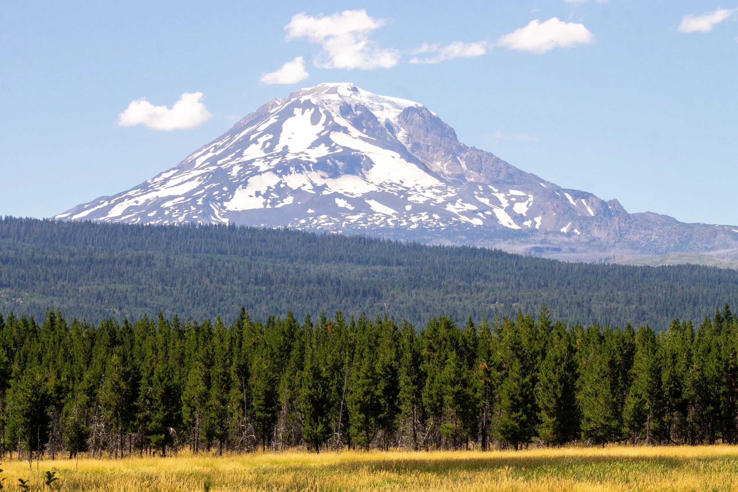
Mt Adams from Sleeping Beauty
Distance: 3 miles out and back
Elevation gain: 1400 feet
Difficulty: Hard
Pass required: None
Dog friendly: Yes, leashed dogs are welcome on the trail.
Restrooms: No
ADA access: No
Season: July - October to avoid the snow.
Getting there: Reaching the trailhead involves navigating some unpaved forest service roads. It’s bumpy but doable in a low-clearance vehicle. From WA-141, turn right onto Trout Lake Creek Rd, which becomes FR-88. After 4 miles, turn right onto gravel FR-8810. After 6 miles, turn right onto FR-040 and look for the trailhead on your left. Park along the side of the road.
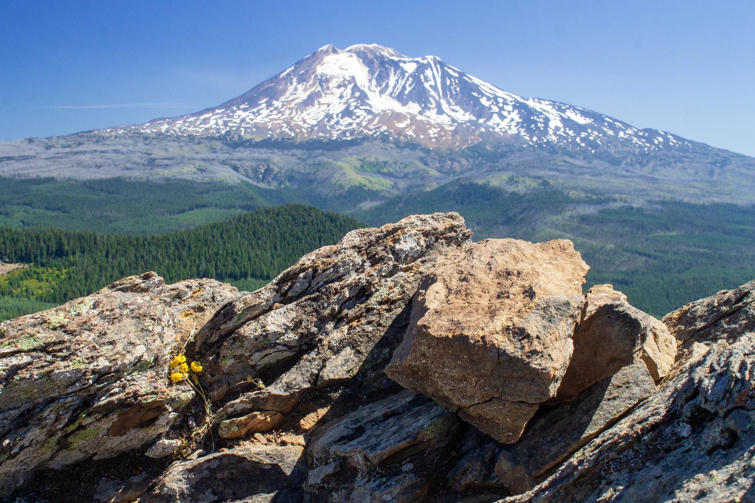
Mt Saint Helens from Sleeping Beauty
About: The short but strenuous Sleeping Beauty Trail leads to an unforgettable viewpoint where Cascade peaks surround you in all directions. Although not much longer than a mile from the trailhead to the summit, this hike is not easy. It’s relentlessly uphill, with its terrain alternating between steep and very steep.
The game is worth the candle, and all will be forgiven once you reach the top. Most of the hike is in the forest with good shade along the trail from the Douglas fir canopy. You might spot a few wildflowers in summer, like penstemon, queen’s cup, and yarrow. Look for the oddly shaped leaves of vanilla leaf that look a bit like platypus feet in the undergrowth. After the uphill march through the forest, you’ll reach the first, although not the best, view of Mt Adams.
When you see the first mountain view, you are almost to the top
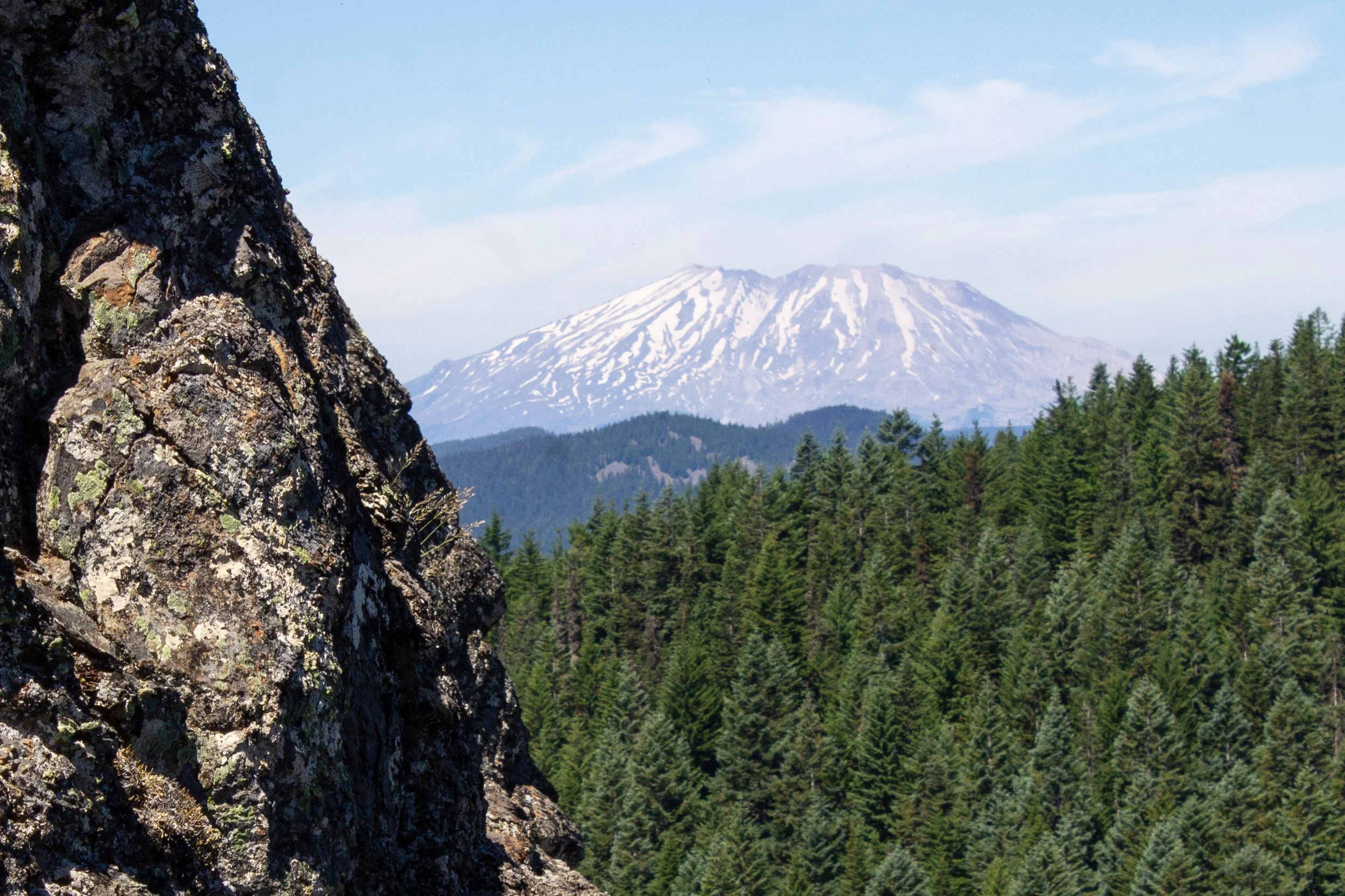
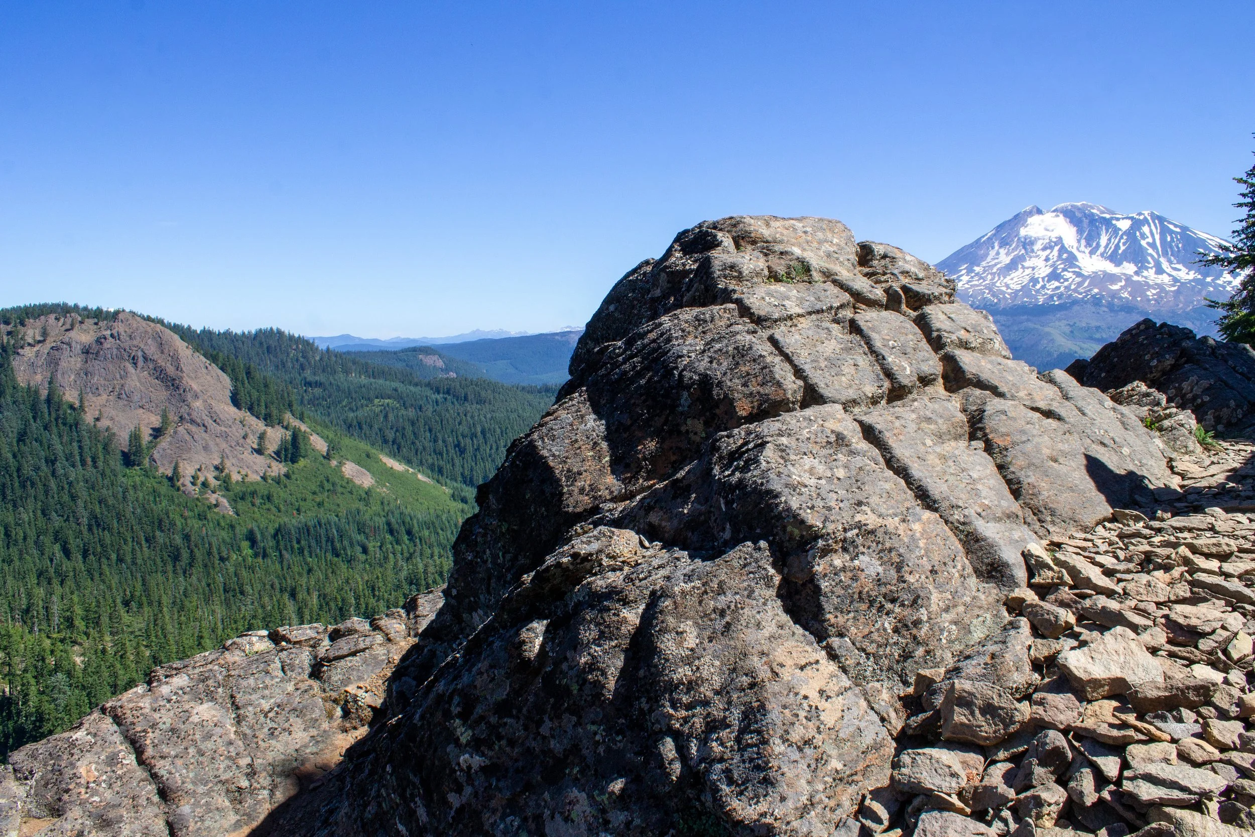
For a second, it will look like you’re in for a harrowing scramble to the top, but then switchbacks appear with impressive stone retaining walls. After the switchbacks, you’ll reach the rocky clearing at the top of Sleeping Beauty and panoramic views of the Cascades from almost 5,000 feet of elevation. Only 11 miles away, Mt Adams looks gigantic from Sleeping Beauty’s summit. Unlike the dramatic pyroclastic flows and ash of Mt Saint Helens, Mt Adams is a stratovolcano made mostly of andesitic lava flows. Nine glaciers surround its summit, some of which are visible from Sleeping Beauty. You’ll also see Mount St Helens to the west, Mount Rainier to the north, and Mount Hood to the south on a clear day.
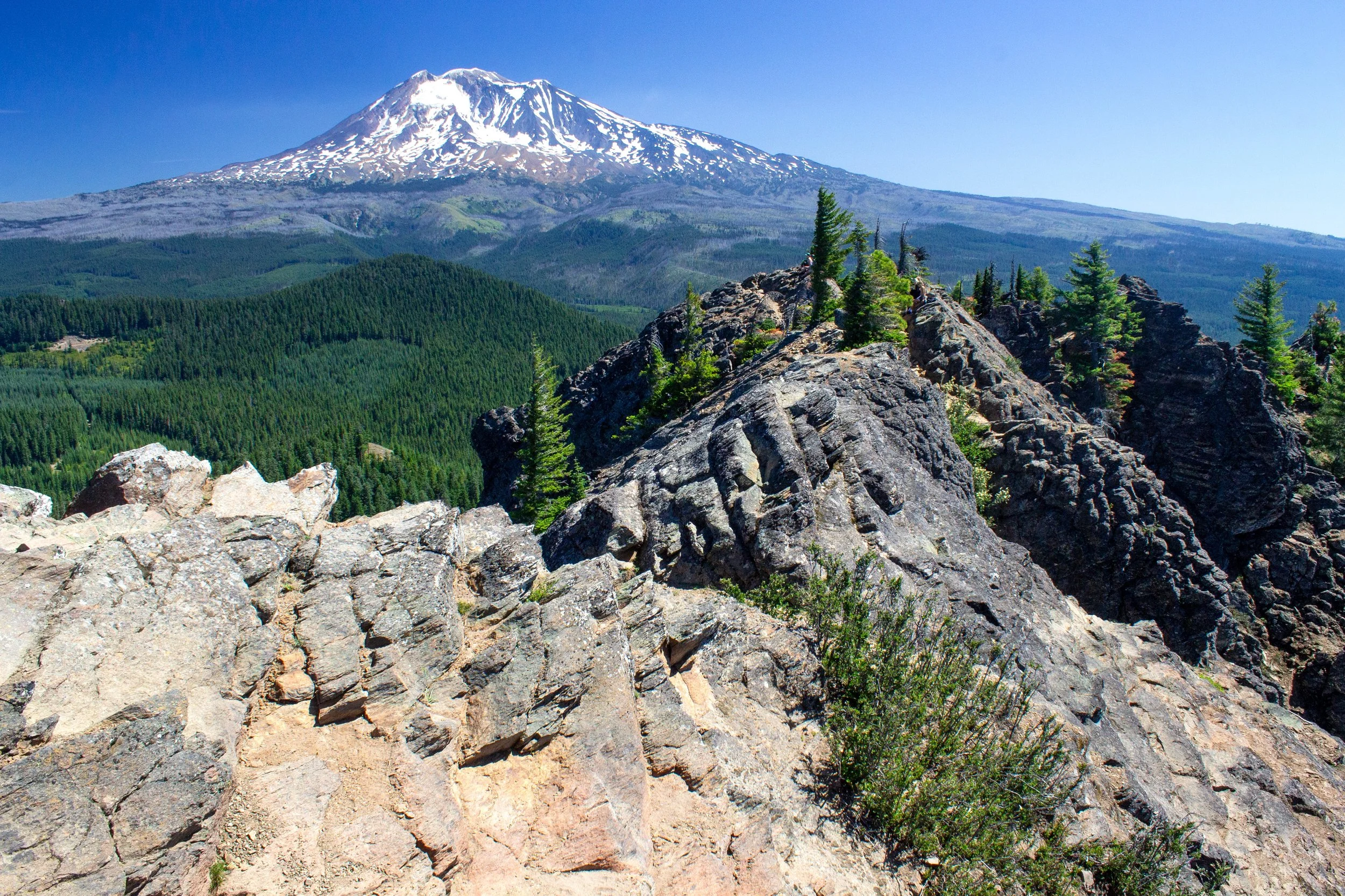
Mt Adams from the top of the Sleeping Beauty Trail
A ridge runs along the top of Sleeping Beauty and allows you to see the vistas from a few different angles. The peak gets its name from the contours of this ridge, which supposedly looks like a reclining woman when seen from the valley. I had to take their word for it. At the summit, you’ll see traces of the foundation of an old fire lookout. It looks a bit precarious from below, but once you’re up there, you’ll find a broad, flat space perfect for admiring the views. You may catch a glimpse of a goat perched on the rocks nearby.
2. Langfeld Falls
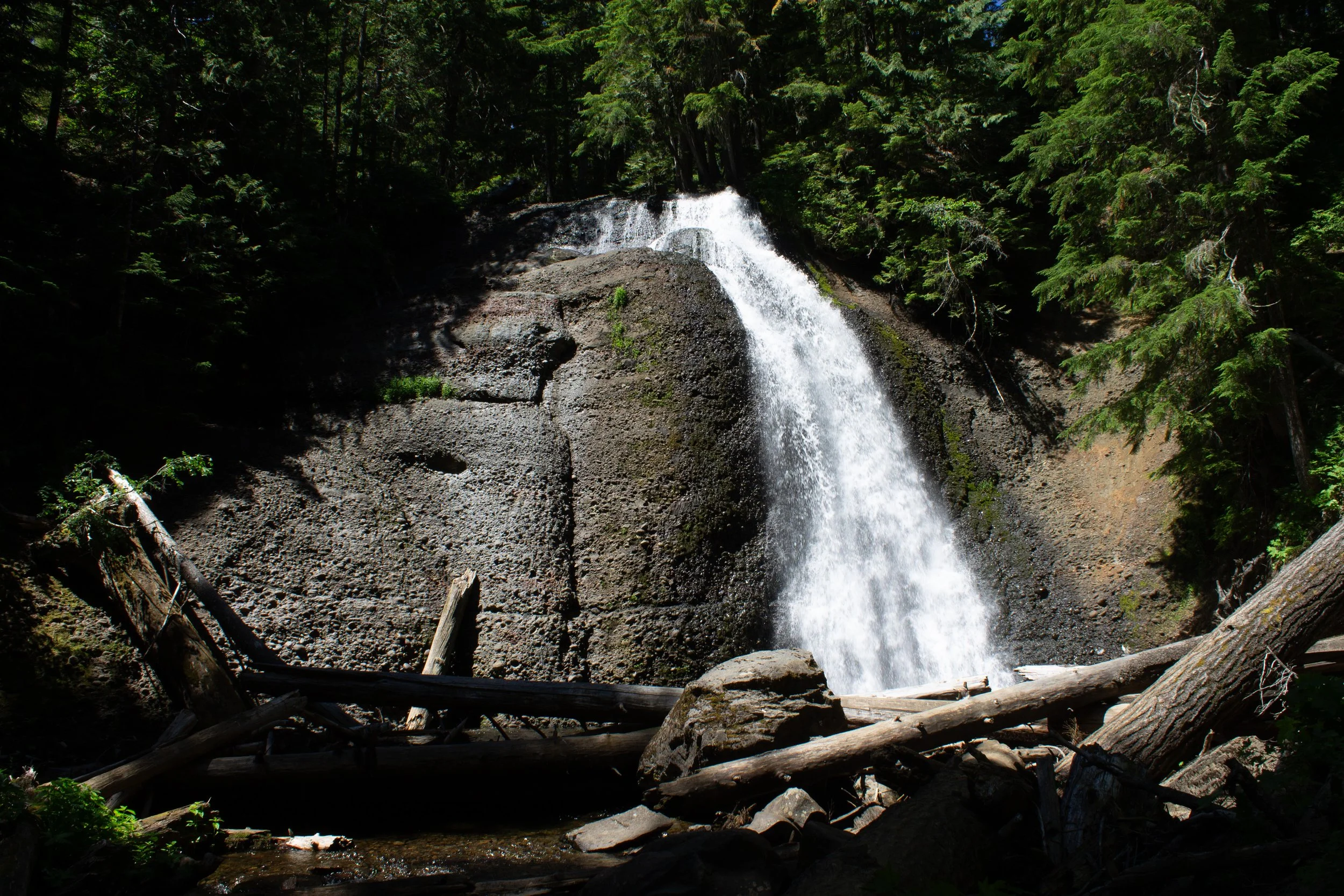
Langfeld Falls
Distance: 0.5 miles out and back
Elevation gain: 80 feet
Difficulty: Easy
Pass required: None
Dog friendly: Yes, leashed dogs are welcome on the trail.
Restrooms: No
ADA access: No
Season: Late spring - fall to avoid the snow.
Getting there: Look for the parking lot directly off NF-88, which is paved and easy to reach with a low-clearance vehicle.
Mosquito Creek
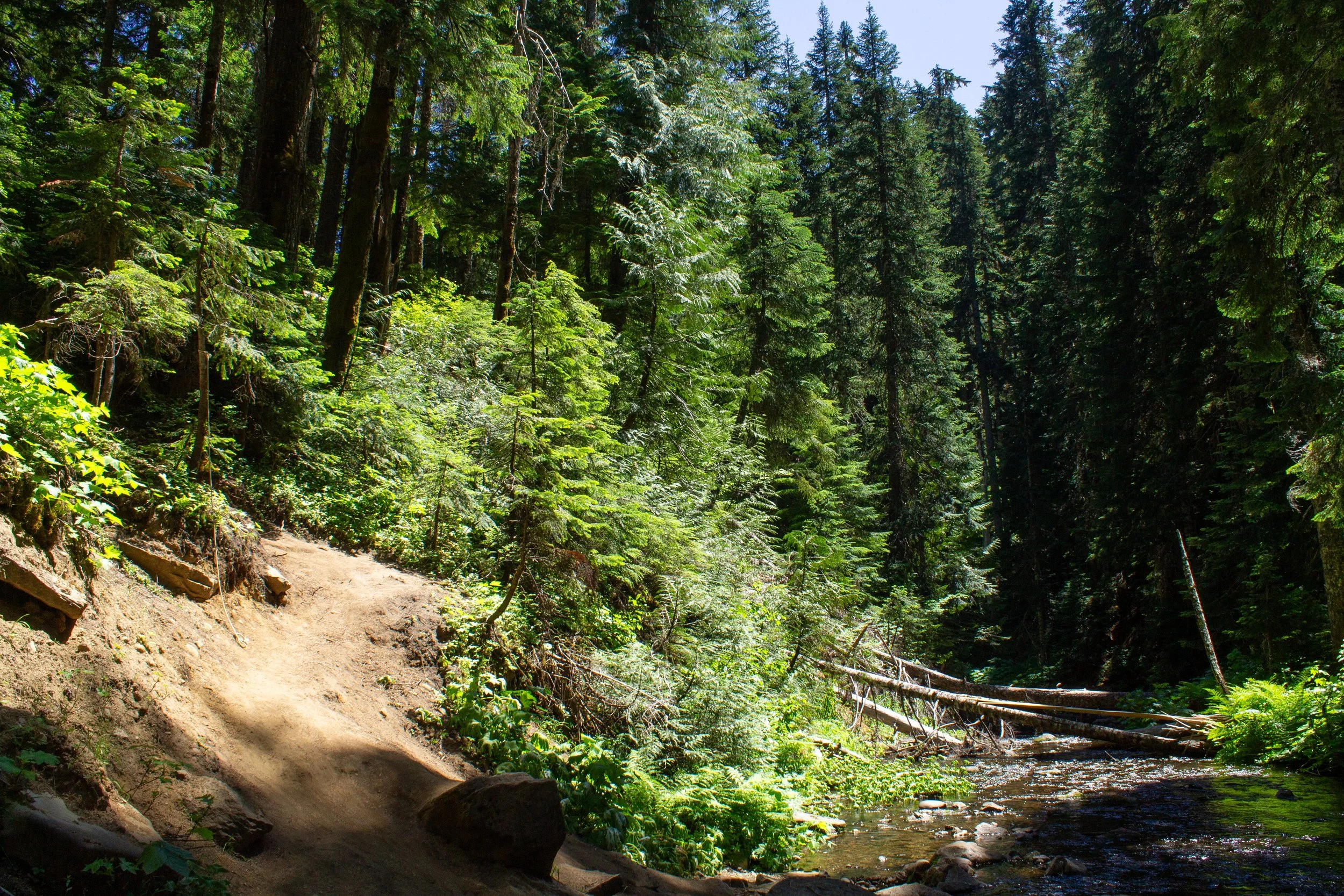
About: After the tiring hike up Sleeping Beauty, nearby Langfeld Falls is a great place to recharge. A short dirt trail leads from the small parking lot down to the falls and Mosquito Creek flowing from its base. About halfway down the trail, you’ll reach a memorial to District Ranger K.C. Langfield and a viewpoint for the falls. This viewpoint can be a good turnaround point if you'd like to avoid the scramble to the creek at the bottom of the trail. It’s not hard or dangerous, just a steep descent.
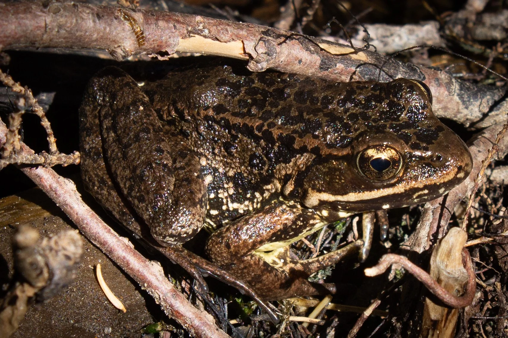
Cascade frog at the base of Langfeld Falls
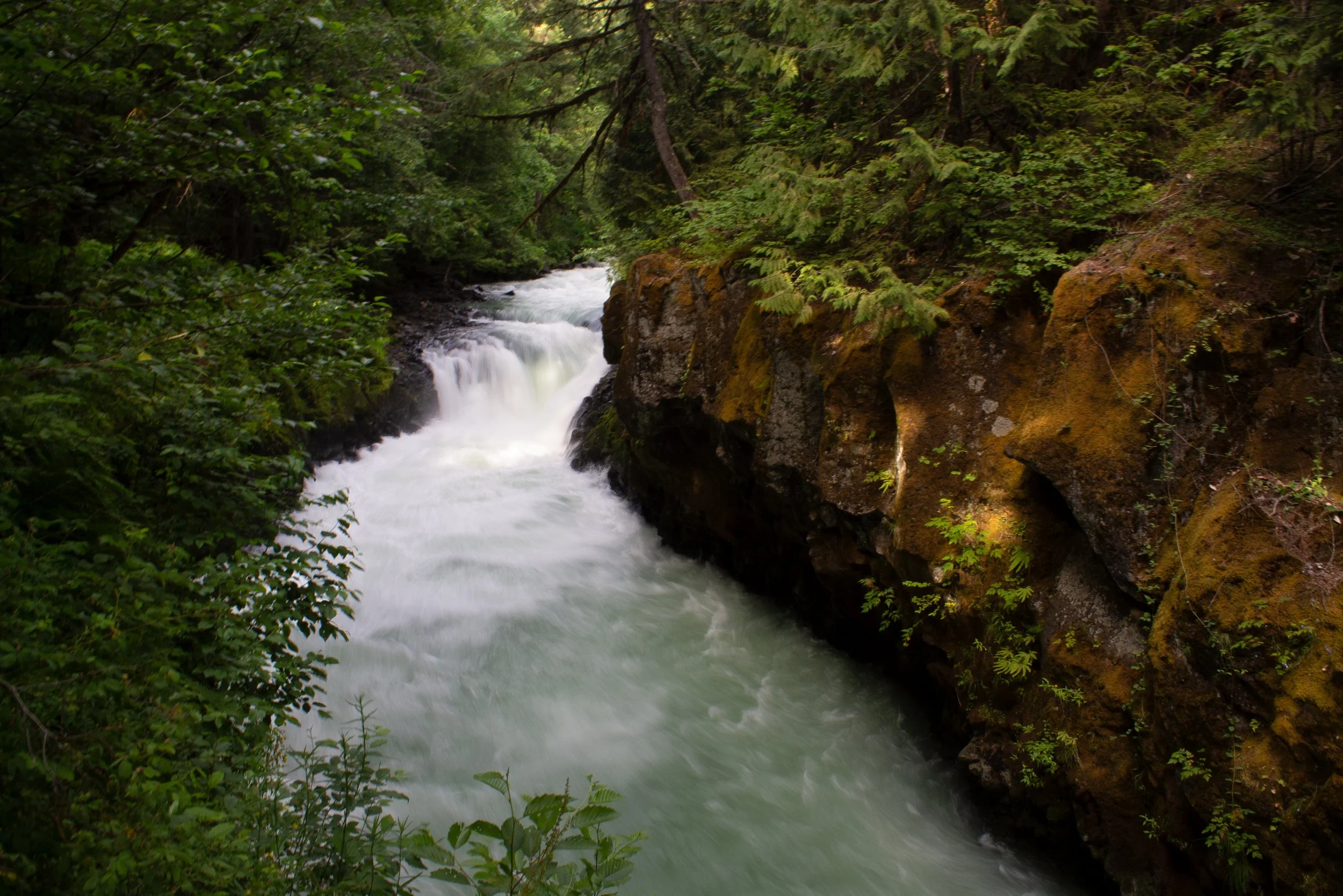
If you do head down to the creek, you’ll be rewarded with a better view of 60-foot Langfeld Falls as it tumbles over a cliff of eroded volcanic breccia. Depending on the season, it may fall as a single or twin plunge. The cold, clear water of Mosquito Creek is wonderful for wading on a hot day. Look for Cascade frogs sunning themselves and hunting for bugs in the log debris at the base of the falls.
3. Conboy Lake National Wildlife Refuge
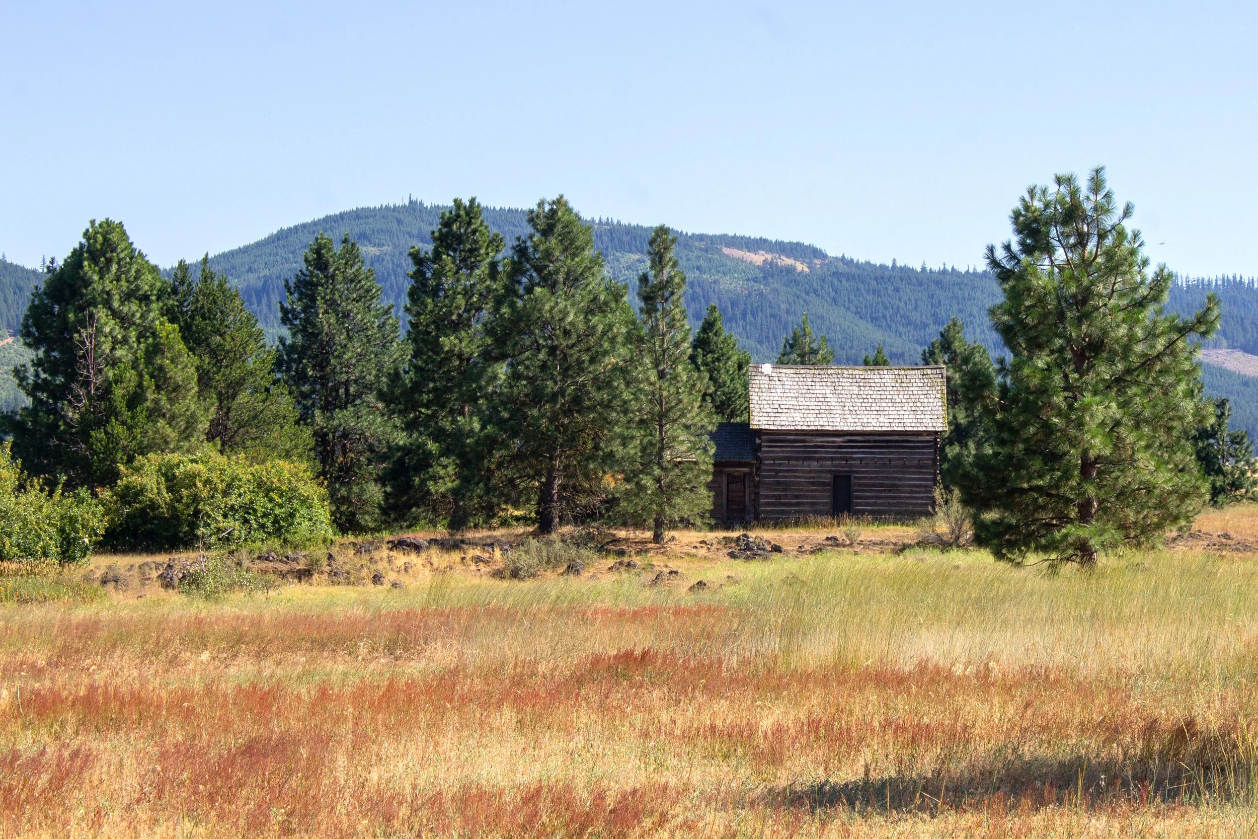
Whitcomb-Cole Hewn Log House
Distance: 3.5-mile loop
Elevation gain: 65 feet
Difficulty: Easy
Pass required: None
Dog friendly: Yes, leashed dogs are welcome on the trail.
Restrooms: Yes
ADA access: No
Season: Any
Getting there: From WA-141, turn onto Warner Rd a little south of Trout Lake. Turn left at the end of the road onto Sunnyside Rd, then take a right onto Trout Lake Highway. Continue for about 7 miles until you reach the wildlife refuge. The drive will be no problem with a low-clearance vehicle.
First glimpse of Mt Adams
The hike through Conboy Lake National Wildlife Refuge leads to excellent views of Mt Adams without tons of elevation gain or sketchy forest service roads. It’s a great one to try out if you’re looking to admire the mountain without needing to walk up a mountain. The trail makes a leisurely loop starting from the prairie around the seasonal Conboy Lake, then enters a forest that feels more like the high desert than the Cascades.
From the parking lot, you’ll see a restored log house that was once the home of the Cole family in the late 1800s and early 1900s. A short spur trail will bring you to the house and the old farm equipment surrounding it. Look for a sign here with details about the log home’s history.
Scarlet gilia along the trail
Past the log house, you’ll walk through a grassland that is a favorite of songbirds. This trail is a great place to see wildlife like elk, sandhill cranes, and the rare Oregon spotted frog. In spring, snowmelt from Mt Adams creates Conboy Lake here, which dries up by midsummer. In its place, you’ll see wildflowers in the prairie grasses like western spirea, yarrow, and St, John’s wort.

Mt Adams from the viewing platform
After walking through the prairie, you’ll enter a forest dominated by ponderosas. A little over a mile into the hike, you’ll reach the viewing platform for Mt Adams. From here, you can take a shortcut trail to return (look for the sign at the trail junction near the viewing platform) or continue to Willard Springs for a 3.5-mile loop. The rest of the hike will be through the woods. Look for bright red scarlet gilia in the grasses along the trail in summer.
4. Trout Lake
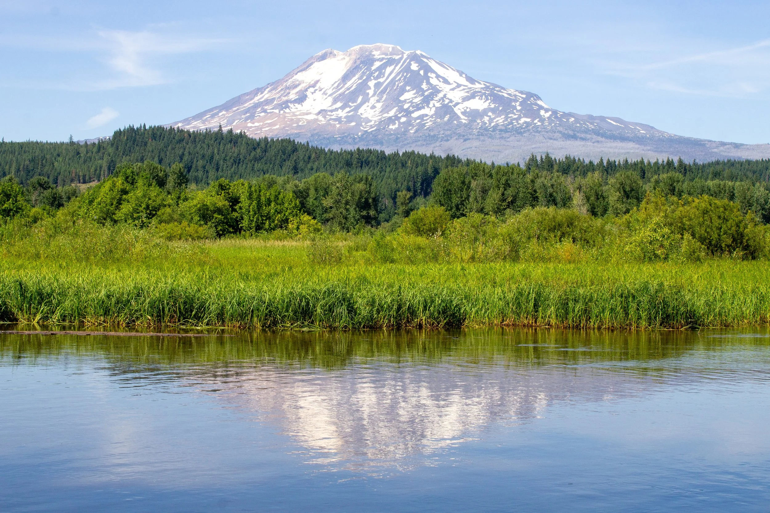
Mt Adams reflects off Trout Lake
Pass required: Washington Discover Pass, $10/day.
Dog friendly: Yes, leashed dogs are welcome at Trout Lake.
Restrooms: No
ADA access: No
Season: Spring - fall to avoid the snow.
Getting there: Look for Lake Rd off WA-141 in the town of Trout Lake, WA, and drive to the end of the road. There are only a couple of parking spots near the lake access, but you can find room by the side of the road on the way. Make sure to avoid private property.
Western spirea blooms at Trout Lake
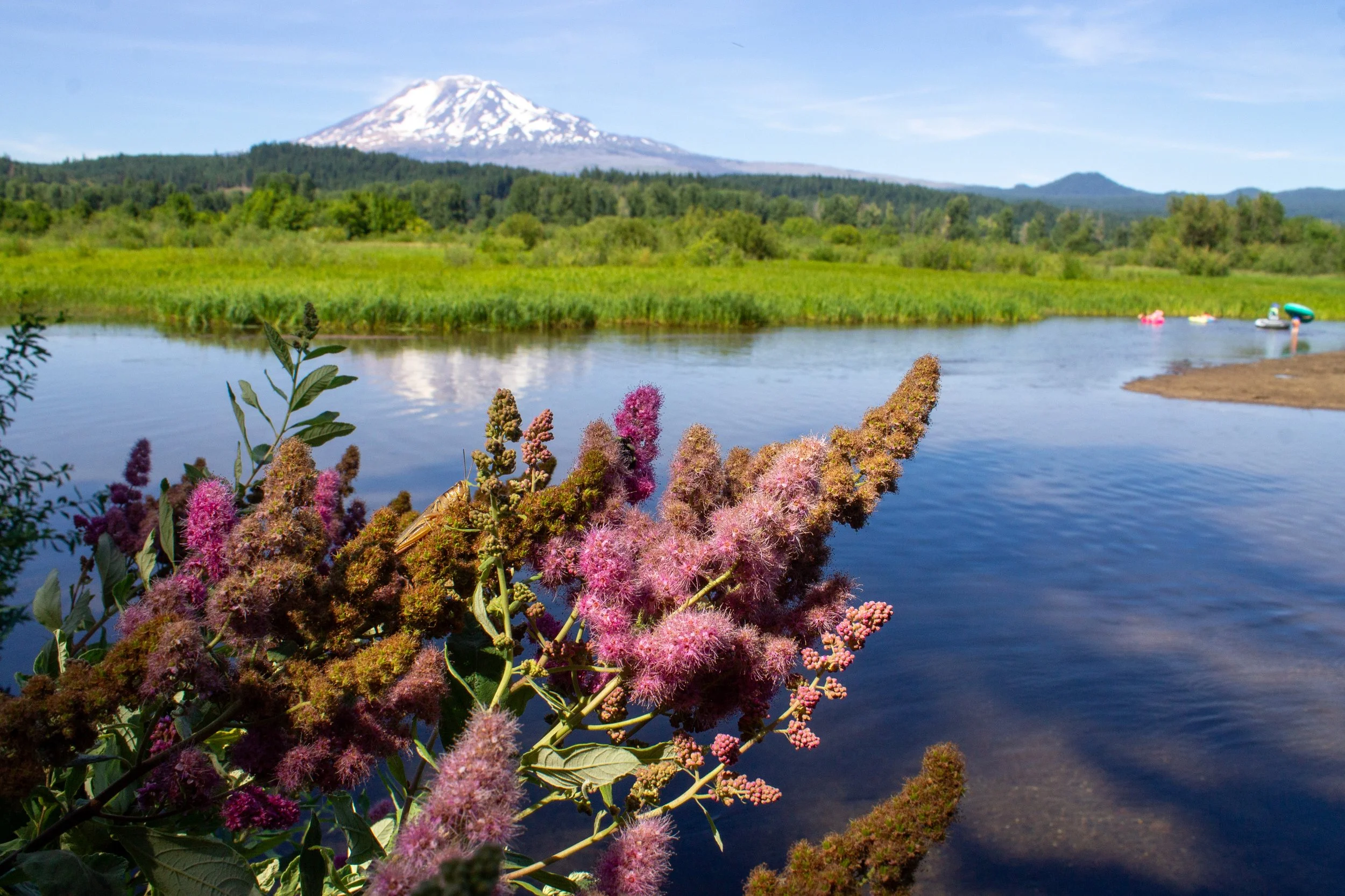
Of the many small lakes that surround Mt Adams, Trout Lake is one of the easiest to reach, especially if you’re coming from Portland. Long and thin, it looks a lot like a broad, shallow river. Trout Lake formed around 6,000 years ago when a volcanic debris flow from Mt Adams created a natural dam that trapped water along the Trout Lake Creek, allowing the lake to fill. Sediment has been accumulating in the lake over time, turning it into a shallow wetland. Thanks to these deposits, the waters of the lake are calm and good for wading. On a hot day, expect to see people floating on the water. The highlight of Tout Lake is seeing the reflection of the mountain off its blue waters.
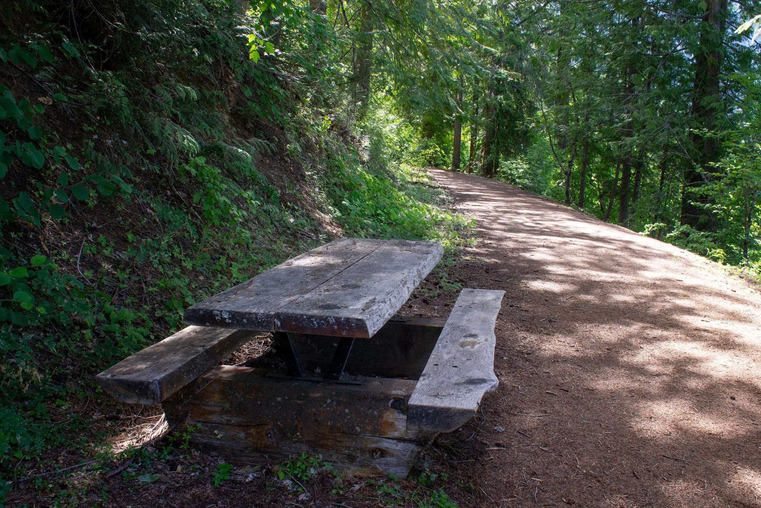
There is a short hiking trail next to Trout Lake
You can reach Trout Lake without hiking by driving to the end of Lake Rd in the town of Trout Lake. If you do want to stretch your legs, a short hiking trail runs along the south side of the lake for about 0.5 miles. Look for the trailhead next to the two parking spots at the end of Lake Rd. The trail is a nice, easy stroll with occasional glimpses of Mt Adams through the trees. You’ll pass a picnic table and then reach an observation deck with benches. Vegetation blocks the view of the mountain from the observation deck, but you can head a little way up the hill to reach an upper viewpoint. The best views are back at the lake access, where you can see the mountain’s reflection.
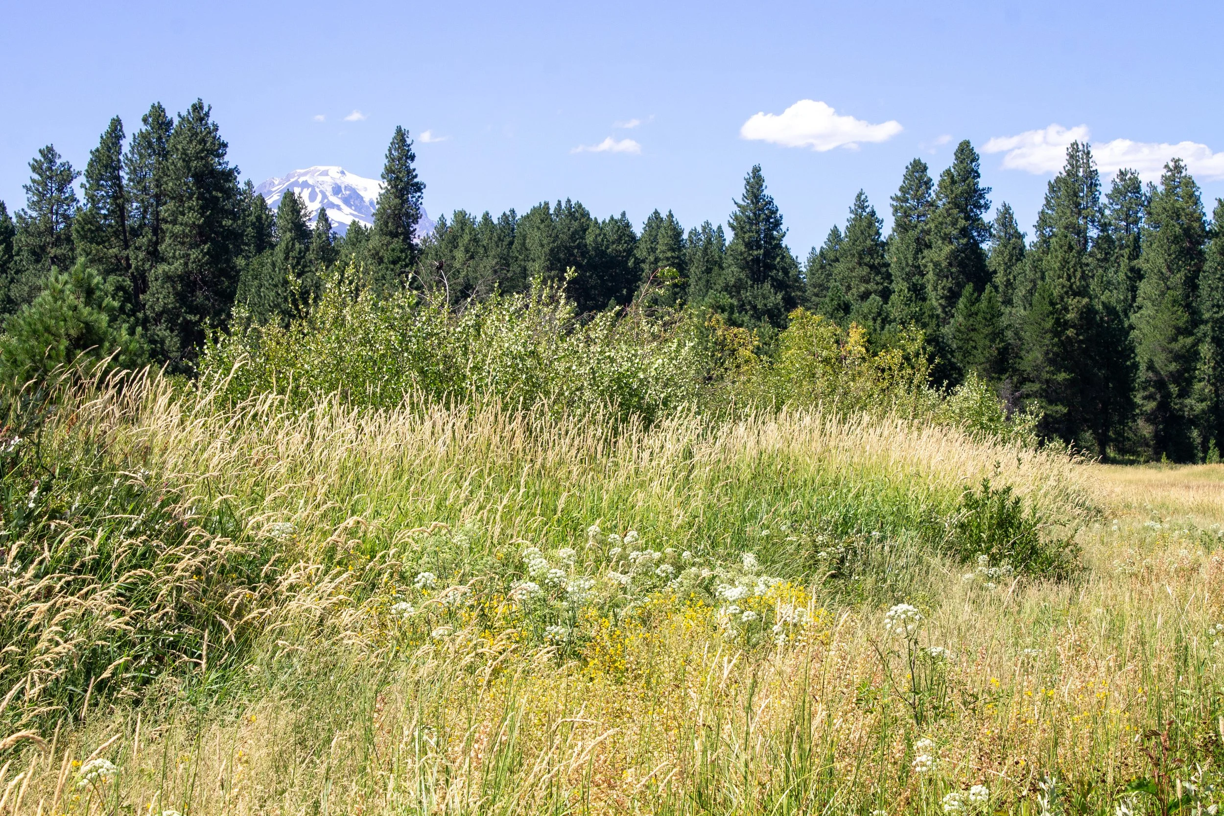
5. Find secluded mountain lakes

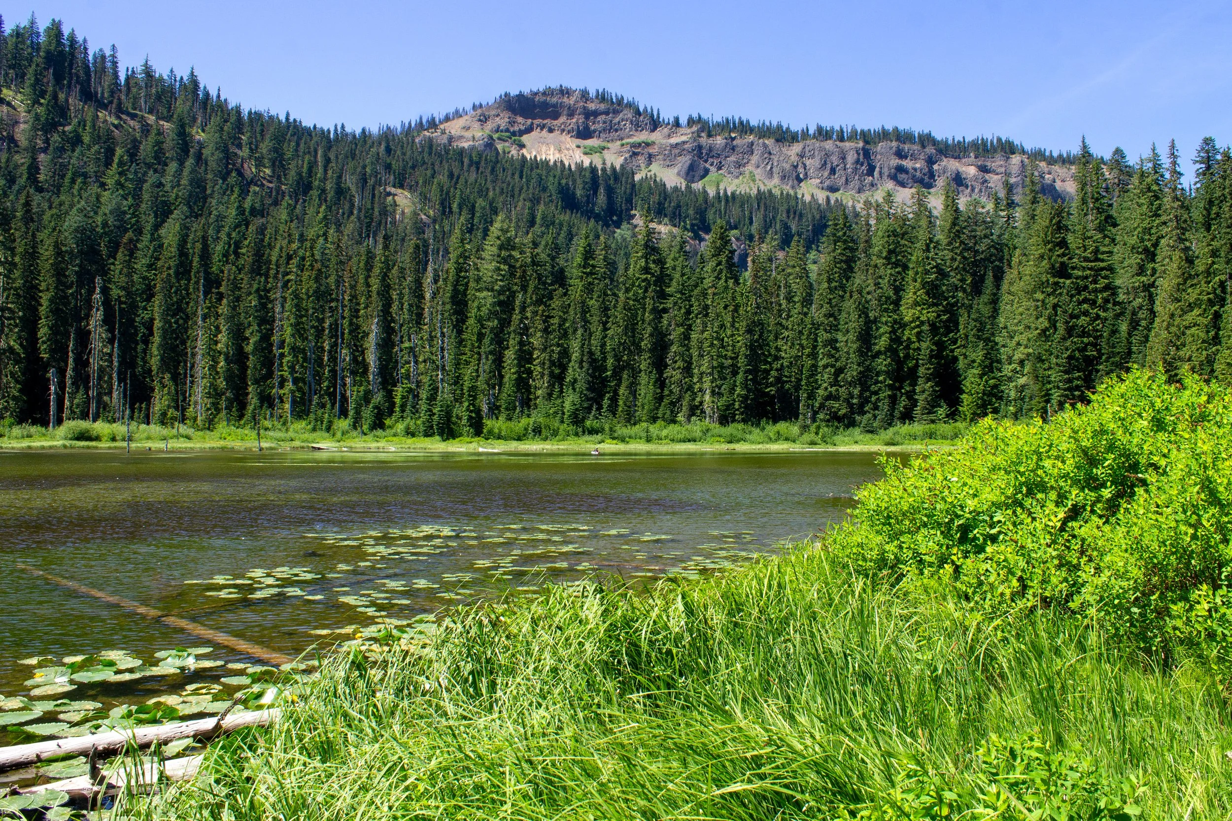
Mosquito Lake
If you head a little farther off the beaten path, you can find some peaceful lakes around Mt Adams that are great places to escape the crowds. If you visit Sleeping Beauty or Langfeld Falls, Mosquito Lake is an easy side trip that you can reach on a paved road in good condition. When the sun is out, the water reflects the deep blue of the sky within a ring of pines and wetland grasses.
A short trail runs along part of the lake where bunchberry blooms near the ground in midsummer. Next to the small parking lot is an easy place to launch a kayak or paddleboard, which is the best way to see the lake. On a hot, beautiful Saturday, my friends and I only saw two other people there. Don’t let the name dissuade you, there aren’t that many mosquitoes. The only downside is that you can’t see the mountain from the lake.
Bunchberry blooms near Mosquito Lake
Feeling initially reluctant to visit somewhere with the unpromising name Mosquito Lake, my friends and I first ventured a bit farther afield to check out Steamboat Lake. Although a pretty lake, it takes a long drive down a bumpy forest service road to reach it. Don’t go with a low-clearance vehicle. Also, as luck would have it, there were way more mosquitoes here than at Mosquito Lake. If you have good bug spray and plenty of clearance on your vehicle, it’s a serene place to kayak where you’re likely to have to lake to yourself.
Steamboat Lake
Some of the most stunning lakes near Mt Adams are to the northwest of the mountain, like Tahklakh Lake, where you can see a wonderful reflection of the mountain off the water. A 3-mile figure-eight hiking trail makes a circle around Tahklakh Lake and its neighboring meadow. A little farther north, you can find Olallie Lake and a group of small alpine lakes known as the Chain of Lakes.
6. BZ Falls
BZ Falls
Distance: 0.6 miles out and back
Elevation gain: 100 feet
Difficulty: Easy
Pass required: No
Dog friendly: Yes, leashed dogs are welcome on the trail.
Restrooms: Yes
ADA access: No
Season: Potentially year-round. Peak season is May - September.
Getting there: Park at the BZ Corner Launch Site just off WA-141 Alt in the town of BZ Corner. Head toward the river to find the trail.
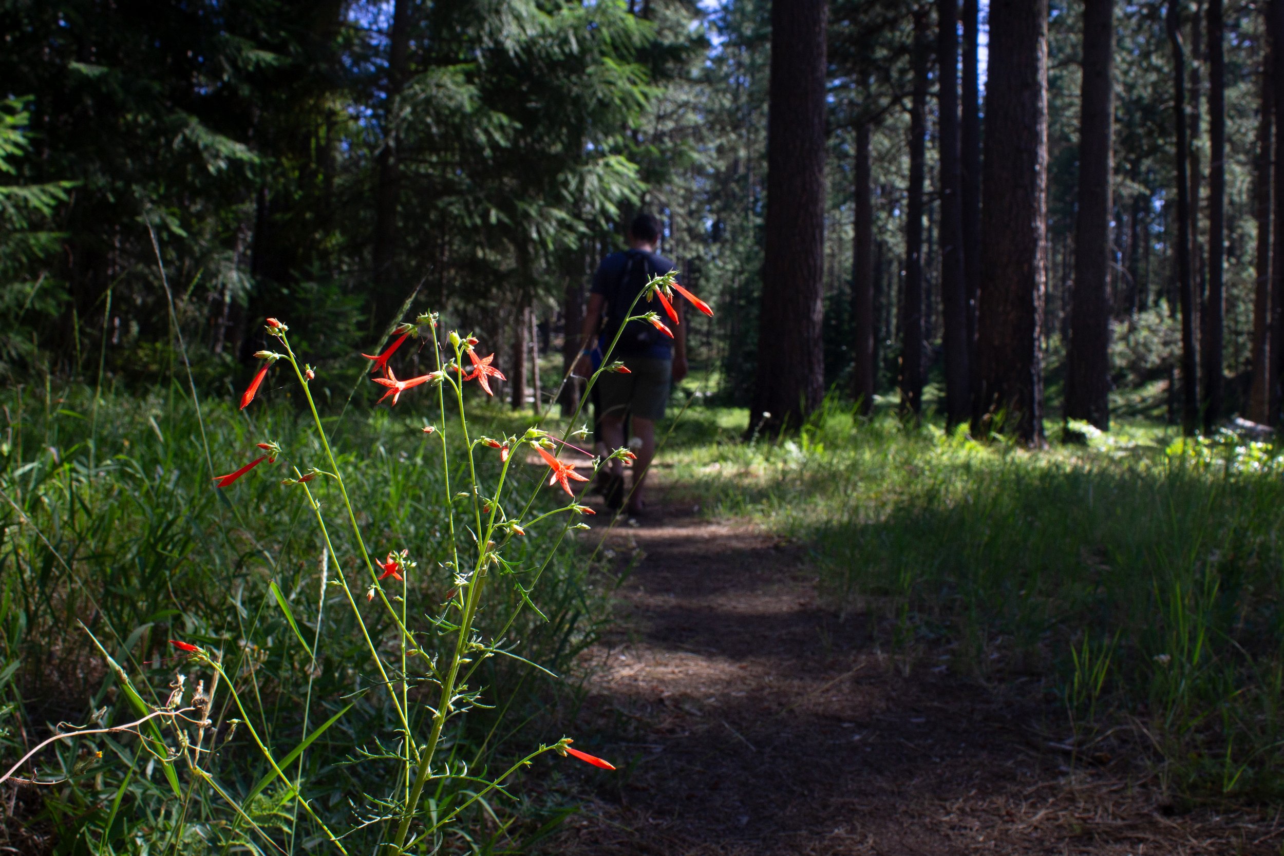
The trail to BZ Falls follows the White Salmon River
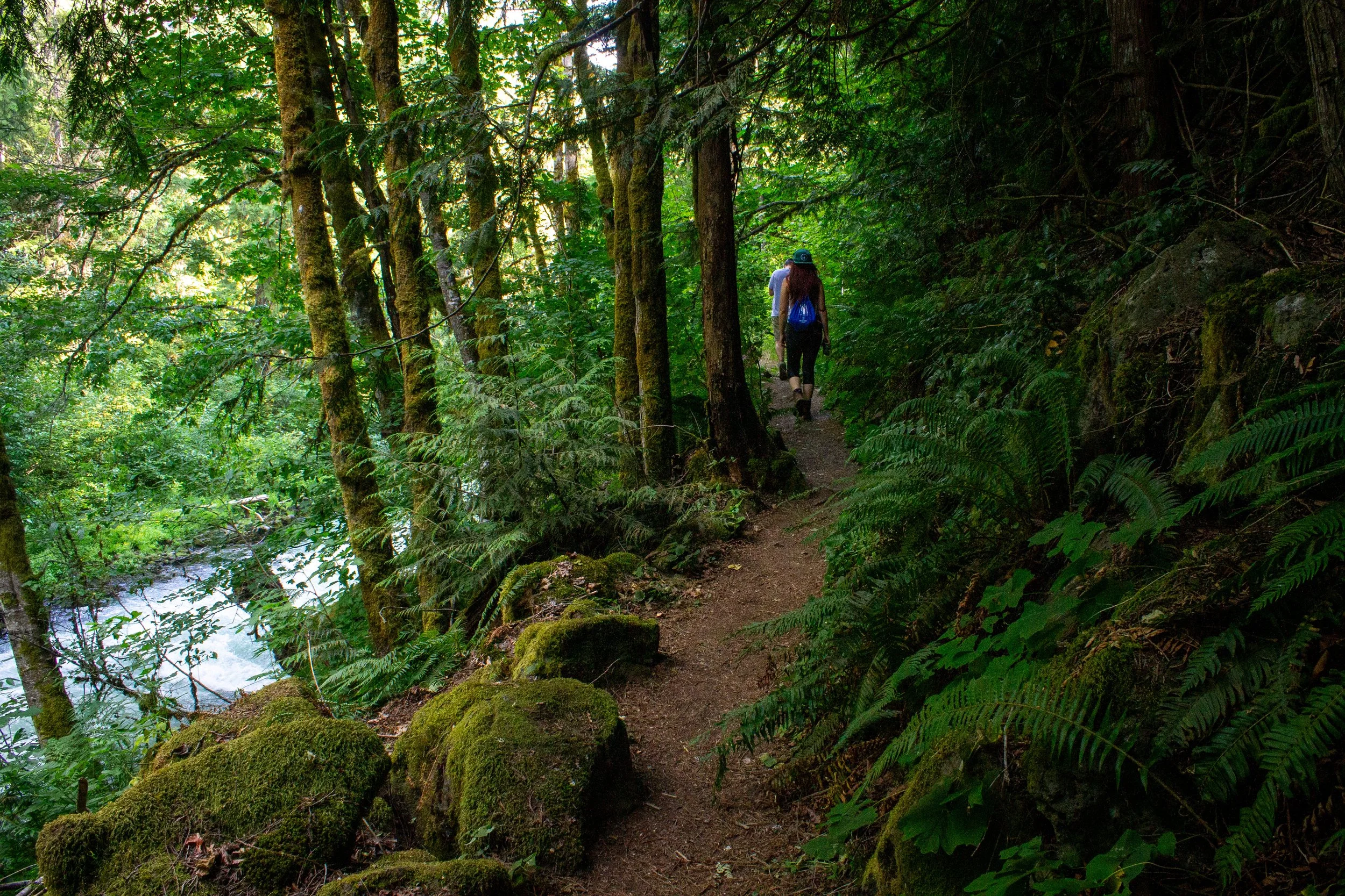
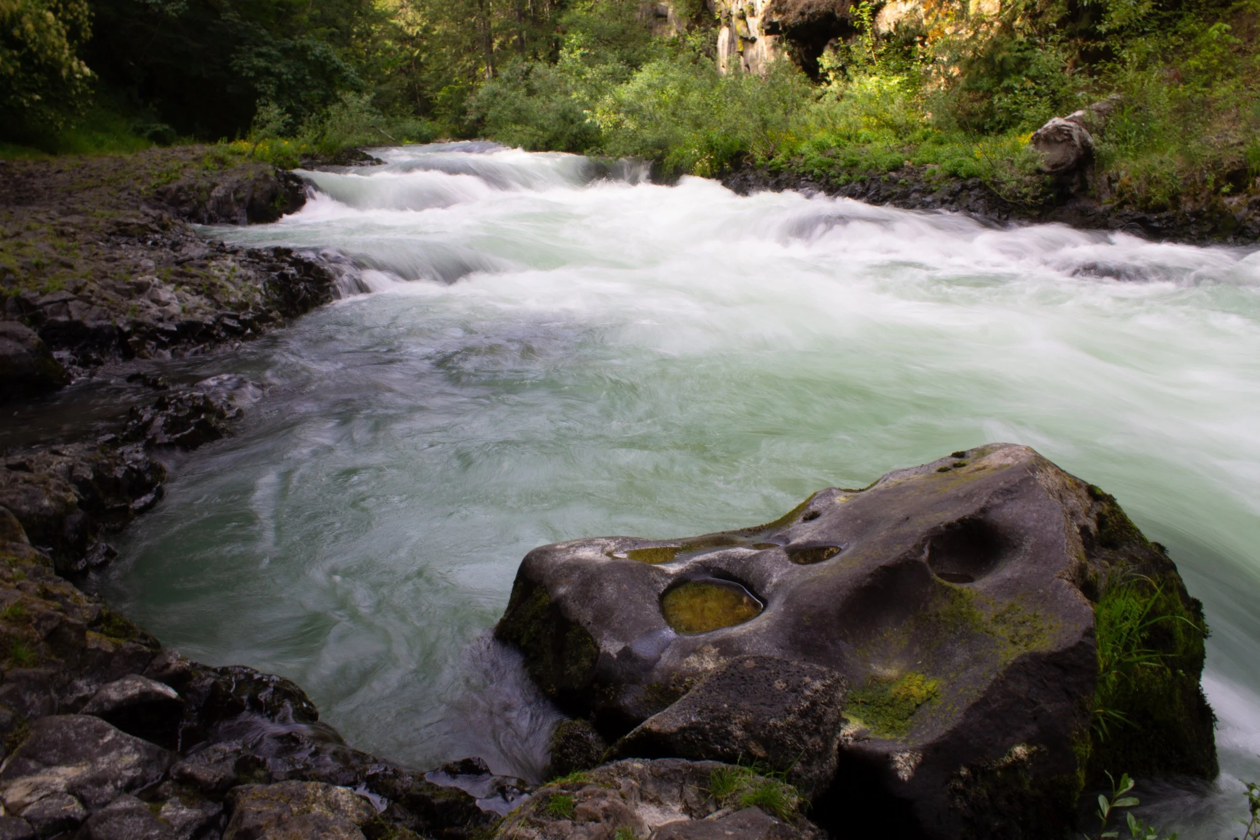
A short trail along the White Salmon River leads to picturesque, 12-foot BZ Falls, a tucked-away gem that is an easy stop between the Columbia Gorge and the Mt Adams Wilderness. The trail begins at the BZ Corner Launch Site, which is mostly used as a boat launch for river rafting. You’ll start on the trail for the boat launch with metal railings on each side. This trail leads down to the water, where you can admire the unexpected pearly blue color of the White Salmon River.
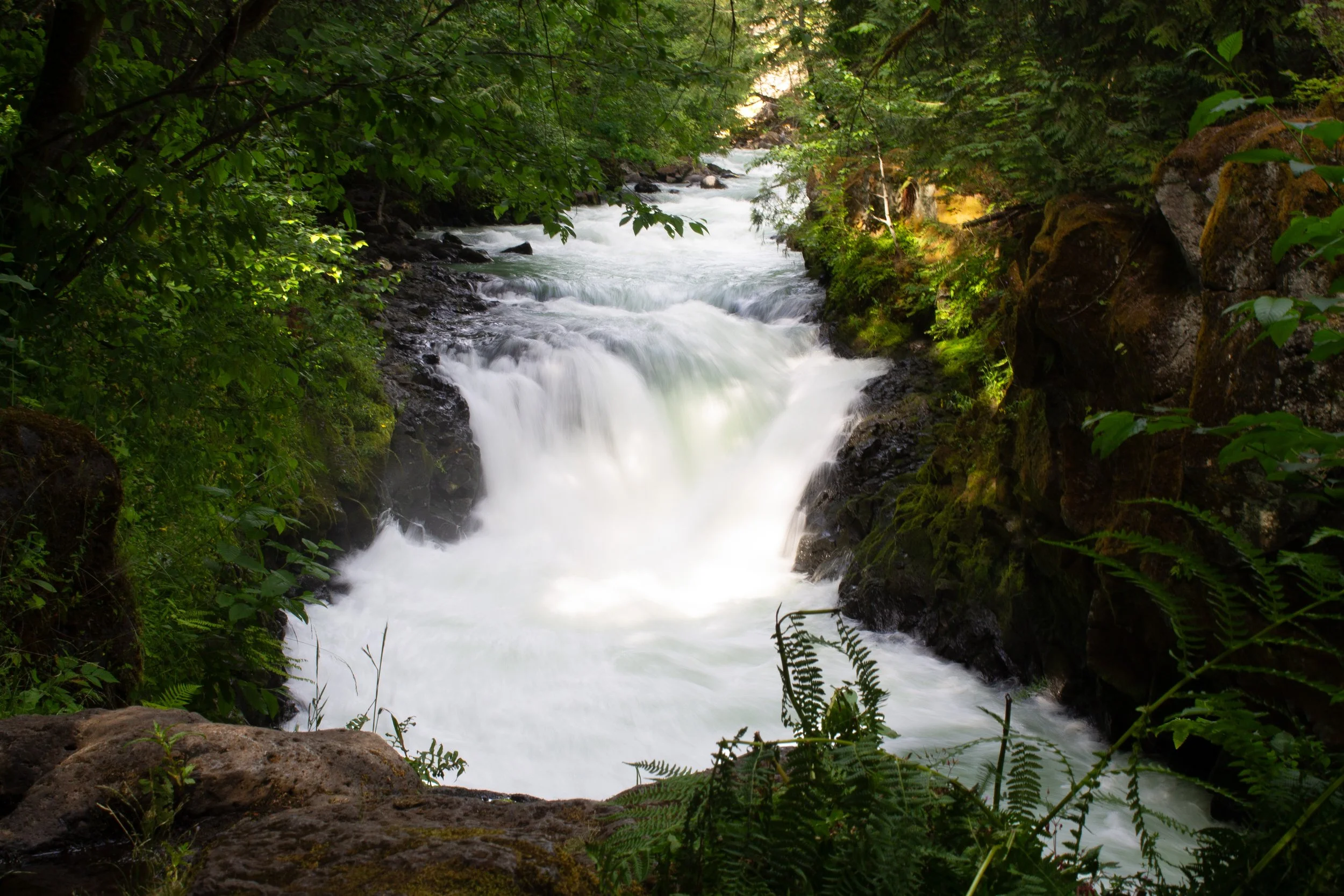
BZ Falls
To reach the falls, look for a gap in the metal railings and the start of an unpaved trail heading north. It will be on your left if you are heading down the hill from the trailhead. From here, the trail follows the river through a dense forest for about 0.3 miles. The trail feels a bit haphazard, having both well-constructed boardwalk sections and overgrown muddy quagmires with a board or two thrown across. The trail ends with a view of BZ Falls as it plunges through a canyon along the White Salmon River.
7. Raft on White Salmon River
Husum Falls
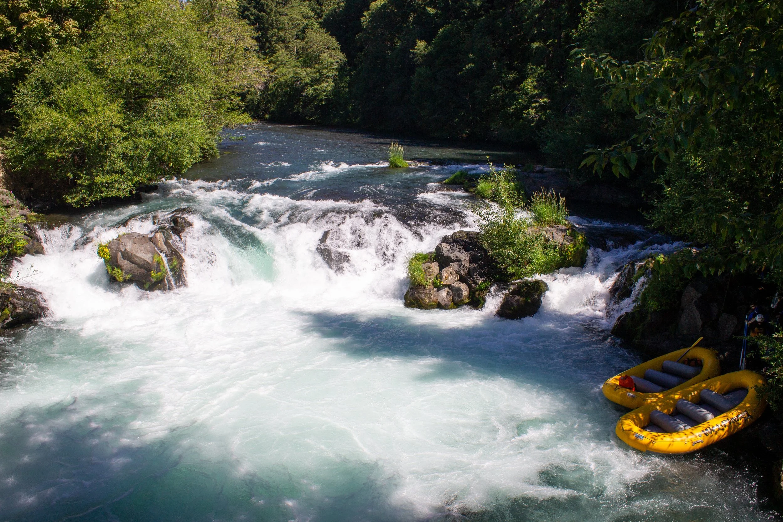
From April through September, rafting tours explore up to 15 miles of the White Salmon River and its Class III-IV rapids. Since the river remains largely undeveloped, rafting is an unusual chance to get an up close look at the aquamarine waters as they pass through a basalt channel that was once a lava tube. Along the way, you’ll pass Husum Falls, an optional 10-foot drop that is one of the largest commercially-run drops in the country. Meltwater from the glaciers of Mt Adams forms the river, so be warned, this water is cold. Tour companies have different options based on distance, price, and difficulty level, including options for kids. Expect to spend about 3-6 hours on a tour.
White Salmon River
Best things to do near Mount Adams, the summary:
Sleeping Beauty Trail
Langfeld Falls
Conboy Lake National Wildlife Refuge
Trout Lake
Secluded mountain lakes
BZ Falls
Rafting on the White Salmon River
Enjoy your trip to Mt Adams!
With love,
Emma
Explore nearby

Find the best short hikes near Mount Hood.
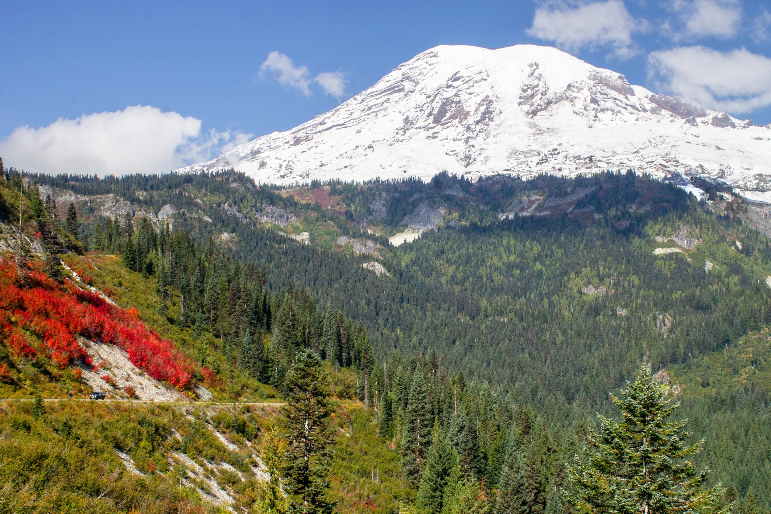
Check out the fun and easy things to do at Mount Rainier.